
Soon we began the steep but not technical climb through the cliffs, and before long reached the open pass. Then, flanked by a towering landscape of glaciated karst limestone, we headed toward Granity Pass Hut. Blue Creek – a final hurdle – was dry and we collapsed happily on the hut’s deck.
It rained heavily that night and by morning Blue Creek, our route down the mountain, was no longer dry. We waded downstream and eventually climbed into the forest, and passed the remains of Taplins Hut being overtaken by the bush.
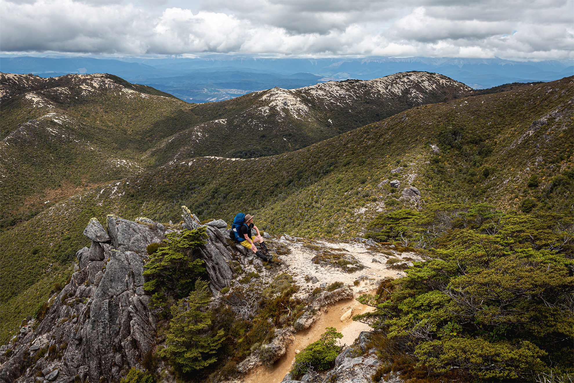
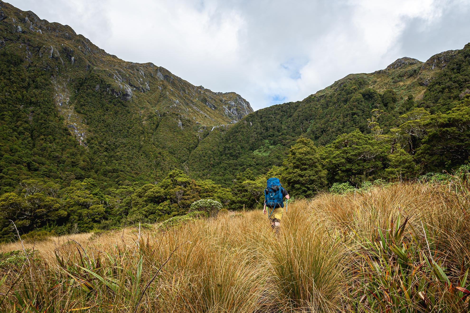
Shortly, the track climbed from the valley floor. We went up the Staircase, a steep 150m through bluffs to the saddle between Billies Knob and Pt1335. From there it was a sidle north through forest before being treated to views of the cloud-cloaked landscape stretching to the horizon.
A knee-jarring descent of the ridge followed, through lush beech forest to the Blue Creek track junction. We pushed through saturated scrub on the ridge to Courthouse Flat, and, dripping wet, crossed the bridge to the campsite and the road, which we followed to the car park by the Rolling River Bridge and the start of the Wangapeka Track.
After lunch, as drizzle and sandflies set in, we crossed the river on the swingbridge and began the Wangapeka along old sections of benched track.
The Wangapeka goldfield, despite optimism, had proved disappointing and the track was left to be reclaimed by the bush, its fate seemingly sealed by the 1929 7.3 magnitude Murchison earthquake that saw hillsides collapse on top of the overgrown route.
However, during The Depression, the government offered a subsidy for the discovery of gold. More than 150 men took up the call and the track was recut. Little gold was found, but a few found a liking for bush life. One was the hermit Cecil King.
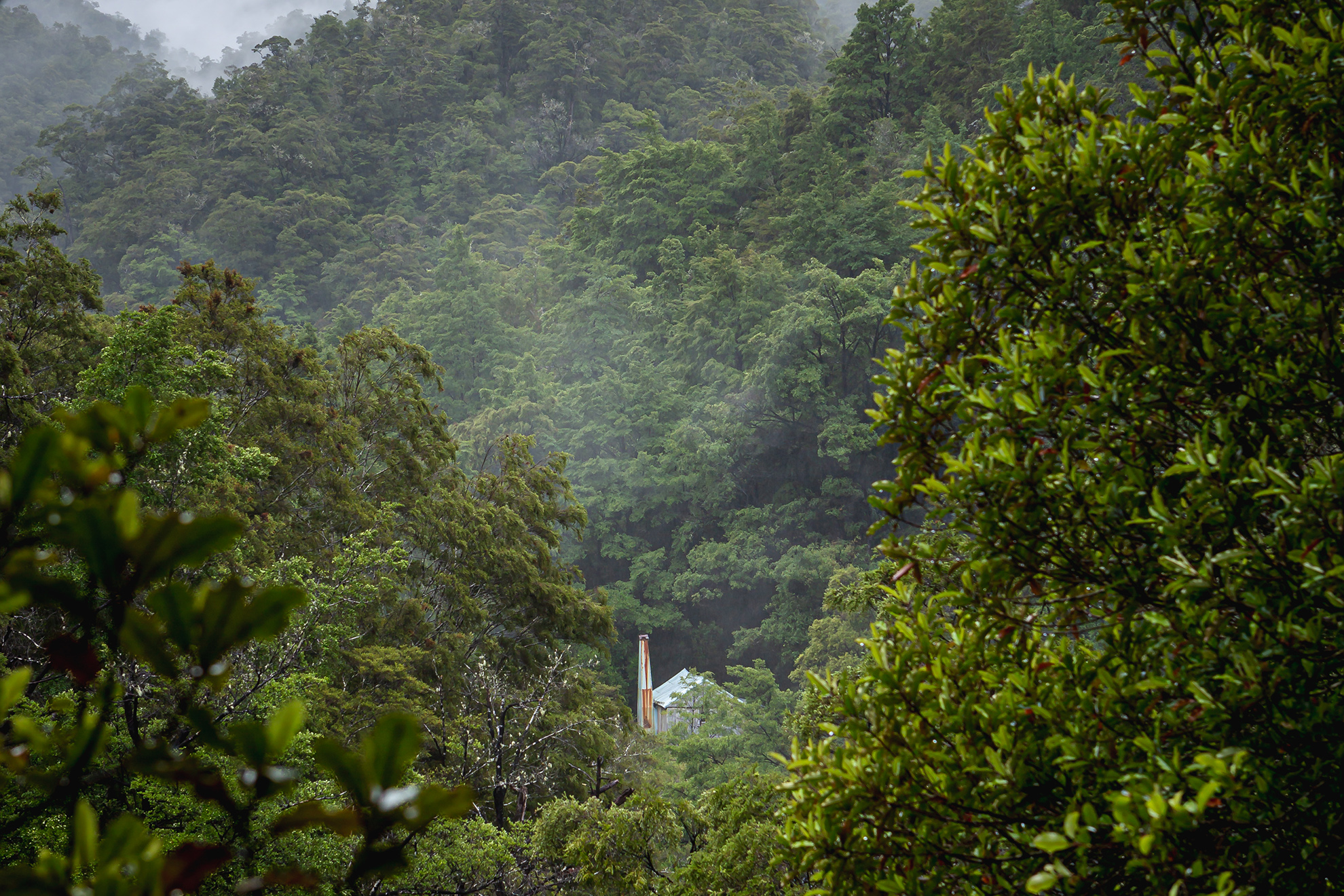
That evening, after we’d slogged to the 20-bunk Kings Creek Hut, we took time to check out King’s actual hut, which can still be used for accommodation today.
King was not deterred by the ceasing of government subsidies; most summers, he continued to stake his claim, travelling from Wellington to the solitude of his hut.
In 1970, the area became part of the new Northwest Nelson Forest Park. The Forest Service poured investment into the track and hordes of ‘hippie’ trampers invaded King’s solitude. The hermit was a popular fixture, known to always have a billy on the boil for passing trampers. When he died in 1982, his ashes were spread outside his hut.
Since then the popularity of the Wangapeka Track has waned. As recently as 2017 it was suggested a road should be ploughed through. Nothing eventuated, and the Wangapeka remains wild.
Next day, in a downpour, we followed a reasonable track on the true left of the Wangapeka’s north branch. White water frothed beneath us and swollen side creeks were crossed with care. The heavy showers eased by the time we crossed Luna Creek, and soon the sun was shining as we reached 10-bunk Stone Hut.
We weren’t staying here though and after some snacks in the sun we continued, crossing a large flat of debris from the long-ago Murchison earthquake.
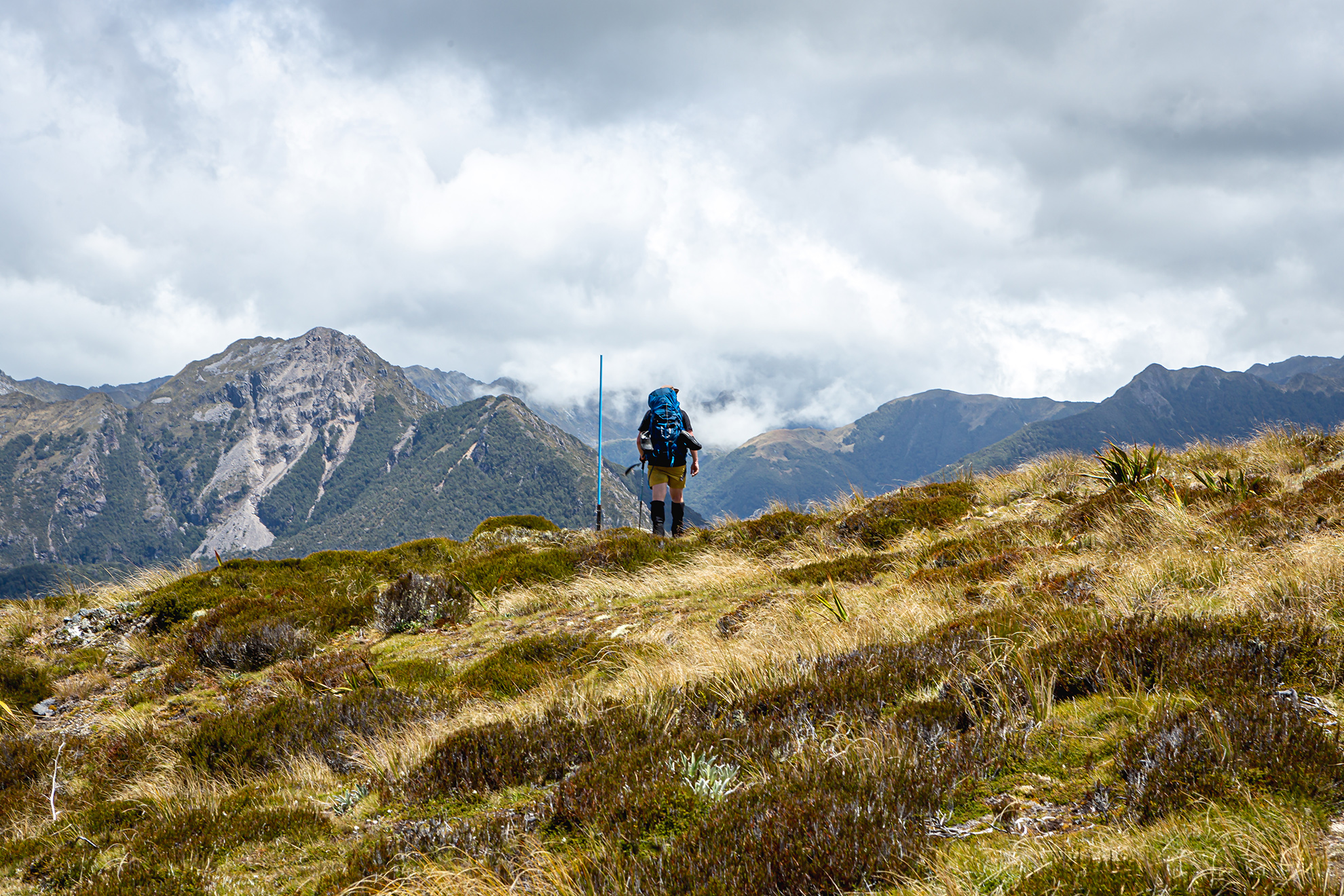
Fording the foaming Wangapeka required concentration and then there was a steep climb to Wangapeka Saddle and the junction of three tracks. The Wangapeka Track continues over the saddle to the headwaters of the Karamea River. To the south the Matiri Tops Route climbs to Nugget Knob, eventually connecting to the Matiri Valley. To the north the Biggs Tops Route climbs to the bushline before crossing an alpine saddle and dropping steeply to Trevor Carter Hut where it rejoins the Wangapeka via the Lost Valley Track.
The weather was fine, so we decided to try the Biggs Tops. On the way up were dracophyllum groves and beech trees, and at the bushline, were expansive views to Mt Luna in the north and Nugget Knob in the south. A series of blue poles led across the tussock-covered slopes under Pt1457 and Pt1414 and up to the saddle. Here we found a sheltered lunch spot where we were serenaded by a flock of korimako.
I had been dreading the upcoming descent, and rightly so. It was 800m of pain as the track zig-zagged steeply through beech forest on a knee-jarring slip-and-slide.
Around the 800m contour the track joins the unnamed creek that drains Biggs Tops.
Lower down the track cuts through a mass of tutu towards the valley floor where we found a sign marking the way to Trevor Carter Hut, just five minutes away.
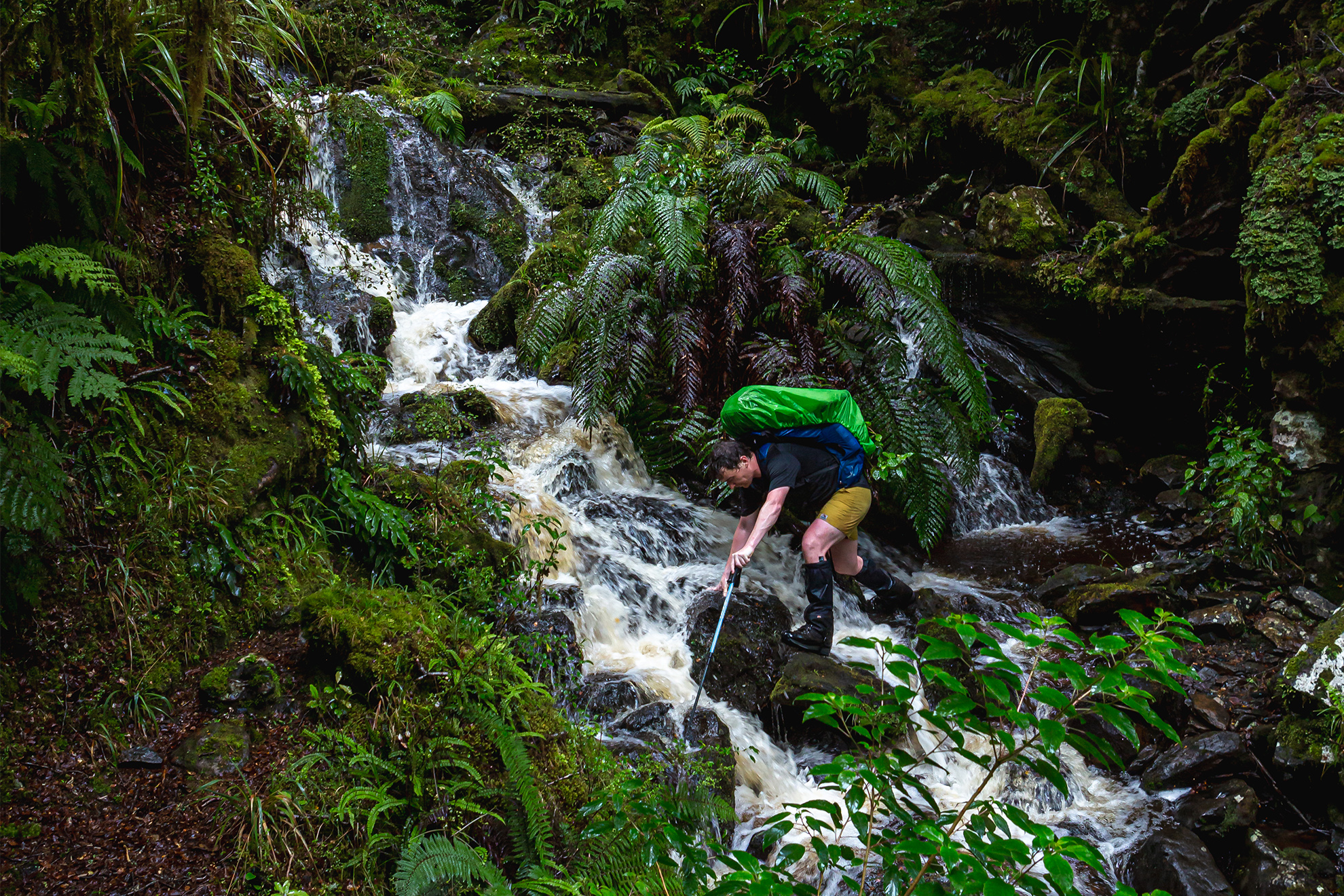
With light still left we decided to press on to Helicopter Flat Hut via the Lost Valley Track. It was through giant masses of tutu, up and over boulders and across creeks. It had been a long day and we still needed to cross the Karamea River to reach the hut.
We slumped, exhausted next to the small lake in the heart of the valley. From it was a short descent to the Karamea. When the river came into sight I sighed with relief. The water was not high and we soon reached the hut, eager to take our boots off.
Again, it was raining as dawn broke. We heard the river before we saw it: a surging mass of brown. The downpour finally began to subside around 8am, but it was 9.30 before we were brave enough to set off.
A family in the hut had left these ominous parting words: “You’ll have fun under that waterfall.”
Yes, it was a thunderous cascade that dropped straight onto the track. The track had been chiselled from a rocky bluff and one look over the edge revealed an abyss below. A chain stretched across the bluff, providing limited reassurance. It was going to be a wet one. Hugh forged his way across and I followed. For a few brief seconds I was pummelled from above before reaching the safety of the other side.
From here it wasn’t far to Brough’s Tabernacle, the rotting remains of an A-frame built in 1898 by Johnathon Brough, the man in charge of the Wangapeka Track’s construction.
Just down from the ruins is the Saxon Falls turnoff which we passed on the descent to the Taipō River. As we crossed the Taipo to make our way up its true right the heavens opened again. We were delighted to discover whio in Herbert Creek, an hour or so before Taipō Hut.
We felt we were on the final stretch now. We needed to climb to Little Wanganui Saddle and then descend the Little Wanganui River to reach the Coast. We were soon crossing the swingbridge over Pannikin Creek and then on a steady climb to the bush edge where we found Stag Flat Shelter – more of a bivvy with a water tank.
We continued across the flat and began the climb to Little Wanganui Saddle. It is a steep track, with much huffing and puffing, and we reached the saddle to be greeted with views of Mt Zetland and the Taipō Valley.
From the saddle it was onwards toward the Saddle Lakes. There was phone reception here and we listened to an updated forecast before continuing past the second lake and into the forest. The track descends in a series of steep zig-zags across a jumble of old earthquake debris, to the valley floor near Little Wanganui Gorge Shelter.
Soon after we crossed the swingbridge to the true right of Little Wanganui River to follow a mixture of track and dry river channels, before fording Tangent Creek and climbing above a gorged section of the river. After negotiating a mess of cut windfall we were back at the river’s edge continuing down river and passing the old Belltown Manunui Hut site before reaching the new hut nestled among trees felled by Cyclone Ita in 2016.

The sun shone on our final day. There were muddy sections around the bluffs near Limestone Creek, and a few awkward climbs, but then the valley opened into regenerating bush dominated by ponga, which thickened further from the river as we crossed a low saddle. Returning to the river we lost the track briefly, but soon we stumbled into the car park just in time to hitch a lift to the highway.
The Wangapeka Track is a great choice for those looking for a wilder alternative to the Heaphy. There are ample options to head to the tops if conditions allow, and it provides the perfect way for ordinary trampers to experience the remote beauty of Kahurangi National Park. Add on the Lookout Range and it allows a difficult but spectacular traverse of New Zealand’s second largest national park. However, go there prepared to be humbled: rivers are king here and this country is certainly untamed.


