
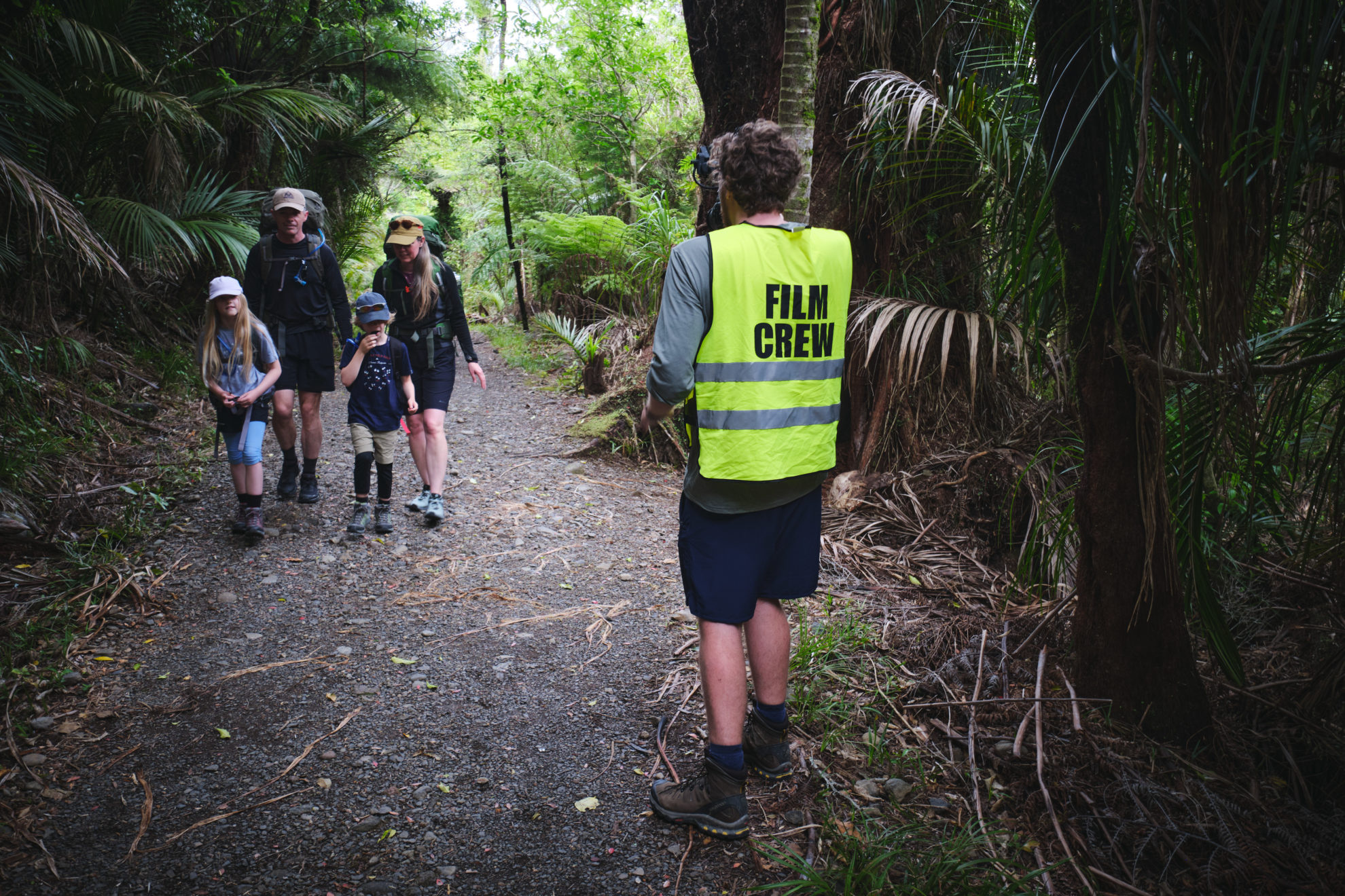
“If they just tell people, some will get it, and some won’t. But if they show them on a video, everyone gets it.”
‘Getting it’ looks different, person to person, Harris says.
“For some people, it means they’re more prepared when they go, but we’ve also heard of people who watch it and say ‘actually, that’s too much for me and I want to do something a bit more straightforward’,” he says.
Back on the Kauaeranga Kauri Trail, we stop to film the water-logged stone steps – a major slipping hazard identified by DOC staff, and also by our sliding feet. Also on the list of identified hazards are weather, river crossings, the steep final scramble and unstable overhangs at the summit.
Harris believes showing people the realities of a track on video can be a more effective deterrent than a verbal warning.
“If you just give them the information you want them to know, it lets them make the choice. If you tell them not to walk, in many cases it drives people more – like it’s a challenge,” he says.
The first series of videos included three Great Walks, the Tongariro Alpine Crossing, and nine other tracks identified as dangerous to trampers. Combined, they’ve had around half a million views.
Mike Daisley says the videos fill a gap in outdoor education and reach more people than was possible when MSC ran training courses.
“We knew roughly how many people were getting connected with that training, and it was a couple of thousand a year,” he says.
“When you put that against the backdrop of a million and a half internationals doing tramping of some sort, pre-Covid, and three-quarters of a million Kiwis doing the same thing – there was a gap, and no one was connecting to them.”
MSC withdrew its outdoor safety programme in 2015 to focus on key messaging – a move which puzzled a number of outdoor trainers. Daisley explains it was a case of too many fish in the same pond.
“There is a whole fabric of outdoor training in New Zealand, and MSC was in the same ecosystem,” he says. “We asked if we were to take ourselves out of that space, what would be missing?
“When you have a number of organisations doing prevention work, it works so long as there isn’t much overlap, and you don’t get gaps. But if there are gaps in the system, that’s a bigger problem than having too many people doing similar things.”
Daisley says the New Zealand outdoors was “a different beast” in 1965 when MSC was formed.
“There were more specialist, knowledgeable people going into the outdoors doing very specific things; wayfinding new tracks, hunting, forestry service, track building,” he says.
“Getting these people together and training them was a fantastic way to give them those key survival skills, and it was part of that psyche – people were keen to learn that way.”
Outdoor courses still have their place, Daisley says, but it’s difficult to target them to the millions of track users who need them but don’t know it.
“There is a spectrum from people who are aware they are unaware through to the people who are unaware they are unaware – they don’t know there is a problem to be worried about,” he says.
“We were spending a lot of time educating the demographic not getting into trouble, so those people get better and better, but those people aren’t the problem.”
The safety videos are perhaps the most visible way MSC works to promote safety in the backcountry, but it also works behind the scenes to improve track signage and infrastructure, Daisley says. “It could be a simple message to say the track takes three hours, or five in bad weather, which is seemingly simple and obvious to dedicated trampers, but not obvious to the people having incidents.”
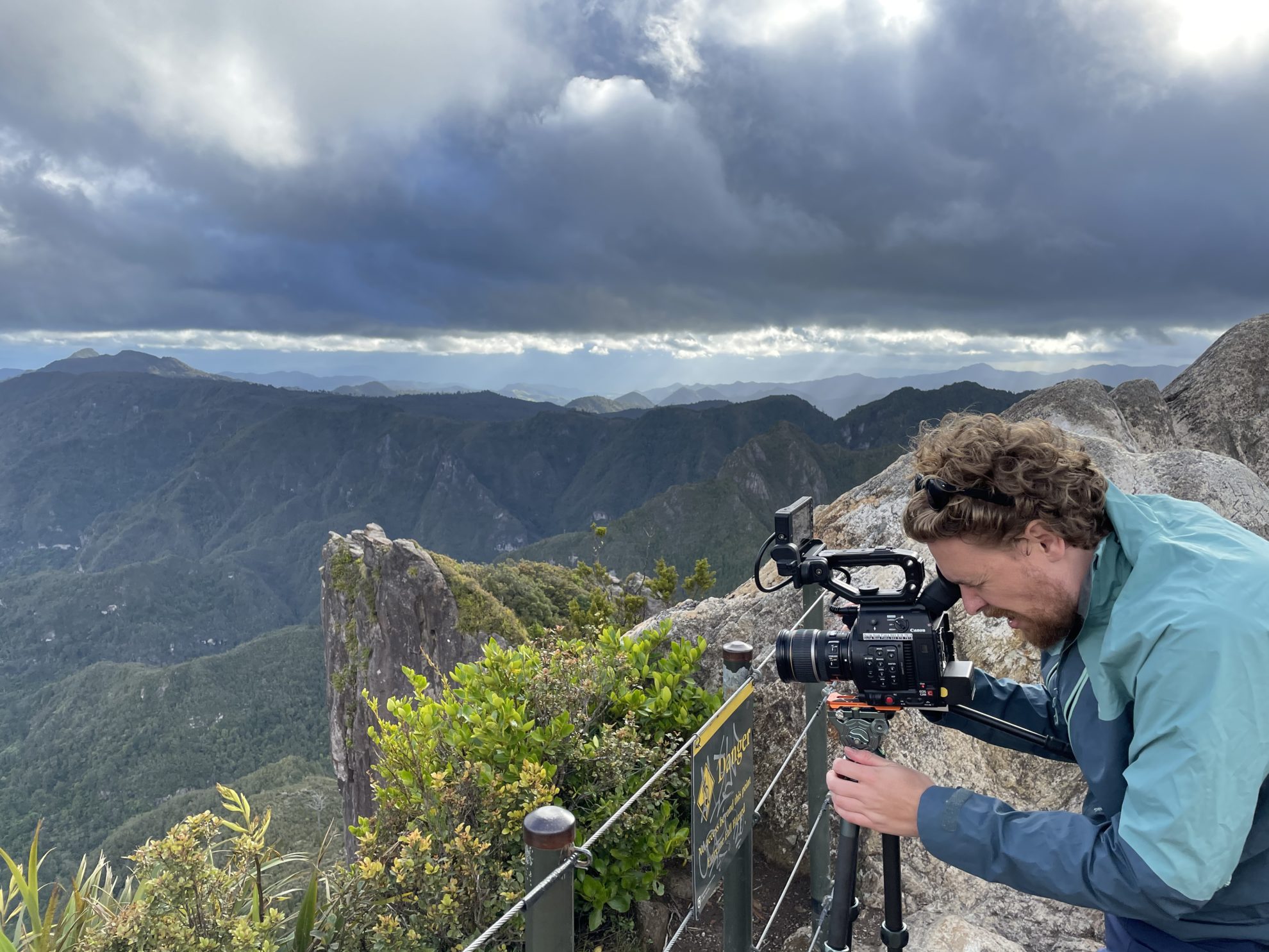
As we reach the final descent to the hut, I realise it’s time for me to begin my descent and return home to Auckland. The MSC team is just getting started, however, and still has a lot of filming ahead at the summit, and on the return journey via Billygoat Track.
In the coming months, videos will be filmed on the Southern Crossing, Richmond Range, Copland Valley, Rees-Dart Track, Gillespie Pass Circuit and Mt Somers Track.
People will still have accidents on these tracks – it’s inevitable – but Daisley believes the videos can make a difference to the number of preventable incidents.
“We’re humans, we fall down, but when you take [the accident aspect] out, you’re left with people who are making poor decisions because they have poor information or they’re motivated by something,” he says.
And with tramping accidents tracking down, despite increasing participation, Daisley is positive MSC’s work is preventing those incidents.
“We do believe, based on behaviour change research, that it’s the nudges – small though they are – that we are making,” he says.


