


It’s easy to follow a track and pay scant attention to navigation, but doing so runs the risk of inadvertently losing the track or taking a wrong turn, writes Heather Grady.
The majority of the time, you can follow a track and not be concerned about losing your way, but anyone can become lost even on the easiest of day walks.
A map is a vital tool that can help walkers correctly confirm their location.
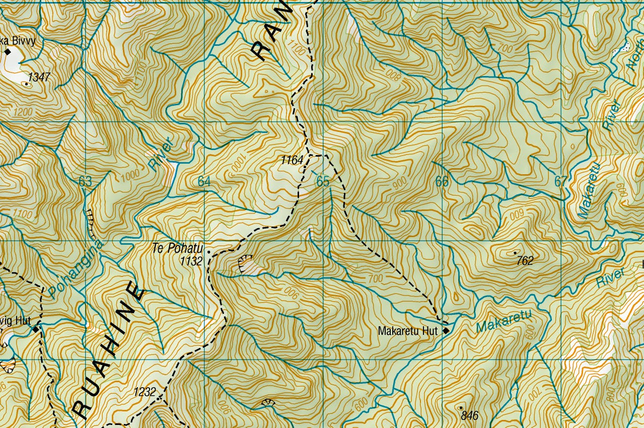
Look at the map illustrating this article and imagine you have come from Te Pohatu and are heading north-east. You are standing at a junction on your right, and you believe it is the junction heading east to Makaretu Hut. Here is how the map can help you confirm your location.
- Have you crossed a high point and travelled about 50m in a downhill direction for around four minutes (based on 3km/h plus 3min per contour (20m) down)?
- Is the track on the right heading in a rough easterly direction? You can confirm this by facing the track, and holding your compass in front of you. Have the direction of travel arrow facing the direction you are planning to travel, and turn the dial so the red end of the needle points to the magnetic variation (taken from the map). If you are facing east, east should now be showing in line with the direction of travel arrow.
- Confirm the track ahead is roughly heading north.
- Confirm the track you have just travelled is roughly south.
- You should be able to see that track to the east follows a spur and there is also a spur to the west coming off Pt1164.
- Recalling your approach to the highpoint, do you remember walking just under 1km with a 130m ascent in around 45min, based on 3km/hour plus 4min per contour (20m) up.
If all of those points are met you can be quite confident that you have identified the junction correctly. If not, consider if there is an explanation for a difference. Take care not to ‘explain away’ differences just to confirm your own belief.
For example, if your timings are out, consider if you have been walking faster or slower than ‘average’ or, if the side track joins the main track differently from what is shown on the map. In this instance, there shouldn’t be much difference as the track follows the spur.
Practise this skill when you come to a junction with a sign, so you are better at reading the map when you need it.
– Heather Grady is an instructor with Outdoor Training New Zealand
