
In the neighbourhood
Alternative track: The Inland Pack Track departs from Punakaiki and heads north in a loop to exit via Fox River over three days, giving trampers a good taste of Paparoa National Park.
Since you’re already here: Walk the 700m Truman Track to explore the rugged coastline, and a waterfall that plunges onto the sand.
Just got a weekend? Get on your bike, and tackle the Paparoa Track over a weekend.
Where to stay: There are plenty of accommodation options in Blackball and Punakaiki, including backpackers, hotels and AirBnB.
Where to stock up: Greymouth offers the widest range of food and equipment options.
Walking and riding the Paparora Track
The Paparoa Track passes through a landscape as diverse as the Heaphy, but crams this diversity into a three-day walk or overnight bike ride.
Smoke-ho car park to Ces Clark Hut
10.3km, 4-5hr
This first section has been in use for years. Known as the Croesus Track, it leads steeply and roughly past gold mining ruins and relics to 16-bunk Ces Clark Hut. The hut is right on the bush edge and has magnificent views to the Grey Valley and the Southern Alps. If time allows, take the side track to Garden Gully (45min return) where you can cross a suspension bridge and explore a century-old quartz crushing battery and collapsed mine site.
Mountain bikers will most likely skip this hut and ride on to Moonlight Tops Hut.
Ces Clark Hut to Moonlight Tops Hut
9.7km, 3hr
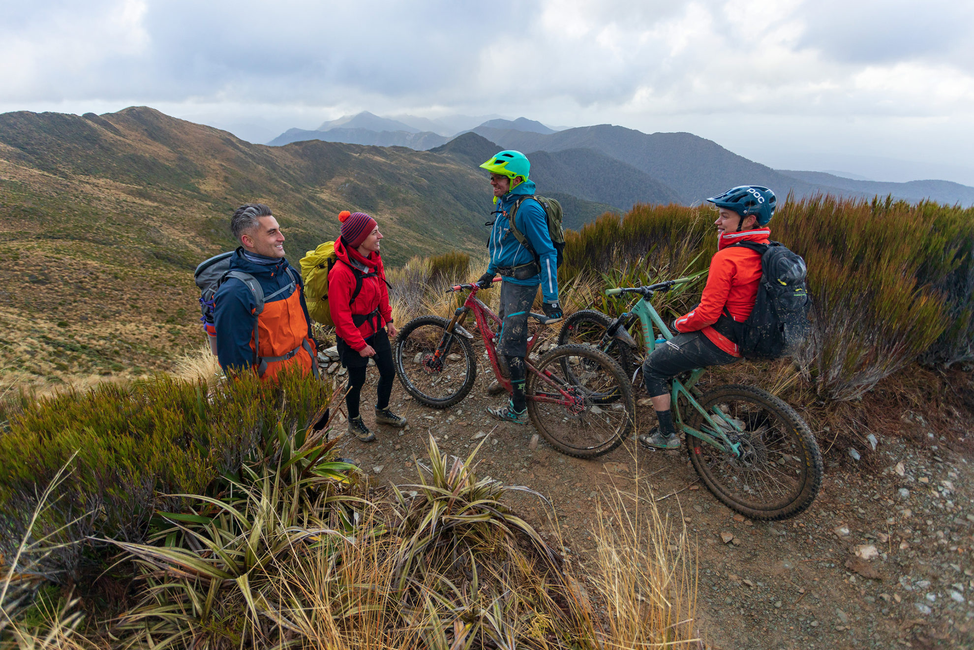
The trail climbs through alpine scrub and tussock to the ridge of the Paparoa Range and follows this north above the Roaring Meg and Moonlight Creek catchments. On a fine day, you’ll have views to Aoraki/Mt Cook. The 20-bunk Moonlight Tops Hut is at 1000m altitude and high above the treeline making it one of the most spectacular hut locations on the walk. It’s the busiest hut on the track and the most difficult to book due to it being the only hut mountain bikers stay at.
Moonlight Tops Hut to Pororari Hut
19.1km, 5-7hr
This section includes the dramatic escarpment – a gigantic sandstone bluff extending 2km along the main range and towering above the Punakaiki headwaters. The track traverses below Mt Hawera and then descends the ridge above Tindale Creek to 20-bunk Pororari Hut. The hut looks across the beech forested head of Pororari Valley, sweeping from Lone Hand (947m) to the Tasman Sea. Roroa (great spotted kiwi) are known to inhabit the surrounding bush.
Pororari Hut to Punakaiki
16km, 4-5hr
The track follows the Pororari River until a junction where the Inland Pack Track veers left – the route for mountain bikers – and the Pororari River Gorge beckons walkers dead ahead. Here, the river has cut a path through the limestone and the gorge is lined with lush rainforest, a confusion of nikau palms and kiekie hanging off giant podocarps, that give way upriver to temperate beech forest.


