Three places to see this shapely tree of the mountains
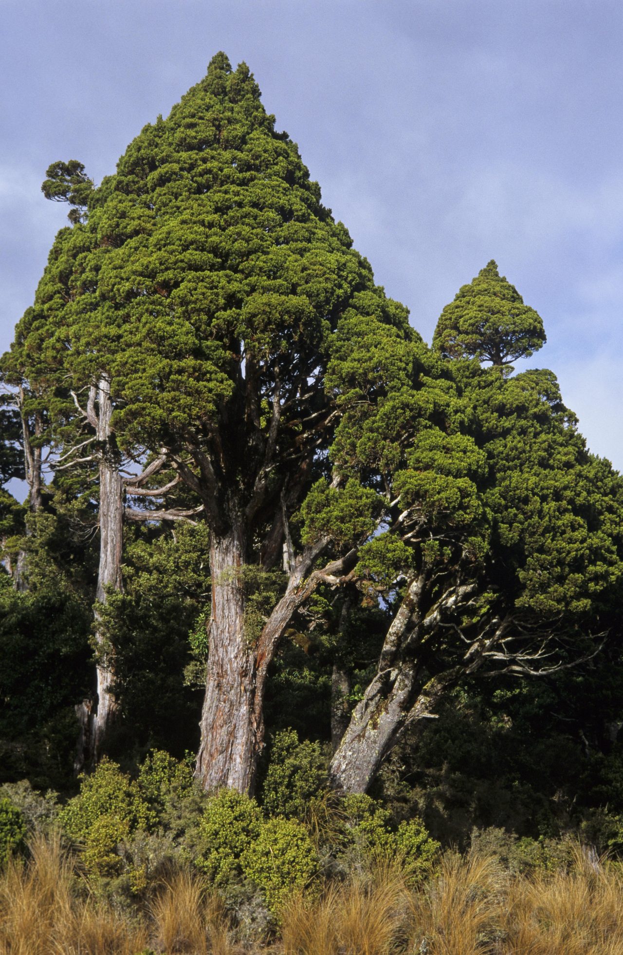
In many ranges of New Zealand, mountain cedar dominates the canopy near the bushline, its dark, conical shape distinctive and striking. Its shape is usually pleasingly symmetrical, though occasionally one produces a protruding branch as a secondary leader and the symmetry is broken. Long straps of reddish bark peel from its trunk, rendering the trees instantly recognisable even from the interior of a forest track.
Mountain cedar (Libocedrus bidwillii) is often mistakenly called by its Maori name kaikawaka, but according to DOC botanist and cedar expert Geoff Rogers it should more correctly be referred to as pahautea. It’s an endemic native conifer.
Mountain cedar grows from Auckland southwards (but not on Stewart Island), usually on the wetter (western) side of mountain ranges – but not exclusively so. In the headwaters of several Canterbury rivers, notably the Wilberforce, Mathias and Rangitata, mountain cedar features in pockets of forest in these valleys.
Unfortunately, severe possum browse will kill the trees, leaving them as stark, bleached stag heads. Reputedly, it was a flight over the Hihitahi Forest Sanctuary, near Taihape, that convinced former Conservation Minister Dennis Marshall to begin large-scale funding for possum control in the early 1990s. He was shocked at the extent of dead stags heads, most of them pahautea, poking through the canopy.
Ruahine Corner Hut, Ruahine Forest Park
At Ruahine Corner, extensive pahautea stands end abruptly at the sprawling red tussock grasslands of the Mangaohane Plateau. It’s a magnificently sharp boundary of forest and tussock, but one not caused by the usual factor of altitude, for the terrain is undulating. Scientist Les Molloy described it as “one of the most dramatic indigenous vegetation contrasts in the North Island.”
Pahautea forests once spread over a 300km² swathe of this country, stretching all the way to Waiouru, but Maori fires during the moa-hunting period some 500 years ago reduced its extent to several remnants. The pahautea forest at Ruahine Corner is the largest of these remnants (Hihitahi is another sizable one).
Ruahine Corner Hut occupies the forest edge, and forms a fine base from which to explore the surrounding plateau. The hut can be approached from the west on tracks past Iron Bark and Colenso huts, or from the east via Colenso Spur and the tops of the Ruahine Range. Both approaches take about two days.
Pahautea Hut, Pirongia Forest Park
A more accessible place to observe pahautea is the Waikato’s Pirongia Mountain, the extinct volcano that dominates the skyline south of Hamilton. Mountain cedar forms quite dense stands around the mountain’s summit, and the nearby eight-bunk Pahautea Hut is named after these trees. Pirongia is most easily approached from Corcoran Road, where a three-hour tramp leads to the summit. After a night at the hut, trampers can take the alternative route over Mahaukura and exit at Grey Road.
Cedar Flat, Toaroha Valley, West Coast
Pahautea and hot springs form a pleasant combination at the West Coast’s Cedar Flat, in the Toaroha Valley near Hokitika. Two huts, one historic, occupy the flat amidst attractive stands of cedar and are reached on a four-hour tramp from Middlebranch Road, near Kokatahi.