Measuring distance on your map

April 2019

Read more from

April 2019

Photo: Matthew Cattin
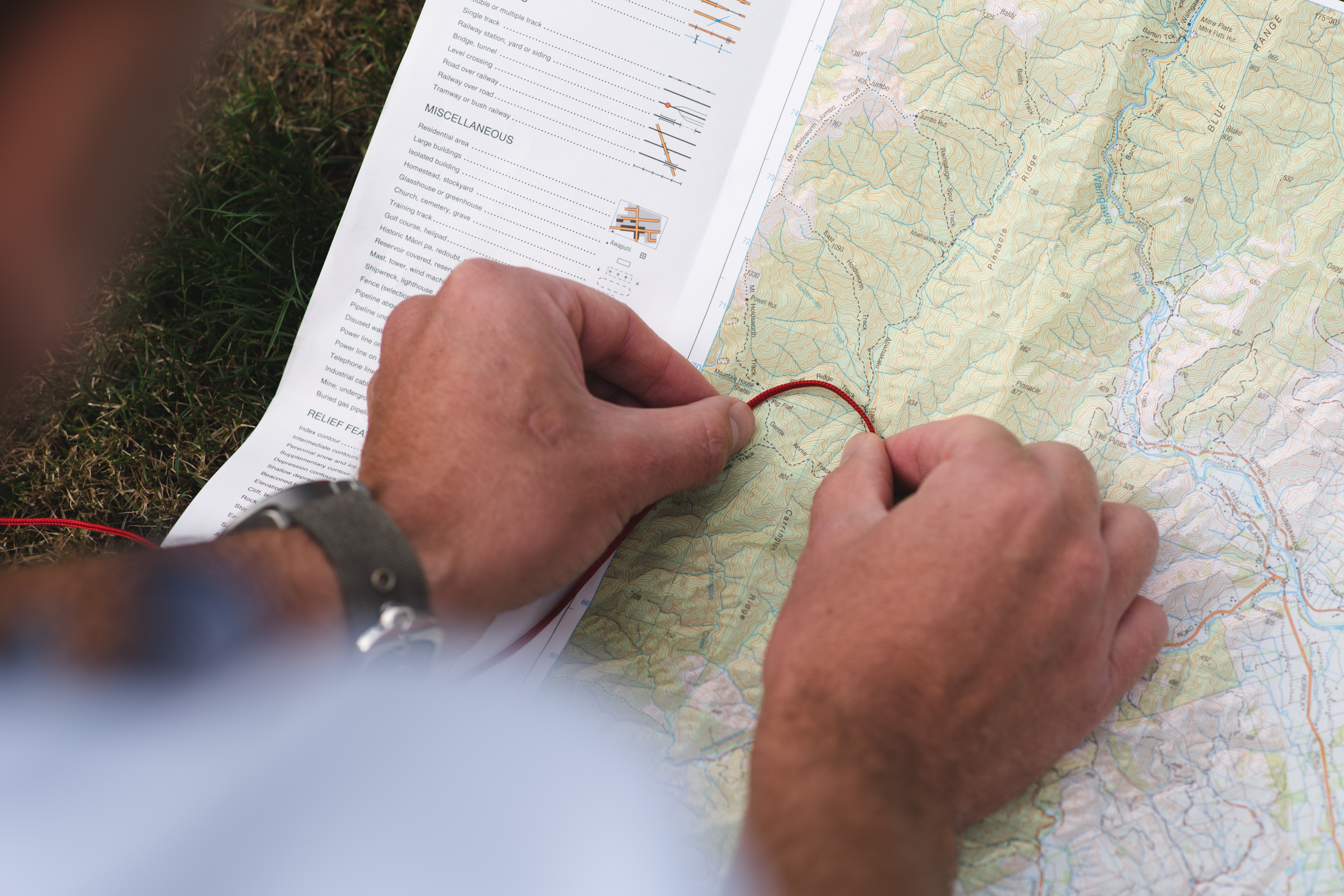
Have you ever looked at a map and tried to figure out how long a track is or how high it climbs? Working this out will help you estimate the time it will take. By Heather Grady Measuring distance Topo50 maps have a scale of 1:50,000 with the blue grid lines spaced 2cm apart representing […]
Heather Grady

About the author

Heather Grady

Heather Grady is an instructor with Outdoor Training New Zealand

More From Skills

Related Topics

Similar Articles

How to clean your hiking footwear

Mocktail energy balls

You can always change your plans

Trending Now

Seven overseas trails you’ll love

Lowry from Days Bay, East Harbour Regional Park

Roaming the red rocks

A tale of adventure and tragedy

Foggy Peak, Korowai-Torlesse Tussockland Park

Subscribe!
Each issue of Wilderness celebrates Aotearoa’s great outdoors — written and photographed with care, not algorithms.Subscribe and help keep our wild stories alive.

Join Wilderness. You'll see more, do more and live more.

Already a subscriber?  to keep reading. Or…

34 years of inspiring New Zealanders to explore the outdoors. Don’t miss out — subscribe today.

Your subscriber-only benefits:

All this for as little as $6.75/month.

1

free articles left this month.

Already a subscriber? Login Now