There’s a new tool to help with planning backcountry hikes or mountaineering adventures, and it’s free.
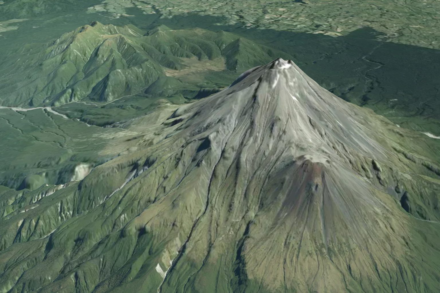
LINZ has upgraded New Zealand’s basemaps, and peaks and plains can now be viewed in 3D across the country.
LINZ head of location information Aaron Jordan says this latest development will help build understanding of New Zealand landscapes through easy-to-view detailed contours, hill shades and slopes.
“New Zealand is one of the few countries in the world where this type of service and the underlying data is available at no cost to users,” he says. It will help “connect people with parts of the country that are difficult to access, or which they’d love to visit from the comfort of their own home”.
The upgrade allows users to zoom right down to one-metre resolution in most areas.
Visit basemaps.linz.govt.nz and click the mountain icon on the left to explore the feature.
Already a subscriber? Log in
Subscribe to read this article immediately and unlock exclusive 10-15% discounts at NZ’s best outdoor stores.
Cancel anytime.

Questions? Contact us