


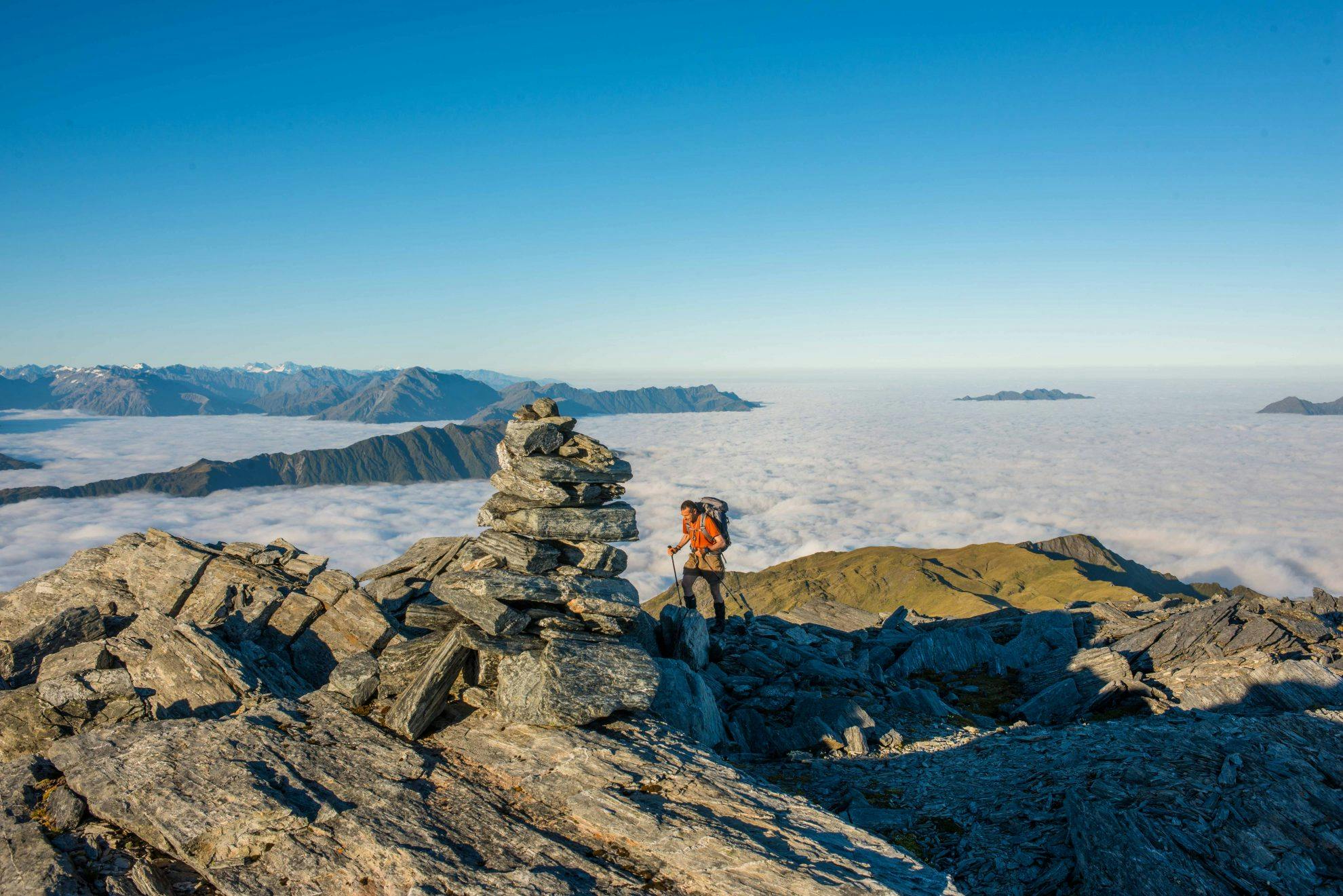

Mt Alexander, West Coast
Nearing the summit of the low peak of Mt Alexander, or Little Alexander as some call the 1795m high point, the entire northern section of Westland, and in particular, the seldom-viewed western parts of Arthur’s Pass National Park, open up for viewing.
The view just gets better and bigger as the unmarked route leads on to Mt Alexander itself – two kilometres away along a razorback ridge and 200m higher at 1958m.
Below the summits is the wide, deep trench of the Taramakau River, some 1700m lower. It feels all of that, seemingly detached from the upper mountain world, the valleys cut around the flanks of these mighty bastions, great arms of grey and green forging their way to the sea.
Though not a Main Divide peak, Mt Alexander has a view to rival that of most of its nearby, and higher, neighbours. But it will take two days of determined effort to reach the top, and there’s no guarantee you’ll get perfect conditions like this – Westland’s weather is notoriously fickle.
- Distance
- 7.71km
- Total Ascent
- 1929m
- Grade
- Moderate / Difficult
- Time
- Car park to Camp Creek Hut, 2.5hr; hut to Mt Alexander, 5-6hr
- Accom.
- Camp Creek Hut (free, six bunks)
- Access
- Signposted access on Lake Brunner Road at Camp Creek, 3km north-east of Lake Poerua
- Map
- BU20
GPX File
- Mt Alexander (gpx, 20 KB)
GPX File
- Your device does not support GPX files. Please try a different device.
