


- Time
- Roadend – Hidden Falls Hut: 2.5hr; Hidden Falls Hut – Lake Alabaster Hut: 3hr; Lake Alabaster Hut – Demon Trail Hut: 3hr; Demon Trail Hut – Hokuri Hut: 3-5hr; Hokuri Hut – Martins Bay Hut: 4-5hr; Martins Bay Hut – Big Bay Hut: 4-5hr; Big Bay Hut – Pyke Crossing: 3-4hr; Pyke Crossing – Olivine Hut: 8-10hr; Olivine Hut – Lake Alabaster Hut: 7-10hr; Lake Alabaster Hut – Roadend: 5hr
- Grade
- Moderate
- Access
- 1.5hr drive from Te Anau, via the Milford Road (SH94). Park at the Lower Hollyford roadend. Tracknet run a shuttle service from Te Anau and Queenstown: www.GreatwalksNZ.com
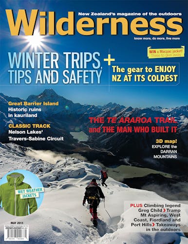
To mark Wilderness magazine’s 30th anniversary, current and past editors and contributors scoured the archives for the 30 best trips we’ve published over the decades. This story, original published in May 2011, was included. You can find all 30 of the greatest Wilderness trips in the October 2021 issue.
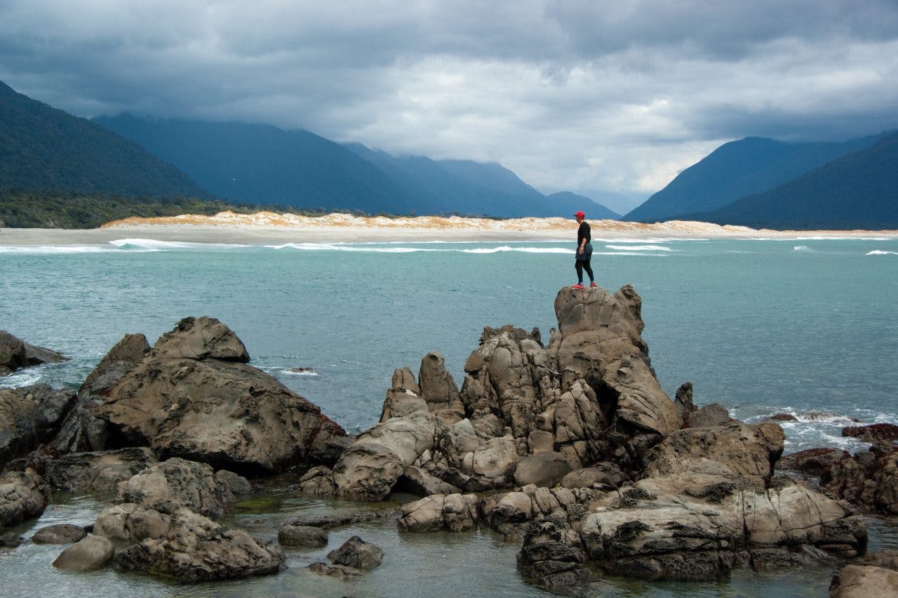
A circuit from Big Bay to Pyke River takes author Raymond Salisbury through Mt Aspiring and Fiordland national parks
They say that beaten paths are for beaten men – but they sure do make great access corridors into the wilderness. My plan was to walk the historic Hollyford Track, from the dizzying height of 61m a.s.l. to the coast, then tramp off the tourist radar, into oblivion. Or at least, into a reasonably remote, seldom-visited locale, out of reach from mechanised means of transport: this was my intention.
Shouldering a heavy swag full of food for nine days, I’d left the relative luxury of Gunn’s Camp, with its rustic charm and idiosyncratic quirkiness, and headed into the rain. Heavy Fiordland rain, which saturates you even under expensive waterproof gear, socks swimming in full leather boots like the trout in the adjacent Hollyford River – which was a raging torrent.
Thanks to the efforts of an employment scheme in the 1980s, the first day was of a Great Walk standard, with a metre-wide benched track and all waterways bridged – a proverbial walk in the park. Actually, it was Davey Gunn who first opened up the Hollyford to tourists, and built a network of huts. In 1926 he’d left behind a wife and children for a solitary life, mustering cattle for 30 years and guiding trampers.
At Hidden Falls Hut, one of six flash cabins on the track which DOC has recently renovated, I stopped for lunch. I boiled the billy and met Christan Long. His father, known locally as Beansprout, lived further up the coast, in the original NZFS hut at Gorge River, for 30 years. I had recently read his book on ‘NZ’s remotest family’ so was pleased that our paths had cross. Chris and his friend Sam departed to climb Barrington Peak; I left for Lake Alabaster Hut.
Little Homer Saddle was the highest point on the Hollyford, but at 168m hardly noticeable. Soaked to the skin, I turned down an offer of tea at Pyke Lodge, the guided walkers hut, and pressed on, 15 minutes, to the DoC hut. An Australian couple was there; their welcome was warm, and so was the fire in front of which I dried my wet clothes.
The following day I forded a flood channel in the Hollyford River to McKerrow Island. Its tidy hut was empty, snuggled into the scrub near the lakehead and sheltered from the winds whipping across Lake McKerrow. I followed fresh deer tracks along the shingle beach, back to the slippery, stony track, which was now affectionately dubbed the ‘Demon Trail’. It wasn’t too hell-ish, and I arrived at the hut in less than five hours.
The third day was bright and clear, so I decided to go hell for leather along the Demon Trail and make the coast by evening. Hokuri Hut was a sort of nowhere place, halfway along the lake, but provided an adequate lunch stop. I pushed on, past Jamestown with its ‘nine roads to nowhere’. Only a plaque remains here to remember the hundred people who battled in vain to establish a western port for Otago during the 1860s.
There are abundant kowhai groves along McKerrow’s shingle shoreline, but the track then winds inland, skirting two airstrips to cross Jerusalem Creek where the mixed podocarp was replaced with lowland coastal forest of treefern, toetoe and stunted scrub. I could hear the ocean long before I saw it.
It took seven hours of fast walking to reach Martins Bay. The hut here has a verandah view up-valley to the distant Darrans, and two bunkrooms to sleep 24. Directly in front a short trail drops onto a sandy beach. One can sit on a driftwood log and watch the tide slip over the Hollyford bar, and the sun slip into the Tasman; it’s a magical place.
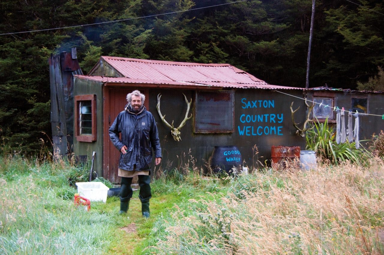
Bruce Reay, in his domain, lost in a time warp, a sort of No Man’s Land. Photo: Raymond Salisbury
Next day, was a pit day and I read a pile of Wilderness magazines before ambling along to Long Reef, where hundreds of fur seals lounged lazily in their rookery, calves suckling off cows, and bulls warily eyeing human intruders.
On the way back to the hut, a rustle in the flax bushes gave me my first glimpse of a Fiordland crested penguin.
The next morning, while other hut occupants, mainly foreigners, jumped on their jetboats for the return journey up-river, I left the beaten track, heading north, boulder-hopping tidal platforms then striding along shingle stretches of wild coastline.
Fishing buoys indicated a rough trail over the headland at Penguin Rock. Oystercatchers complained and gulls circled when I invaded their real estate.
I stumbled upon a hunters hut and noticed a basic four-berth sleepout, useful for stopovers and a refuge from sandflies. An old fishing buoy led me astray onto a bulldozed road shown on the map.
It was so overgrown that I ended up crawling on hands and knees through cutty grass, as bush lawyer ripped my clothes. Eventually I exited onto the beach, cursing the cartographers.
I skirted a lagoon to find the high tide pouring into the mouth of McKenzie Creek. Between waves I timed my crossing, and rushed through surging, waist-deep saltwater. The next 4km was a gravel-bash along Big Bay, nearly to the northern spit where the Awarua snakes through sand banks to the sea.
A large orange triangle invited me inland, over deserted dunes, to be met with a cacophony of chattering cicadas. Hidden in dense coastal scrub was Big Bay Hut, home to a solitary soul who had squatted here for a fortnight. Andrew had pitched his tent inside the hut to insulate himself from the voracious mosquitoes.
Big Bay is one of the few flat places in Fiordland where aircraft can land. To prove it, we heard a vague drone, annoying like a mozzie but too distant to bother about. But then the noise grew louder, until the sound of its engines was unmistakable. A small aircraft had landed at low-tide. Minutes later, our peace and quiet went out the window when a quartet of holiday-makers came in the hut door.
The crowded hut was stiflingly hot, so I went for an evening stroll along the undulating dunes. A four-wheeler road cut through the jungle, betraying a small community of dishevelled cribs, scattered in the long grass beneath aging macrocarpa. In late August these private shanties are home to a handful of hardy men who return for the white-baiting season, fishing the relaxing reaches of the Awarua.
Next day, I made an early start, conscious of previous wayfarers taking 14 hours to reach Olivine Hut. I headed east in the direction of Red Mountain, on an old bulldozed road, spooking a few kereru. A couple of hours on, this corridor through the Pyke Forest saw me arrive at Stockyard Stream, a legacy of the era when Davey Gunn ran 1000 cattle on his leased land. Then the path deteriorated into toetoe flats, while orange marker posts led down a dry river bed to the Pyke Crossing. A pile of firewood was secured under a black polythene cover – I remembered reading this was a good place to camp.
Once on the true left of the Pyke, the road ran out; in fact, I could barely follow the old cattle track and promptly got lost in a swathe of flax bushes. After consulting my map, I journeyed along open river flats for a while until the dashed line on my map kissed the Pyke River. Here I found the light ground trail which wound through 7km of beech forest.
Despite being marked by DOC in recent years, it was in disrepair so progress was pitiful. Navigation was a challenge, albeit an enjoyable one – the ubiquitous hook grass which tore at my hairy legs wasn’t so enjoyable. A final surprise: the route led me into the river, wading knee-deep in crystal clear waters until the Pyke spat me out into Lake Wilmot.
Taking time to enjoy the simple things in life at Lake Wilmot. Photo: Raymond Salisbury
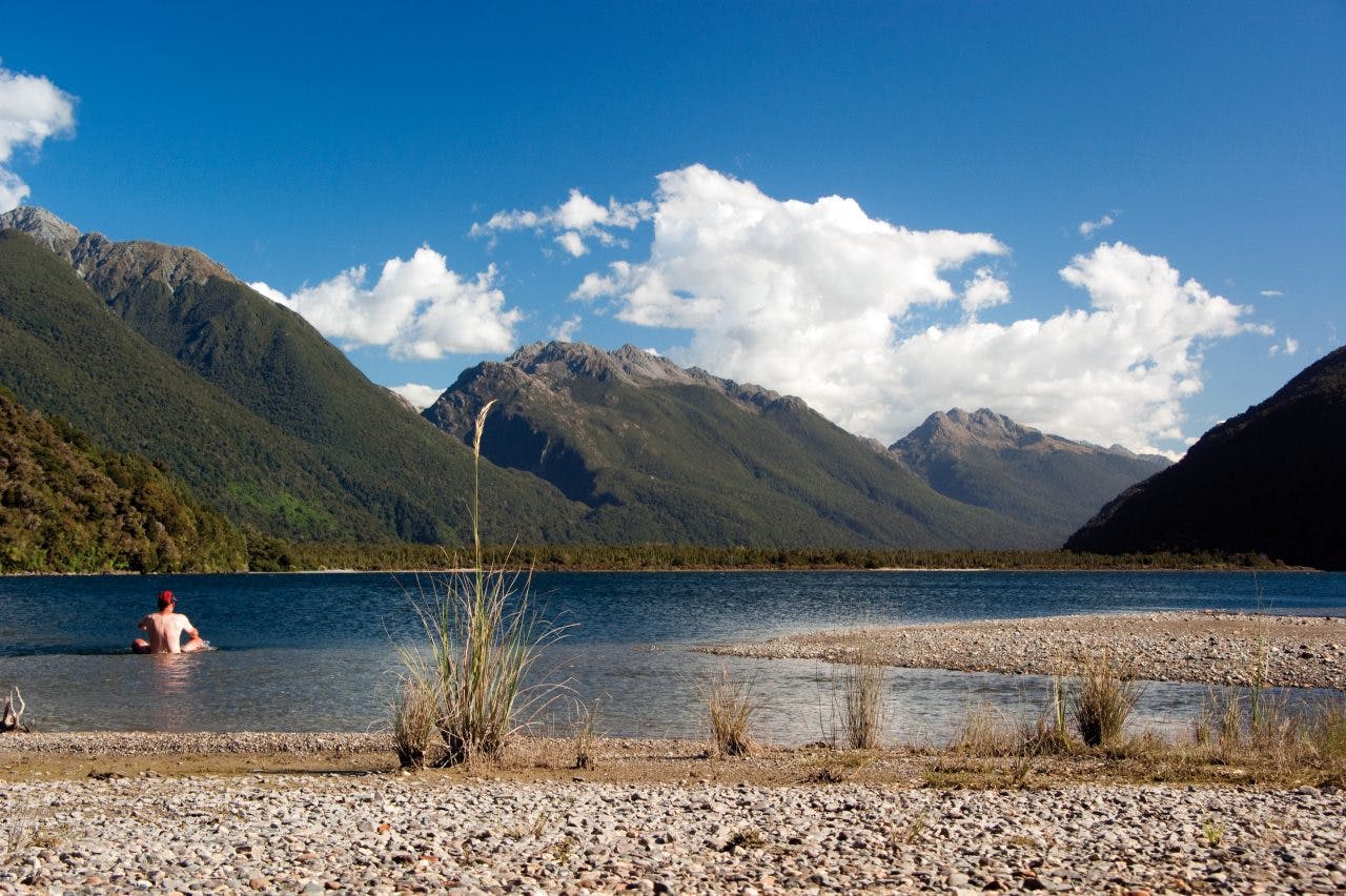
Seven hours on the go and I was hungry and tired. My original ambition to arrive at Olivine was soon replaced with a long lakeside lunch and swim. Wilmot was a wonderful place to while away an afternoon of tea-drinking and drying damp polypro.
After much searching, I eventually discovered the rock overhang mentioned in Moir’s Guide North and I soon made the rock bivouac comfortable. I felt at home here, far from the madding crowds. Then the sandflies found me and they were soon joined by marauding mosquitoes. Some time after midnight, I dared expose my head from the confines of my mummy bag to breathe fresh air. To my relief, I was now alone, with the chilling chant of a morepork cutting through the quiet of a warm summer night.
From my starlight hotel, I lay on my back watching the brilliant Milky Way burn through the blackening sky. For a while, all thoughts about the world I would soon return to were non-existent.
A few clouds drifted lethargically along an azure sky – today I would slow down, take life easy and breathe deeper. I ascended the jumbled, mossy rocks of the sidle track around Lake Wilmot. This became easier as the glacier-carved walls became less steep. This cattle track was originally blasted by Davey Gunn to access the Upper Pyke.
Near the lake outlet it was critical to locate the track which starts indistinctly amongst scraggy beech swamps, festooned with hook grass.
I was on the lookout for marker poles, which I followed through open flats where Davey’s cattle grazed, half-a-century ago. Apparently, this larger-than-life legend was known to light matches, starting illegal fires in order to keep the clearings open. A line of rotting fence posts is all that remains of the stockyards here. When Davey drowned in 1955, his grazing license was dissolved and the region was swallowed up by National Park.
The ground was uneven underfoot; I now understood why parties moved so slowly through the Pyke Valley. I was relieved when the old stock route entered the beech forest, but annoyed when it was washed out by the river. Well-developed route-finding skills and a keen eye were essential for travel through this neck of the woods. I recall that in 1864, Alphonse Barrington’s prospecting party took eight days to travel this 10km section of the Pyke River, living off a staple diet of kakapo.
From its origins in the Olivine Ice Plateau, the Olivine River was divine, its waters sparkling – now a spent force, emptying into the Pyke. Beckoning me on across the far bank was the hut, a vestige of comfort in this isolated backwater.
There’s a cableway to cross this daunting river, but in such low water-levels I had no need of the cage, preferring to wade, waist-deep, and haul myself up through a wall of bracken.
Resplendent in its coat of new paint, Olivine Hut sits on a terrace above the confluence – a magnificent corner of the country and worthy of a hundred photos. Beyond the deep green pools of the Pyke and framed by forested ridges, Mt Madeline takes centre stage, snow-capped against a perfect sky. The monumental beauty of the valley is complimented by the colossal architecture of the Darran Mountains.
And so, here I am writing, finally alone, with a hut to myself. Not a soul in sight, not a mechanical noise in earshot. Just a warming wind playing in the beech trees, enhanced by a soundtrack of birdsong, the ever-present envelope of chattering cicadas and, if I listen carefully, the distant thunder of Olivine Falls tumbling 71m off the mountain into deep shadows.
Tomorrow I have another long day to arrive at Alabaster Hut, the Hollyford and then the circle is complete.
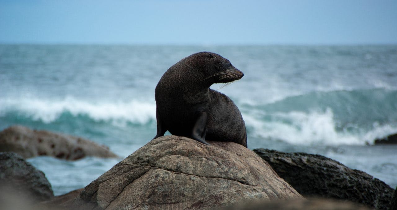
New Zealand fur seal at the Long Reef colony, near Martins Bay. Photo: Raymond Salisbury
My eighth day in the bush has me walking briskly along the river flats, a touch nervous as gathering cloud banks threaten to unload. The signpost suggests a 10-hour day to wade around Lake Alabaster; not something to smile about. I am struggling to locate the next marker pole as the route disappears in a confusing maze of toetoe when I hear it. Too weak to be an aircraft, it must be the sound of a single outboard motor, working up the river. It’s Bruce Reay, the infamous fishermen of the Pyke – he has spent a lifetime eeling every major river from Heaphy to the Hollyford.
He’s collecting his night’s catch from an inflatable and was looking out for me. I board the boat and Bruce whisks me away downstream.
Bruce lives in a dilapidated dwelling beside a remote airstrip opposite the notorious Black Swamp. His provisions are flown in irregularly from Haast, and it looks like he’s on his last rations. (It was Davey Gunn who called this country ‘the land of doing without’, because he didn’t have any ‘modern in-conveniences.’) A satellite phone hangs from the dark interior of Bruce’s cabin, looking a little out-of-place. A fire burns in the hearth as a pillar of smoke wafts heavenward through an iron chimney.
I recall reading that Bruce graduated with a forestry degree from Canterbury University in the late 1970s. He worked in Nelson with rangers Snow Meyers and Max Polgaze, before turning to eeling and possum trapping. For eight years he owned a microlight, but he eventually crashed it.
Bruce tells me of his battle with DOC to legalise his right to fish here. On the far river bank, he explains, is Fiordland National Park; this side is Pyke Forest. But the river, he grins, is neither – a sort of no man’s land.
We leave the old shanty to continue our voyage down-river, where protruding logs threaten to snag the raft, but Bruce manoeuvres the Zodiac with remarkable aptitude. The bearded recluse knows every bend in the Pyke – this is his domain, and he is king, at least for now. As the mountains slide past, my 10-hour tramp is reduced to a one-hour cruise, when I am chaperoned to the southern shore of Lake Alabaster. My nine-day epic is shortened to eight eventful days, and I elect to walk out to the road-end straight away, elated at how providence has provided for me in extraordinary ways.
As if on cue the weather dissolves into torrential rain as I glide along the Hollyford ‘highway’, yet, by nightfall, I am enjoying a hot shower at Gunn’s Camp.
In retrospect, my experience of the Hollyford was comprised of contrasts: from the misty moods of Lake McKerrow to the roaring Tasman rollers; from Fiordland’s famous downpours to brilliant sunshine; from mixed beech and podocarp forest to stunted coastal scrub; from a crowded tramping Mecca to an empty cabin in the back of beyond.
The Hollyford and Pyke valleys offer a range of diverse opportunities: there is the beaten path; there is off the beaten path; and then there is no path at all.
