Tapuae-o-Uenuku and Te Ao Whēkere were the mountains climbed – but there were a few in between.
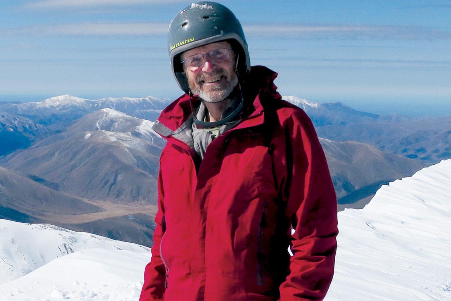
Almost 50 years after it was published, a sketch of peaks visible from the Port Hills in a 1967 Christchurch Press article would send Andy Buchanan on a mission. His new book, Alpine Panorama: A view to a climb, documents his challenge to summit each of the 133 mountains depicted in the sketch. In the book, the former structural engineer and university lecturer embellishes each climb with a wealth of historic and geographic detail, along with imagery ranging from digital mapping and professional photography to his own expressive oil paintings.
Most people change down a gear when they retire. What inspired you to climb Canterbury’s peaks instead?
We were always a walking family, but I didn’t begin serious climbing until my middle age. About the time I retired in 2014, I started looking again at this 1967 panoramic sketch and got the idea that maybe I could climb them all. So over the next five or six years I just went at it, one by one, from Mt Peel in the south to the Kaikōura ranges in the north.
Which peaks were the most satisfying to climb?
I think the furthest ones, at either end of the panorama. Tapuae-o-Uenuku and Alarm in the Inland Kaikōura Range, then Manukau and Te Ao Whēkere in the Seaward Kaikōura Range, because they’re such landmarks from Christchurch.
Fox Peak on the Two Thumb Range and Mt Somers and Mt Taylor were the most rewarding southern peaks. The most difficult were the remote Inland Kaikōura peaks, which aren’t in any of the guidebooks.
Some peaks had to be accessed across private land. Was gaining permission difficult?
In the book I acknowledge over 20 farmers who gave permission. Most landowners were pleased to be asked and couldn’t be helpful enough. Others said to wait till after lambing or winter. But that was part of the game: I didn’t have any particular sequence or deadline. I just wanted to get it done.
In one situation I was under the impression that I’d been given permission. I completed the climb, and the following week the owner rang to confirm when I was coming. He was a bit surprised when I said I’d been and gone – a slight misunderstanding.
What made you decide to turn it all into a book?
The people who came with me, mostly mates, kept telling me that I had to write a book. I know publisher Quentin Wilson personally, and when I proposed the idea to him he immediately agreed. For the digital maps I went to Roger Smith at Geographx, and for professional images I went to photographer John O’Malley. I’m thrilled with the way it came out.
Is there a message you’d like to leave Wilderness readers with?
I’d like to encourage other people to consider doing this, or similar challenges. Although it was daunting when I started, it was doable, one step at a time, one peak at a time. Extremely satisfying, fun and very rewarding – not only to climb them all, but to come home from each climb and look out at the distant peak I had been on a few hours ago.
Now that you’ve fulfilled this mission, what’s next?
I was born in 1948. Some of my friends have suggested my next challenge should be to find all the peaks that are 1948m and climb those. Which I’m not doing!