Mt Alfred/Ari, Glenorchy
NOTE: Access to Mt Alfred has been closed to the public.
On each of the dozens of times I’ve driven around Mt Alfred/Ari – usually seeking a few days in the hills – I’ve thought, ‘I need to come back and make time to walk up that’.
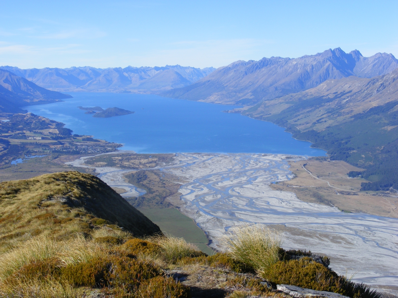
It’s a wedge-shaped monolith, formed when the Dart Glacier split into two streams, and stands more than 1000m above the surrounding valleys. Draw a 20km circle around it and you encompass much of the Humboldt, Ailsa, Forbes and Richardson mountains. It couldn’t possibly fail to be an outstanding viewpoint.
Starting on the western side, a couple of kilometres from the Dart Bridge, the track’s job is to get you up that 1000m to the summit ridge, and it’s got just over 2km to do it, so there’s no mucking around. It’s a steady zig-zag on a benched formation for the first 45-minutes. From there, it’s pretty much a case of following the fall line until the bushline is reached in another 45-minutes. I’d heard tales of steep slopes above the bushline and my eye was quickly drawn to a line of bluffs guarding the ridge. Spying what seemed to be an obvious breach in the defences, I soon found that others had seen the same thing. Although there’s no marked track, there’s a very obvious ground trail and, apart from a couple of bits that required a slither on the way down, nothing was difficult. I gained the ridge in two hours.
The 1375m summit was to the north, but I initially headed south for a couple of minutes for more extensive views over Lake Wakatipu. Then it was 20-minutes of easy travel to the north to gain the actual summit. Nearing the top, I met a bloke with a large pack and his young daughter. They’d bivvied out on the top – quite an adventure for the child, I’m sure.
Mt Alfred/Ari is named for Alfred Duncan, pioneering Queenstown runholder WG Rees’ shepherd, who ran the first sheep at the head of Lake Wakatipu. I’ve tried to find out the history of the Maori name, Ari, but without success. Perhaps that’s not surprising. Sometimes, aspects of an oral tradition just disappear into the swirling mists of time.
A cool wind meant a fleece and a beanie took precedence over the view and the camera, but once rugged up I just drank in the views. They were all that I’d hoped for: a slow 360-degree turn revealed the sites of many great tramping trips, several that I hope will be enjoyable trips one day, and a few places that I’m content to just sit back and look at. A lifetime of great memories surrounded me. Familiar valleys – Greenstone, Scott Creek, Routeburn, Rockburn, Beans Burn, Dart, Earnslaw Burn, Rees, Twenty Five Mile and more – and passes in and out of them were arrayed before me. Dominant amongst them all was the glaciated southern face of Mt Earnslaw/Pikirakatahi.
Eventually, the wind drove me from the heights and it was time to retrace my steps. I had a quick lunch above the bushline, savouring the last views, before returning to the car.
– David Barnes