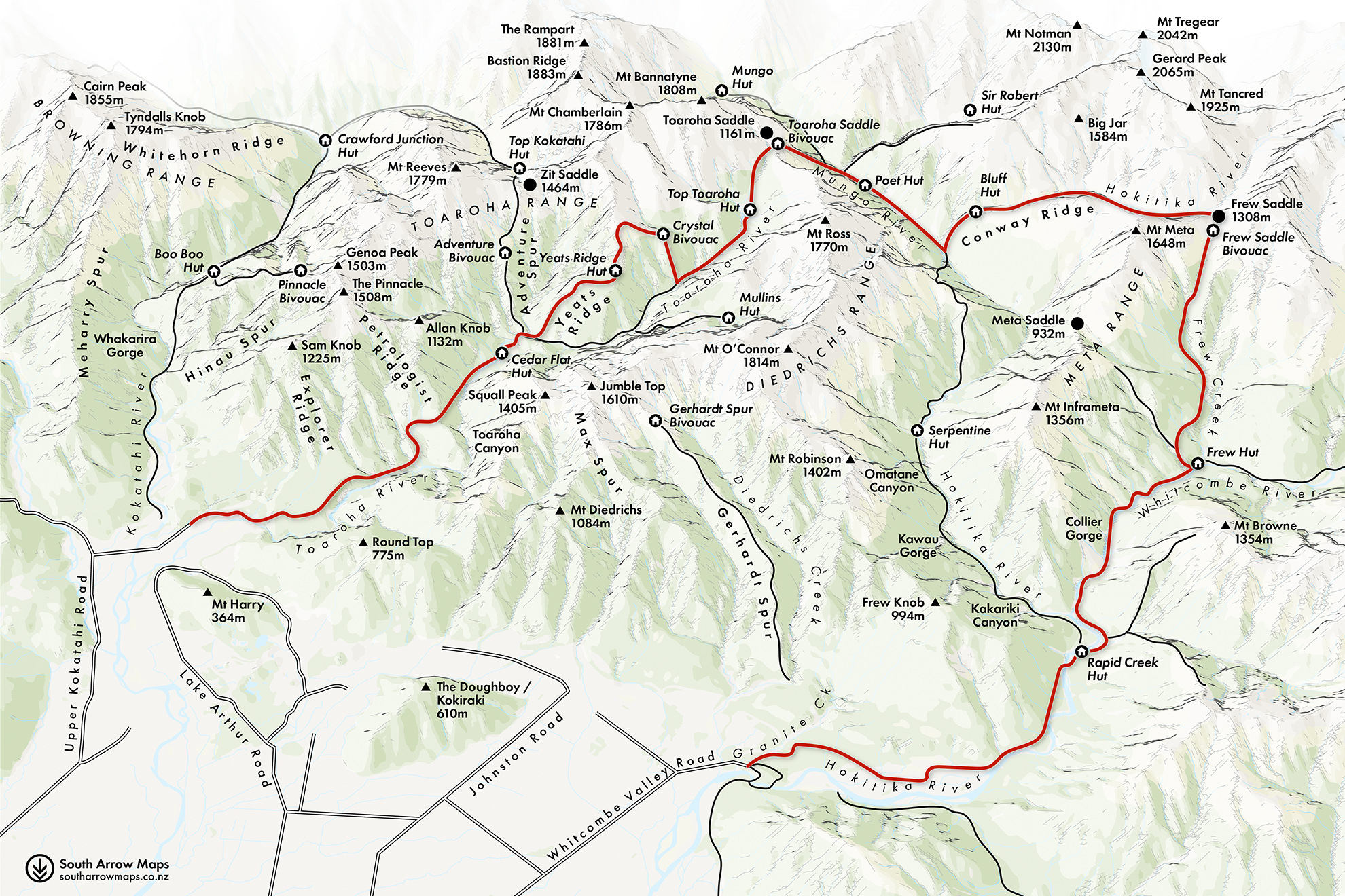
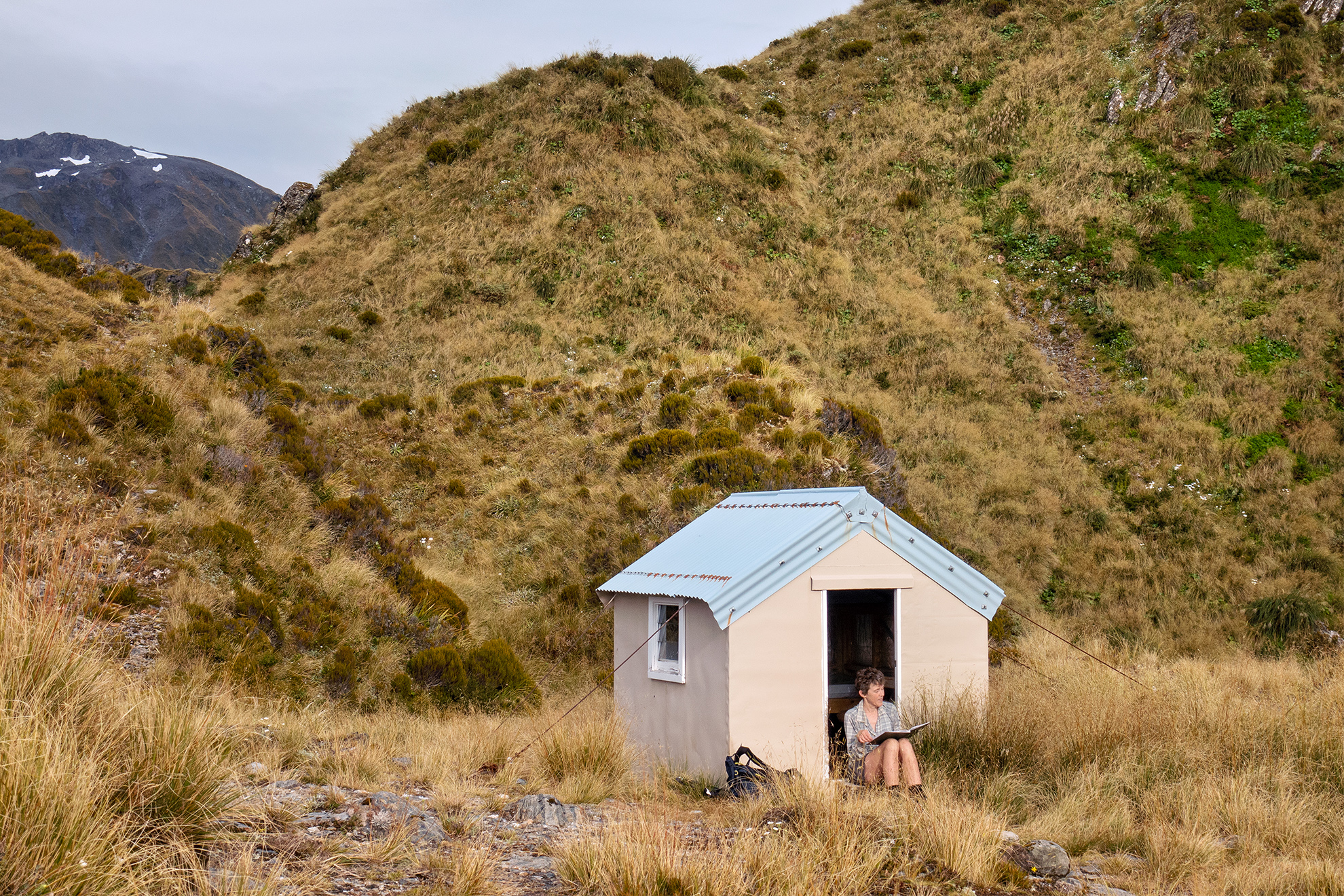
Frew Hut arrived suddenly. Perched on a grassy terrace high above the river, it has a picture window facing the Main Divide.
Inside was a copy of Chris Maclean’s Stag Spooner: Wild man from the bush. Spooner was a deer culler in the Whitcombe during the 1939–40 season; the book reproduces his hilariously self-deprecating cartoon-style diary. He was also an excellent shot. In just one season he felled 525 deer, and on one legendary day he scored 45 with 95 rounds, including three deer with one shot.
The cullers were based at an earlier iteration of Frew Hut at the same spot on Frew Creek. They also recut the old gold-mining tracks in the area and it’s the cullers we have to thank for the present-day route.
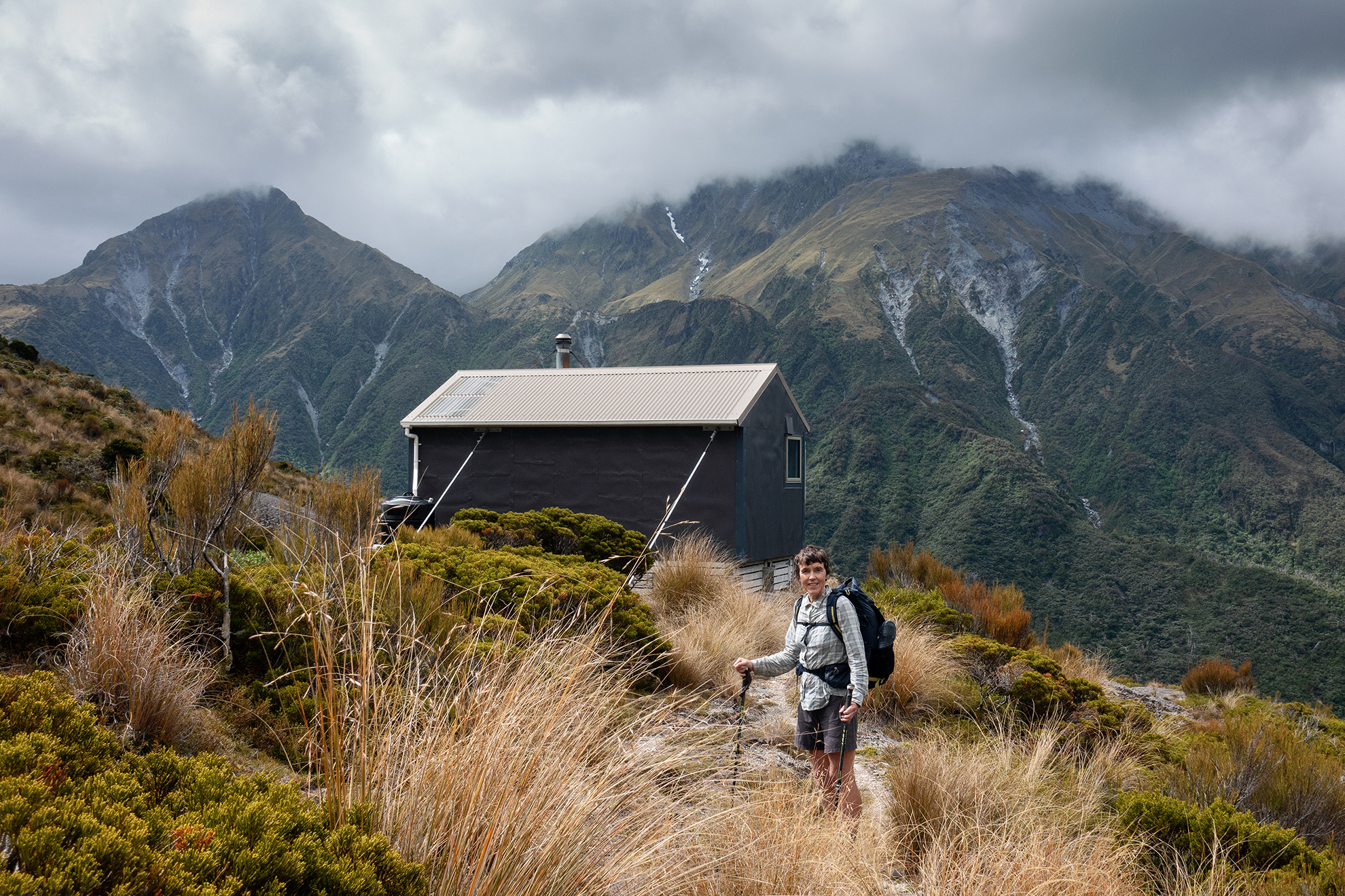
Next morning we faced the thousand-metre climb to Frew Saddle Bivouac. The early part is tracked and bridged, but above the bushline we were in the creek, scrambling over slippery boulders.
Frew Saddle Bivvy is a few minutes below the saddle in an expansive tussock basin. It’s a cosy two-person affair, built in 1957 and a template for many more cullers’ bivs.
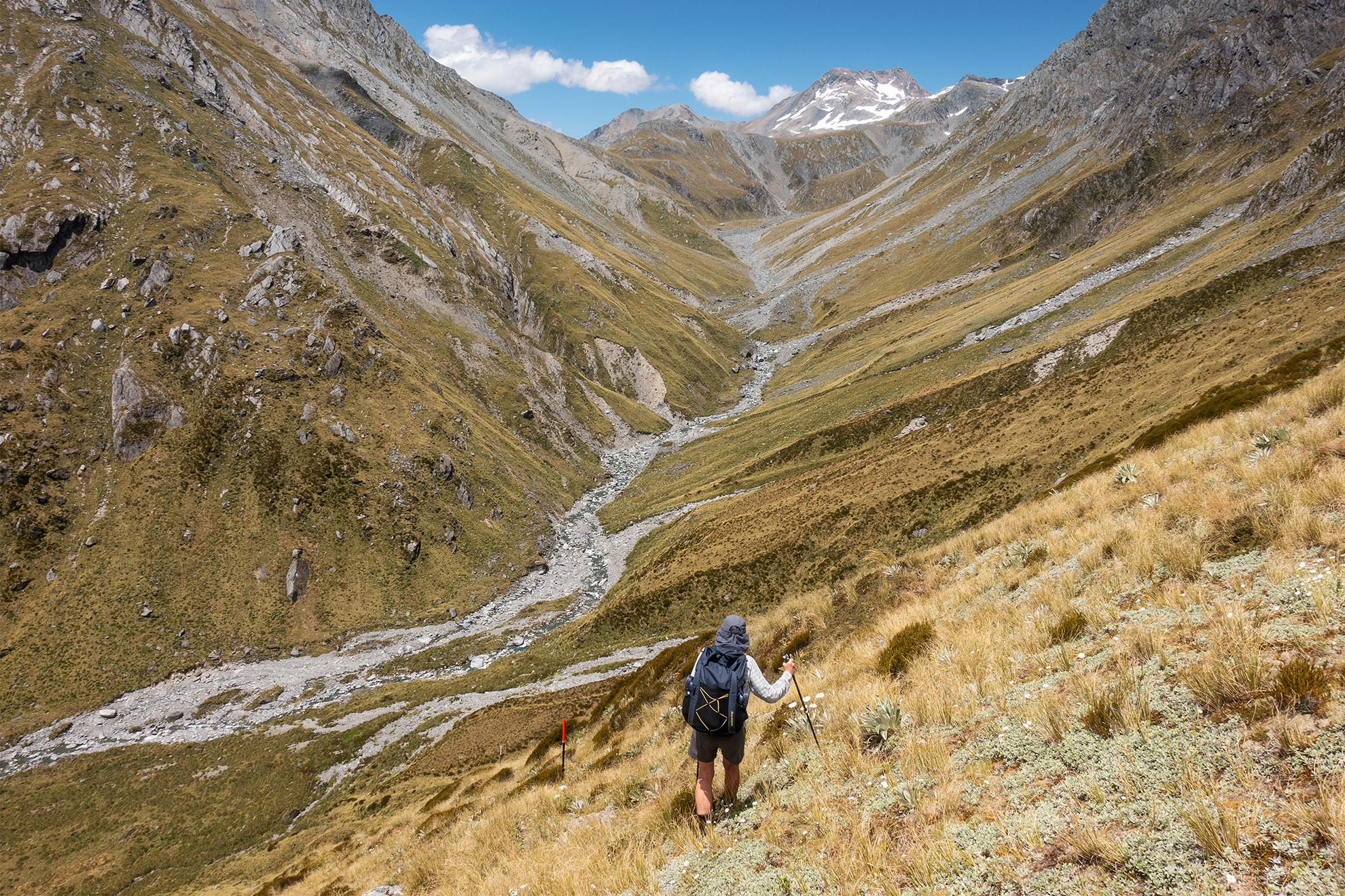
From the saddle we followed a line of snow poles, descending steeply to river flats and the upper Hokitika River. It took some substantial map gazing to work out how these rivers fitted together. A vague trail led down the broad, glaciated valley. After a few kilometres the river became steeper and we sidled above as it cut into the landscape through a series of cataracts.
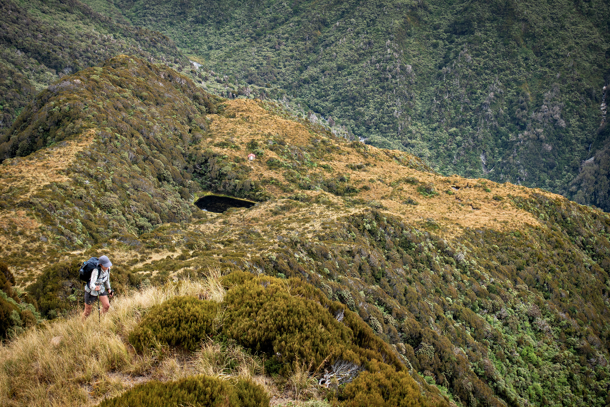
As we approached Bluff Hut, which sits atop a house-sized boulder, the weather deteriorated. From the hut are views into the Mungo Valley, the Hokitika Chasm and the Main Divide mountains. Bluff was originally a culler’s hut further down the hill. It was relocated to its present site in 2009 and rebuilt in the process. But it maintains the character of a classic NZFS six-bunker. The hut book reads like a who’s-who of trans-alpine rockstars – Jan Heine, Geoff Spearpoint, Penny Webster, Rob Brown, Jane Morris, Johnny Mulheron … We were treading in the steps of giants.
After unpacking we found that Paul had left his headlamp and Snow Peak mug in Frew Saddle Biv. That mug had delivered hundreds of comforting teas and soups over the years, and he was inconsolable.
Next day was misty and drizzly. I was happy to have a pit morning and encouraged Paul to retrace his steps to collect his belongings.
I drowsed the morning away until Paul arrived back, soaked and cold. He’d been gone four hours but was happy to have found his mug.
From Bluff Hut the track descends 550m, almost vertically, through fissured, bush-cloaked bluffs. The Hokitika River drops to the Mungo confluence parallel to the track, in a series of impressive cataracts.
There’s a swingbridge over the Hokitika near its junction with the Mungo. In 1994 this bridge was destroyed by a slip, and the river remained uncrossable for 15 years until DOC replaced the bridge in 2009.
The route from the swingbridge to Poet Hut follows the true right of the Mungo, climbing high above a massive slip. Pink ribbons tempted us to cross the slip to avoid the upward slog, but we dutifully followed the orange triangles up and up and more up.
“Paul,” I whined, “look at the GPS, we must be on the wrong track.” A cursory glance prompted the exclamation, “Oh shoot, we’re climbing the wrong mountain!” Down, down, down we went, back to the pink ribbons, until we reached the track. Easy! Feeling smug, we rounded a corner – only to be confronted by the mother of all slips. We took a less hasty look at the map, this time with glasses on. “Oh! We did have to climb up there after all.”
So, upwards again, around the top of the slip, before dropping into the Mungo River. Our reward was more fun rock hopping among giant schist boulders.
Four-bunk Poet Hut has had a DOC makeover and the groovy paint scheme extends to the woodshed and toilet. Needless to say, the hut book is full of poetry.
It also tells the tale of a Canadian backpacker desperate to get his Snow Peak double-walled titanium mug back. He’d lost it on a side trip to Sir Robert Hut and offered a reward for its return – yes really! Email and postal addresses provided. “See, I’m not the only one,” crooned Paul, smugly cradling his mug of soup. I imagined those original cullers sipping heavily sugared tea from equally precious battered tin mugs.
Next morning we tackled the unrelenting 600m climb to Toaroha Saddle Bivouac. I was glad to be facing this brutal ascent early, but this wasn’t to be the only big climb of the day.
The descent into the Toaroha came with waist-high tussock that obscured potholes and spiky spaniards. Eventually things levelled out and some marshy wandering brought us to Top Toaroha Hut. It was still only mid-morning and the tops beckoned. We could head straight downriver to the Cedar Flats hot springs, or we could bag another couple of huts high above on the Toaroha Range.
Hut lust won. After a little more river travel we climbed 500m to Crystal Biv. It was another bluebird day and tiny frogs peeked from grasses along the tops between Crystal Biv and Yeats Ridge Hut. Australian frogs, but delightful anyway.
The long, gradual Yeats Ridge dropped into the Toaroha River just short of Cedar Flats Hut, and we found we had hut companions who’d made the short journey from the road end to enjoy the hot pools. That night the heavens opened, and next day we trudged the last few hours in the wet, immensely satisfied at having explored what just might be the best tramping country in New Zealand. The terrain was challenging but doable, with a great infrastructure of huts, tracks, bridges and historic routes. And it’s an intrinsically New Zealand experience that links you to the adventurers of the past – Māori greenstone hunters, European explorers, gold miners, deer cullers and our tramping forebears. The best of it, though, is the spectacular and powerful rivers, the golden, tussocky tops, the dense lushness of West Coast rainforest and the not too distant snowy peaks.