
By Ali Middleton
Victoria Domain is a prominent recreation reserve in Waitohi/Picton. Within its 200ha are over 30km of walking and mountain biking tracks providing spectacular views over Picton, Waikawa and across Queen Charlotte Sound.
The area is rich in history, with Māori names given to some parts of the Domain including Te Pahoehoe (‘the Snout’) which is the headland at the northern end of the Domain, and the furthest point of the Snout Track.
This track starts at The Snout car park, one of two parking areas along the road on the ridgeline. It’s initially on gravel along the open ridge before entering the regenerating native forest. A number of tracks branch off from here (including the purpose-built Lions Centennial MTB Trail which also heads to the Snout), but the walking-only Snout Track (and Queen Charlotte View lookout) is clearly marked.
The track is well maintained and ascends gradually along the western side of the ridge through five finger, akeake, mānuka and kānuka with ever-changing views of the bays of the inner sound. Melodious calls of korimako and tūī punctuate the occasional low throb of the Interisland ferry and buzz of boats from the water below. Pīwakawaka and weka are also commonplace.
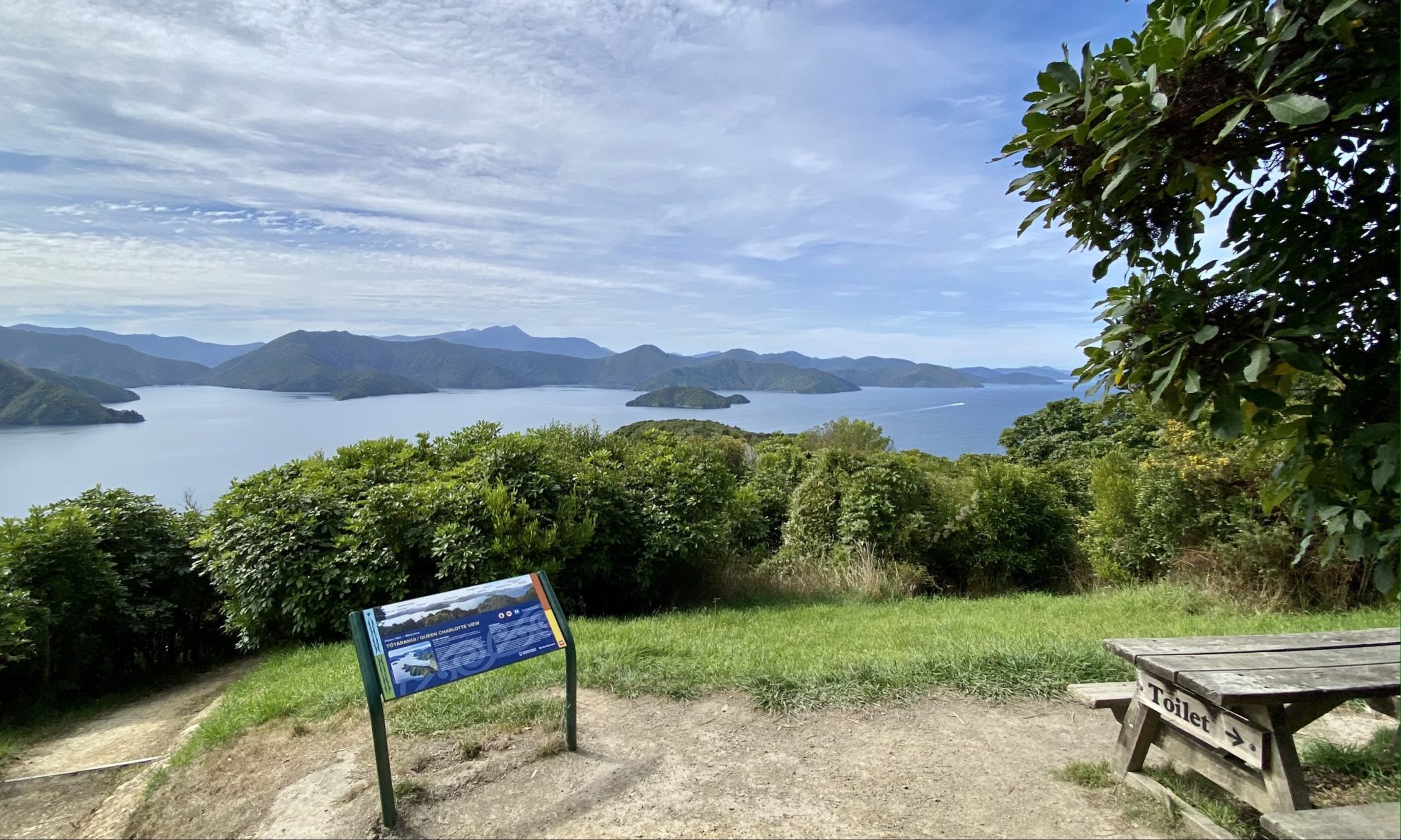
After 2.5km, the track reaches the Queen Charlotte View lookout, which is at its highest point (170m). The Lions Centennial MTB Track also connects to the lookout from the other side of the ridge. For those short on time, this would mark a satisfactory turnaround point as the views are easily on par with those at the Snout.
The track continues for a further 1.5km from here, descending the whole way and with frequent slippery-when-wet switchbacks to eventually arrive at the open grassy slopes of The Snout, 10m above sea level. Fair warning is given prior to the intersection with the Lions Centennial MTB trail along the way, and the shared Kanaku MTB Trail merges 400m before the Snout, so watch for bikers on this final stretch of shared track.
On any given day, the views up the sound can be of boat wake and white caps, or it can resemble a vast millpond. There’s a memorial plaque at the bush edge for a Japanese diver who drowned off nearby Karaka Point.
While most walkers go out and back on the Snout Track, it is possible to make an almost-round trip returning via the shared Kanaku MTB Trail. This trail hovers around the 60m contour along the western side of the domain, avoiding the ascent back to the Queen Charlotte View lookout. It eventually joins The Snout Track back at the ridge road.
34 years of inspiring New Zealanders to explore the outdoors. Don’t miss out — subscribe today.

Questions? Contact us


