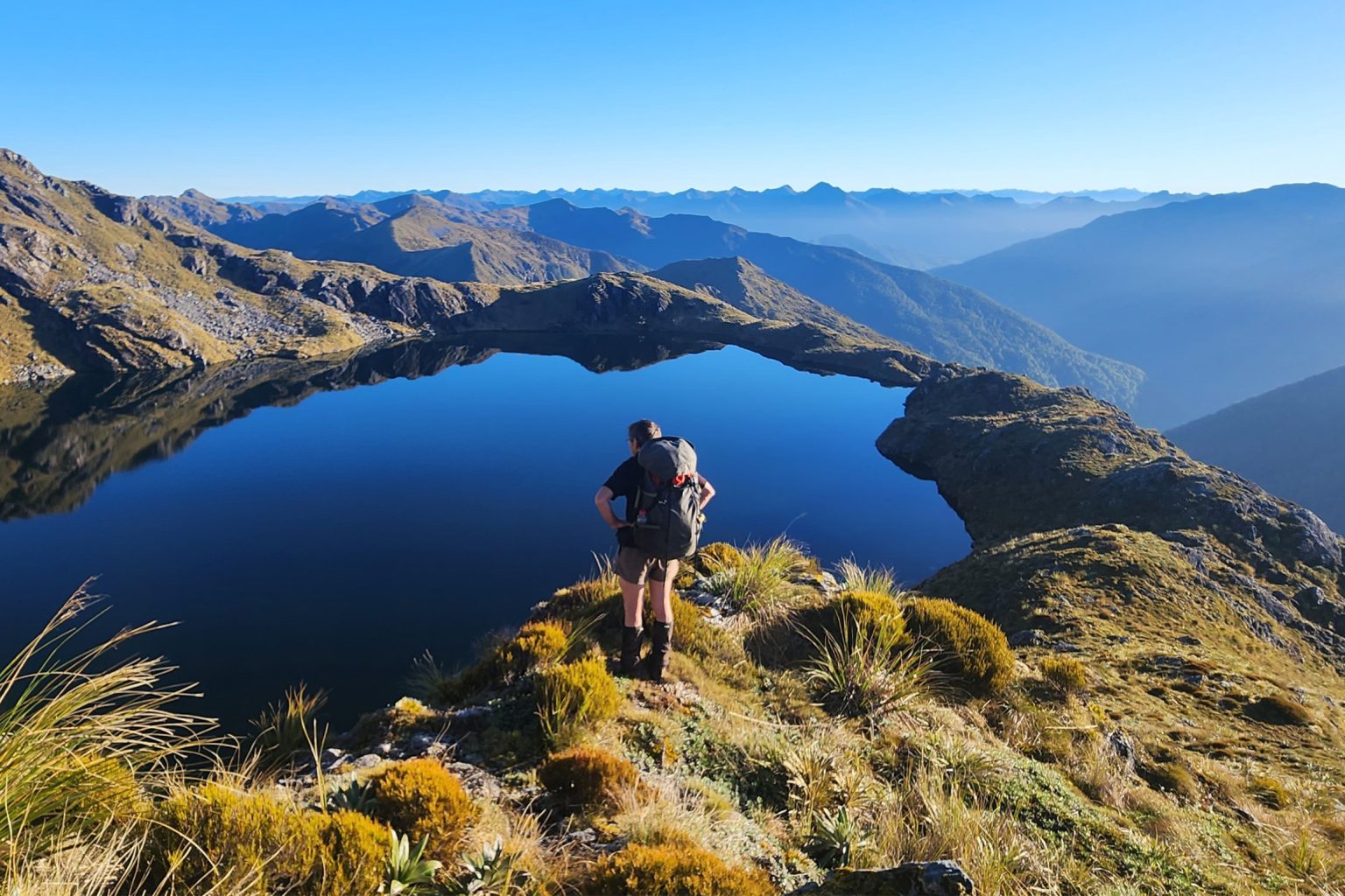
A reopened forest service route gives relatively easy access to luxurious alpine herb fields and two idyllic tarns.
This trip starts at Safety Creek at a parking area next to the bridge. Fill water bottles here as there’s no water for the next 4–6 hours until the first tarn.
The track is on the true right of the creek although this isn’t immediately obvious from the road. The track becomes clearer after a cutting and entrance to the forest, where there’s a sign saying ‘Elliot Tops Track’. The first 30min include short climbs onto fairly easy-going bush-clad stepped terraces.
It’s well-defined here and steepens to a good steady climb above the 500m contour winding around a few minor obstacles. At 950m, and around 3hr from the carpark, the track veers left and the forest changes to gnarled and mossy beech trees until the scrub line at 1000m. Follow a roughly cut track through rocky knolls covered with alpine scrub to 1100m, where there’s low scrub and tussock.
From here game trails run on the broad ridge to Pt1309, or you can sidle to the saddle between Pts1309 and 1419. A short, sharp climb is required before the tops open up again. Follow well-trodden game trails along the ridge, or keep low and sidle across alpine herb fields with luxuriant carpet grass underfoot. The first tarn is found by dropping east down a broad spur at the low saddle before Pt1425. The tarn, referred to as Lake Aynsley, is deep and clear and perched below high, blocky cliffs. There are several campsites around its lip and a few flat and sheltered, albeit damp, campsites high above. It takes around 2–3hr to reach the tarn from the scrubline at 1000m.
From Lake Aynsley it’s another easy sidle to rejoin the ridgeline at the saddle between Pts1425 and 1453. Climb or sidle around the northeast side of Pt1453. From here choices depend on your appetite for adventure.
Stay high and skirt between bluffs overlooking the chartreuse-coloured tarn. It can look intimidating but is fine provided care is taken around the bluff edges. Or, take the broad south-facing spur below Pt1453, winding between rocky bluffs and spaniards down to the outlet of the tarn, sited in a basin below an impressive cirque – rather like a miniature Earnslaw Burn.
If dropping to the basin, to regain the ridgeline there is a lightly flagged route up an obvious vegetated gully east of the tarn. The ridgeline from here to Pt1380 is easy and there are expansive views of the Southern Alps, lakes Ahaura, Hochstetter and Haupiri, and Gloriavale Christian Community to the southeast. Allow 3hr from Lake Aynsley to Pt1380.
Find your way down the northwest spur through rock and spaniards to pick up the odd cut and flagged section through scrub. After around an hour there’s an obvious entrance back into the forest at 1100m. Completing the loop takes a further 2.5hr, dropping through the beech forest following tape and markers to where the gradient eases at 300m with the vegetation changing to damp lowland forest and pungas. Here the trail veers right to avoid private land. This newly-created 1.4km route from the main track back to Safety Camp Creek is meandering and a bit rough.


