
The Tuahu Track is named after its location on the old Māori route across the Kaimai Range, which was also used as a bridle path in the 1890s. It runs east to west and provides access to Te Rereatukahia Hut from either side of the range. The route from the east is longer but provides the opportunity to see giant kauri.
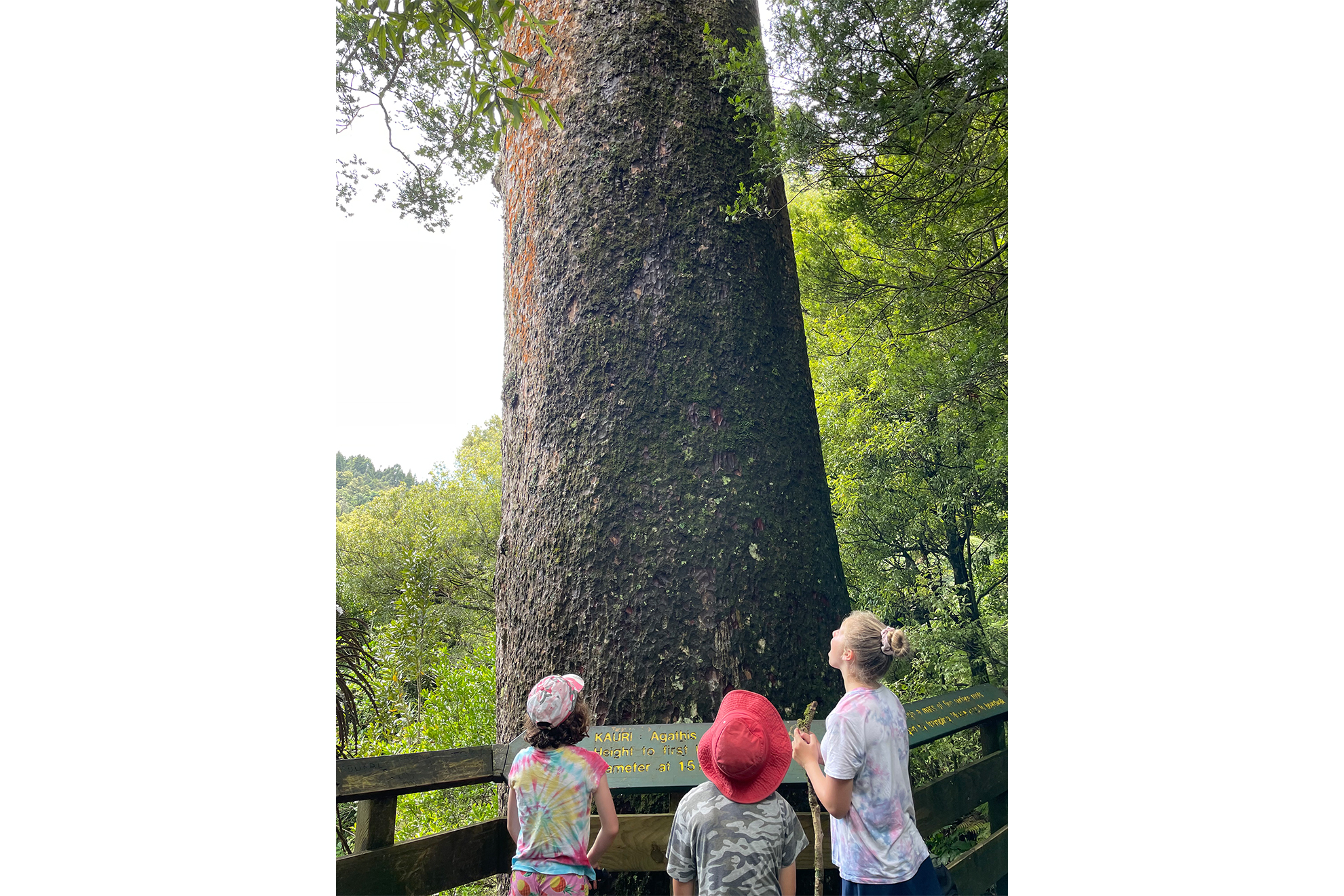
The eastern trailhead starts out wide and flat and is suitable for all abilities. Near the start is a kauri grove, and approximately 700m along is a short side track to Tuahu kauri tree. Climb the stairs to admire this tree. It’s one of the few large remaining kauri in the Bay of Plenty and is thought to be over 600 years old.
The diversion to this tree is also near a junction with the Sentinel Rock Track.
Stay on Tuahu Track for 600m as it follows Rereatukahia Stream. The track now becomes narrower and more difficult. A wet-foot crossing of the stream leads to the true left side. It’s a great spot for a rest.
The track then swings east and climbs 60m to wend around a spur coming off Kakarahi (641m). Along the way there are several small waterfalls, stream crossings and beautiful views to the Bay of Plenty, including to Mt Maunganui and Mayor Island. After 300m the trail once again turns west and climbs steadily (200m over 1.5km) above the stream into its headwaters to eventually gain the Kaimai Range ridgeline and the North South Track.
Tuahu Track continues westward to the trailhead on Wairakau Road. If heading to Te Rereatukahia Hut, turn north onto the North South Track and follow this for 3.2km. It’s an undulating trail with some short, steep climbs. There are good views of the Waikato, including glimpses of Te Aroha, as well as to the Bay of Plenty. There is a distinct change in the vegetation as the track follows the ridgeline through low forest and meadows.
Then, just before reaching the hut, the track crosses the regrowth of a large slip.
34 years of inspiring New Zealanders to explore the outdoors. Don’t miss out — subscribe today.

Questions? Contact us


