Encounter ever-changing landscapes in karst country.
After beginning at Flora car park, at the end of a steep, unsealed road, the first 700m follows a wide 4WD track up to Flora Saddle. Shortly before the saddle, turn left onto the track to Mt Arthur Hut.
It’s about an hour’s easy walk through beech forest to Mt Arthur Hut, which holds the last water supply before Salisbury Lodge.
Shortly after the hut, turn left at a junction to take the Mt Arthur Route and follow blue poles. Dark grey marble slabs protrude from the grass as the route goes over a small peak and up the spur belonging to Pt1565. It’s barely pyramid-shaped from this angle, but Gordons is identifiable by a distinct ridge, visible to the right of Arthur’s summit.
After 2km a second junction divides those climbing Mt Arthur from those heading over Gordons Pyramid towards Tablelands. The right turn, marked by orange poles, is the Gordons Pyramid Route and it descends steeply into Horseshoe Basin. Beware of sinkholes in this ice-gouged karst.
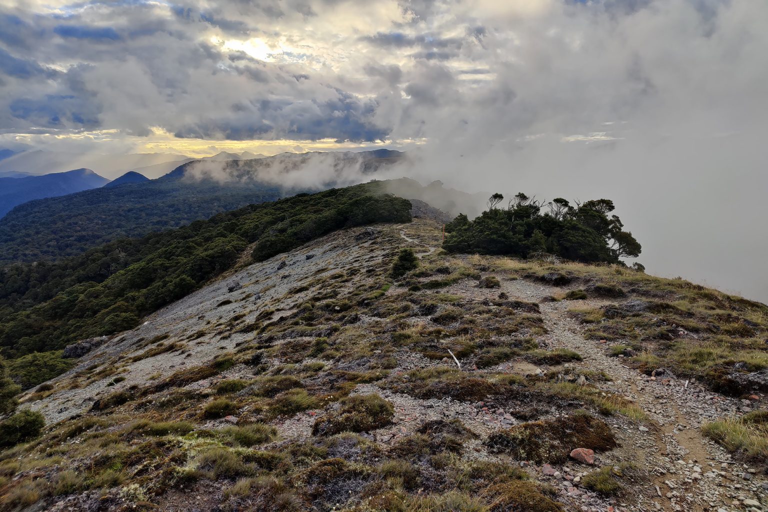
The route climbs out of the basin, on a more gentle gradient, and follows a spur that narrows and turns into a near-vertical descent after Pt1380, the steepest of the trip. There can be slippery rocks and mud here when it’s wet.
Soon after, the route ascends the spur to the summit of Gordons Pyramid (1489m). There are excellent views of Kahurangi and west to Tablelands from here. A signpost to Salisbury Lodge points straight on, but the route is actually a slight right to the northwest, though this should not be mistaken for the hard turn to the right. Checking a compass or GPS should remove any doubt.
A 1km descent over loose rocks leads to a slim section of woodland before a sloping ridge. After some steep downward scrambles through mossy forest with slippery tree roots and mud, the track levels out to wind around rocky groves. Purple pouch fungus can be seen here in season.
A junction offers a detour to Sphinx Valley Cave via Potholes Track, but it’s quicker to exit the forest to the open plateau by taking the right fork; 400m on, the route meets Salisbury Track.
Turn left, and tidy 22-bunk Salisbury Hut is 500m away.
Return the way you came, or make the trip into a loop via the Salisbury Track.