Beaches, birdlife and bountiful forest, the Rakiura Track is the best way to experience Stewart Island.
Rakiura is known as the anchor stone of Maui’s canoe, used to secure his waka when he and his brothers fished up Te Ika a Maui, the North Island. So appropriately enough, a large chain sculpture at Lee Bay marks the start of the Rakiura Track; one that mirrors a similar sculpture across Foveaux Strait at Bluff.
The track sidles above Lee Bay, giving teasing glimpses of the sea through manuka stands before reaching an estuarine inlet at Little River.
There’s more sidling through forest on the benched track leads past Peters Point and into Wooding Bay and Maori Beach, where trampers are usually pleased to finally walk along a sandy beach. As well as a campsite and shelter, there’s a well-preserved engine and boiler to mark the days when a sawmill operated here.
From Maori Beach, the track crosses an estuary over a large footbridge before a climb past a headland to a track junction. From here, the track head north to Port William Hut, set in a sheltered bay distinguished by large gum trees. These are the sole relics left by 24 settlers from the Shetland Islands who endured a miserable existence trying to establish homes and industry here during 1871. Most lasted less than a year. That the Shetlands proved a more cheerful place says a lot about the damp, mud and oppressive forest they faced at Port William.
Back at the track junction, the second day of the track begins its long push through forest, which connects the northern coastline with the shores of Paterson Inlet. Most of the forest is not majestic, perhaps because a lot of it was milled early in the 20thCentury, and combined with a lack of views, the walk is rather tedious. However, the restored log hauler at a former milling site provides a point of historical interest.
It’s with some relief that you finally reach the coastline of North Arm. The hut has a deck and windows positioned to overlook this large bay of Paterson Inlet and makes a pleasant place to linger. At low tide, it’s worth exploring the shoreline, fringed by wind-twisted trees beside Stewart Island’s largest harbour.
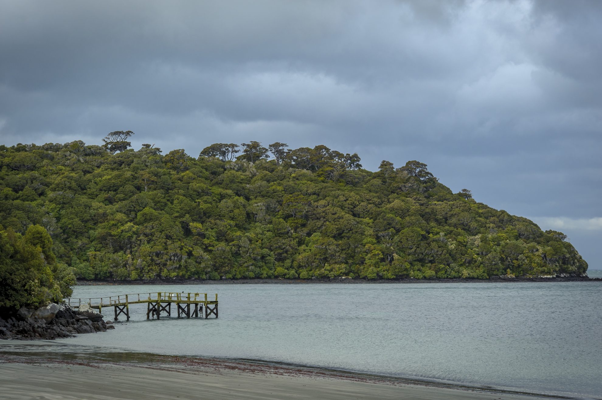
The last day traverses the northern edge of Paterson Inlet, at least where it’s possible for such a convoluted shoreline. After wending through forest, the track emerges at Sawdust Bay. So much saw-milling activity occurred here that once the sheer volume of sawdust killed all the marine life in the bay. Nowadays, clean waves wash around granite boulders projecting from the seafloor.
A brief climb over a low, forested ridge leads to the site of another sawmill, and the remains of an earth dam once used to operate a water wheel. Milling ceased in 1929, but not before several boats were built here. Since then, fern and forest have reclaimed the area.
Near Kaipipi Bay, a footbridge crosses a tidal arm of the inlet, before the track reaches the shore again. Here a viewpoint offers vistas over this lovely inlet, and the curiously named Burial Island. Beyond, the Rakiura Track heads inland, now following part of a historic road. It ends at Fern Gully and Main Road. The Ryans Creek Track follows the shoreline of Paterson Inlet past Cow and Calf Points, with views of the Faith, Hope and Charity islands, and offers an alternative route to Halfmoon Bay.


34 years of inspiring New Zealanders to explore the outdoors. Don’t miss out — subscribe today.

Questions? Contact us


