There is still scope to travel off track and experience Ngauruhoe without following in the footsteps of an ant-like trail of other walkers.
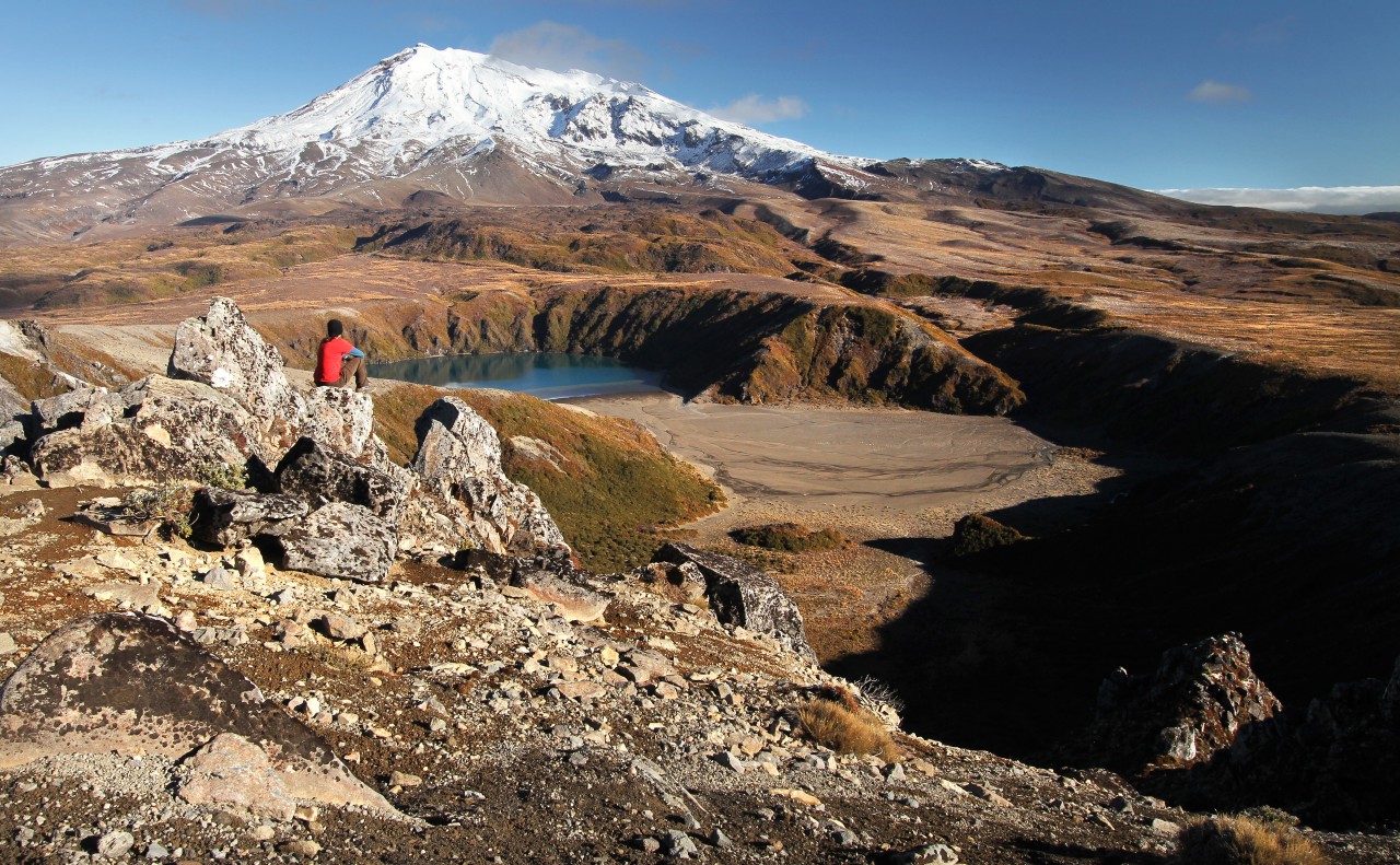
Set out from Whakapapa Village along the track towards Tama Lakes. This forms part of the Northern Circuit Great Walk and is of a high standard. The Tama Lakes are two in-filled explosion craters named after Tamatea, the high chief of the Takatimu canoe, who explored the region some 600 years ago.
The lower lake, at 1200m, is just 10 minutes from the Round the Mountain Track. Climb on up the steep ridge to where the track ends above the glorious upper Tama Lake (1314m). Then, it’s further upwards along the defined ridge west and north of the lake to the shoulder below point 1650, before a sidle eastwards to the lake shore.
A short climb brings you to a valley funnelled between the steep volcanic walls of points 1584 and 1562 and with the perfect cone of Mt Ngauruhoe towering almost 1000m above. Traverse eastwards, over rugged open slopes, making your way over rocky basalt ridges and multiple (often) dried up water courses.
A steady climb up the south-eastern flanks of Ngauruhoe (avoiding the bluffed headwaters of the valley) brings you to a shoulder and an easy scramble down to South Crater on the Tongariro Alpine Crossing. Climb the ridge towards Red Crater, before turning off towards the summit of Mt Tongariro. From the summit, leave the marked track, descending south-west across the headwaters of the Whanganui River to pick up a strong ridge – known as Hardmans Ridge – offering easy travel to Pt1409.
Follow the ridge for about 1km before dropping off it to cross the Mangatepopo Stream about 10 minutes before Mangatepopo Hut. After the hut, set off back to Whakapapa along the pleasant undulating Mangatepopo Track with standout views of Mt Ngauruhoe and Ruapehu.


34 years of inspiring New Zealanders to explore the outdoors. Don’t miss out — subscribe today.

Questions? Contact us


