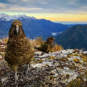
The Rimutaka Range is the most accessible high country on offer to Wellingtonians and, while it might not be the loftiest, the range has a rugged Tararua-like aspect to it. With Mt Matthews, 941m, the highest point, even on its summit you don’t breach the tree line.
The summit of Mt Matthews can be done as a day trip, but there are six DOC huts along the route, which must be booked in advance. There are also a host of other privately owned huts along the Orongorongo River.
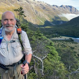
A reasonable level of fitness and good weather are required to climb Mt Matthews. From the Catchpole Valley Reserve car park, take the Orongorongo Track for about 4km until it joins the Orongorongo River at the Turere Bridge, and then either continue along the trail for a further 3km through bush on the true right of the river, or just walk straight up the river bed – an easier and quicker option if water levels are down and you don’t mind wet feet.Access to the summit route is via the true left of Matthews stream.
When you leave the stream and head into the bush, find the big DOC orange triangle, which isn’t immediately apparent. The first half of the climb is through native forest, on an obvious but steep trail to 550m, where it branches right to South Saddle. To reach the summit stay left and keep climbing.
Above South Saddle, the trail cuts through areas of grass before heading back into a forest trail. At about 900m you reach a small clearing created by a slip, providing another view northwards and another point where you need to keep an eye on the trail. From the top of the slip face it’s only a short slog to the summit. The route here isn’t immediately obvious due to the tree cover, so look for the clearing through branches to the Wairarapa coast.
This route is a nice place to easily escape the hustle of the city, grabbing a lovely native bush fix, while keeping the body match fit for loftier objectives further afield from Wellington.


34 years of inspiring New Zealanders to explore the outdoors. Don’t miss out — subscribe today.

Questions? Contact us