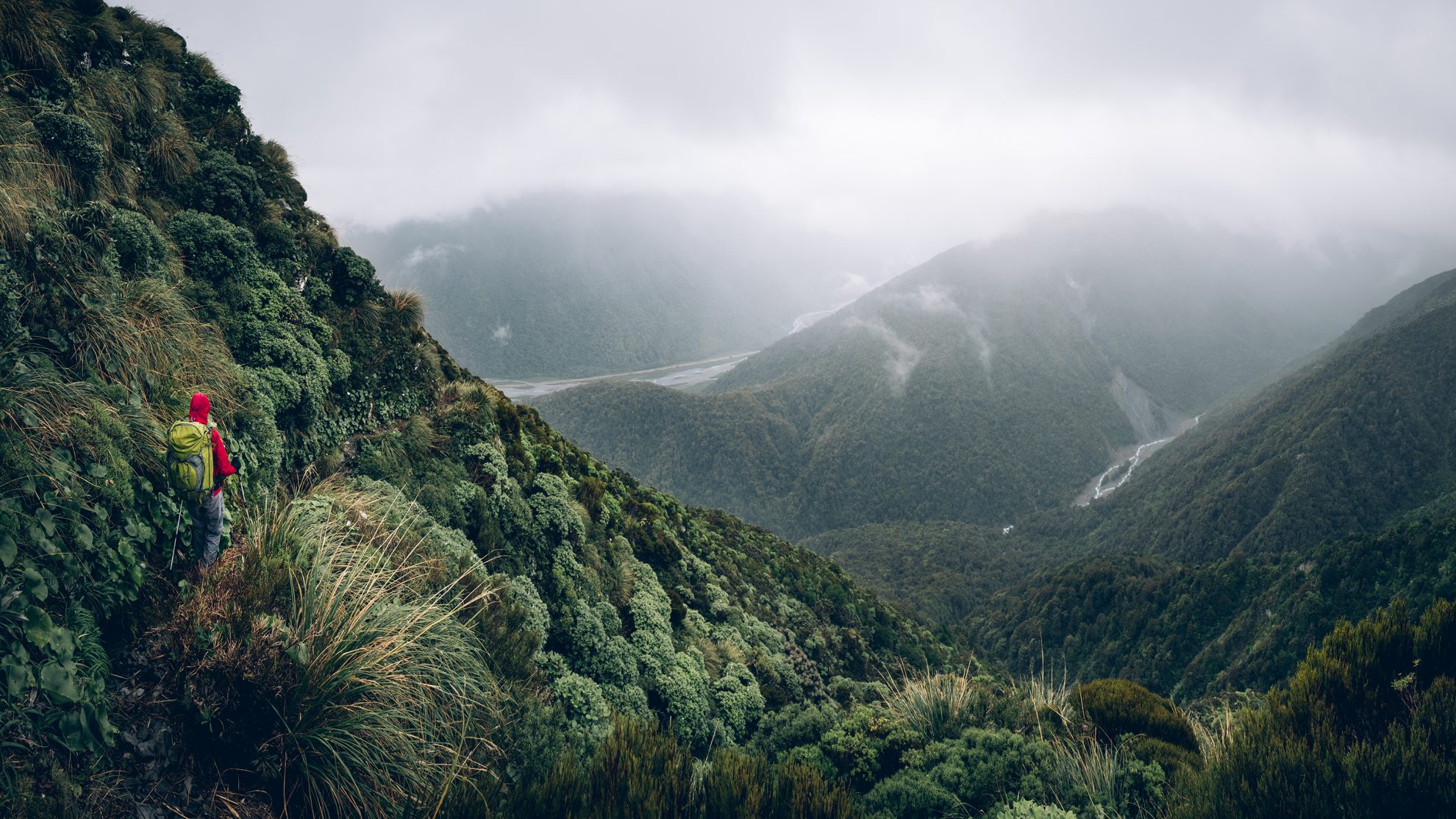
The wide, rolling tops of the Kelly Range is sprinkled with tarns. Photo: Dennis Radermacher

Kelly Range tarns, Arthur’s Pass National Park

December 2017

Read more from

December 2017

break in the storm

Summer had not been good to us and we were itching to get out again. With one stormy weekend after the next, we had planned, attempted and abandoned numerous trips due to adverse conditions. Rain without gale seemed to be a rare occasion on the Divide.

So when a wet, yet windless forecast finally overlapped with a weekend, we grasped the opportunity.

The Kelly Range near Otira was the ideal destination. Our research showed an easy tramp through native bush. The wide, rolling ridgeline that followed was supposed to be sprinkled with small tarns. We had visited the area a few winters back, when a cold change forced us to abandon our plans to camp and we opted for the warmth of Carroll Hut instead. If the weather decided to play tricks on us, we would once again fall back to the conveniently located hut near Kelly Saddle.

We set off in sunshine and followed a slippery but well-defined path through lush bush for the first two hours. Eventually the dense canopy parts, allowing glorious views across the deep green forest of the West Coast. We could see all the way along Otira Valley to the sharp incline of Arthur’s Pass.

This time, at Carroll Hut, we had a quick peek inside, replenished our water and then moved on in search of tarns to camp beside.


December 2017

Read more from

December 2017

A rainy day on the West Coast adds drama – and slippery tracks. Photo: Dennis Radermacher

A rolling mass of cloud spread along the edge of the Bald Range to the north, but even with our line of sight drastically reduced, the gently rising and falling terrain guided us to our destination.

What we missed in views, we gained in mood. The tarns shrouded themselves in a mysterious gloom.

We found two flat spots by one of the bigger tarns and made ourselves at home. A small knoll, only a few dozen metres in height, took the brunt of wind and clouds, but soon enough, moisture was creeping into every nook and cranny. With little visibility, and even less to do, we retreated to the warmth of our sleeping bags.

A humid night was followed by a soggy breakfast, and a wet departure wrapped in waterproof layers.

With seriously reduced visibility, we decided to pick the marked route for our walk back. Slipping on wet grass at first, and wet roots later, we were grateful for our tramping poles. They spared us a great many slides down the hill on our backsides.

At the end of an uneventful return trip we were wet but happy that the spell was broken: we had finally finished a trip.

Distance
3.45km
Total Ascent
869m
Grade
Easy / Moderate
Time
4-5hr toters
Accom.
Carroll Hut
Access
Park at the concealed car park off SH1, where Kellys Creek meets Otira River
Map
BV20

GPX File

Kelly Range tarns (gpx, 40 KB)

GPX File

Your device does not support GPX files. Please try a different device.
Dennis Radermacher

About the author

Dennis Radermacher

Dennis is an architectural photographer with a long-standing connection to the outdoors. He has been contributing to Wilderness Magazine for more than ten years, combining his interest in tramping with photography. In his spare time, he makes furniture, experiments with 3D printing, and enjoys exploring new places.

More From December 2017

More From December 2017

Related Topics

Similar Articles

Great hikes

A lesson in securing huts before departure

Your trips, your pix, June 2026

Mt Wakefield, Aoraki Mt Cook National Park

Edwards Hut, Arthur’s Pass National Park

Lagoon Saddle huts, Craigieburn Forest Park

Join Wilderness. You'll see more, do more and live more.

Already a subscriber?  to keep reading. Or…

34 years of inspiring New Zealanders to explore the outdoors. Don’t miss out — subscribe today.

Your subscriber-only benefits:

All this for as little as $6.75/month.

1

free articles left this month.

Already a subscriber? Login Now