A steep track to the site of an historic gold mine and stunning views of the Rees Valley.
By Enrique de Azkoitia
The track was built in the early 1800s after W. Rainey and W. T. Campbell, two shepherds who were mustering in the area, found a quartz reef suggesting the presence of gold. By September 1880, James Evan and Thomas Hope had created The Invincible Quartz Mining Company that ended up producing 7500 to 9000 ounces of gold during its operation until its liquidation in 1890.
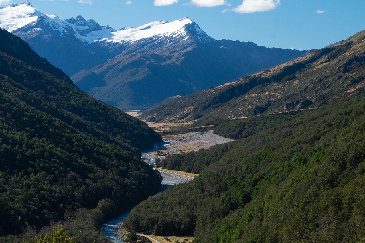
The track was re-cut in 1973, but follows its original 1800s route. The trail starts with a steep, although easy, climb straight after the gate and follows a wide and well-marked path through dense beech forest with occasional clearings towards the west where Mt Earnslaw, the Rees River and Mt Alfred can be seen.
After 20 minutes, the remains of a collapsed log hut are passed and the first switchback begins. Here, the forest canopy opens up enough for views towards the north, up the Rees Valley with the Forbes Mountains as a backdrop.
The track narrows but becomes more pleasant to walk as it continues ascending through mānuka. Despite the track’s steep nature here, it’s easy going and the track is clear of roots and other obstacles.
It becomes less steep just before reaching the historic mine site, where there are several information panels describing the area’s history.
The majority of the mining equipment and machinery has been moved to the Lakes District Museum in Queenstown. However, the set of seven berdans used for gold crushing at the battery house site is especially significant as it’s the largest array left in New Zealand. There’s also evidence of the 7m overshot water wheel and stamper battery.
Opposite to the battery site, a path leads to the Invincible Mine upper workings where remains of the underground works, now all collapsed, can be seen from afar.
For more gold mining ruins, less than 1km from the car park, up Rees Valley Road, is the Otago Pyrites Saving Company’s circular convex table which is signposted as the Invincible Concentrator: an impressive 26-foot concrete and cast iron round table.


34 years of inspiring New Zealanders to explore the outdoors. Don’t miss out — subscribe today.

Questions? Contact us