
There are various routes to Crosbies Hut. The Te Puru Track (from the Tapu-Coroglen Road) is a good option during or after heavy rain; while it can get quite muddy, there are no stream crossings to negotiate.
It’s a relatively short trip of about four hours to the hut, although fit parties should manage it in less time. It’s also a good option for family groups with kids.
Starting at 448m, the first section of the Te Puru Track promises the least uphill, making it a worthwhile contender for an overnight mission. Parking is limited, so it’s advised to arrive early or arrange to be dropped off.
From the access point at the summit of the Tapu-Coroglen Road, the track follows a rolling ridge through native bush, gradually gaining in elevation. It gets quite rocky and rooty underfoot, with some muddy sections. And, while it’s well maintained, walkers should watch for the orange track markers. The track is overgrown in places, and there are various smaller hunting-tracks branching off into the bush.
The track continues along the undulating ridgeline, offering occasional glimpses of the bush-clad hills of Coromandel Forest Park.
After two to three hours there’s a junction that links Te Puru with the Crosbies Main Range Tramping Track. At 690m, this is at the highest point. From here, it’s an easy 60min meander through a relatively flat section of scrubby vegetation before a final short climb to the hut.
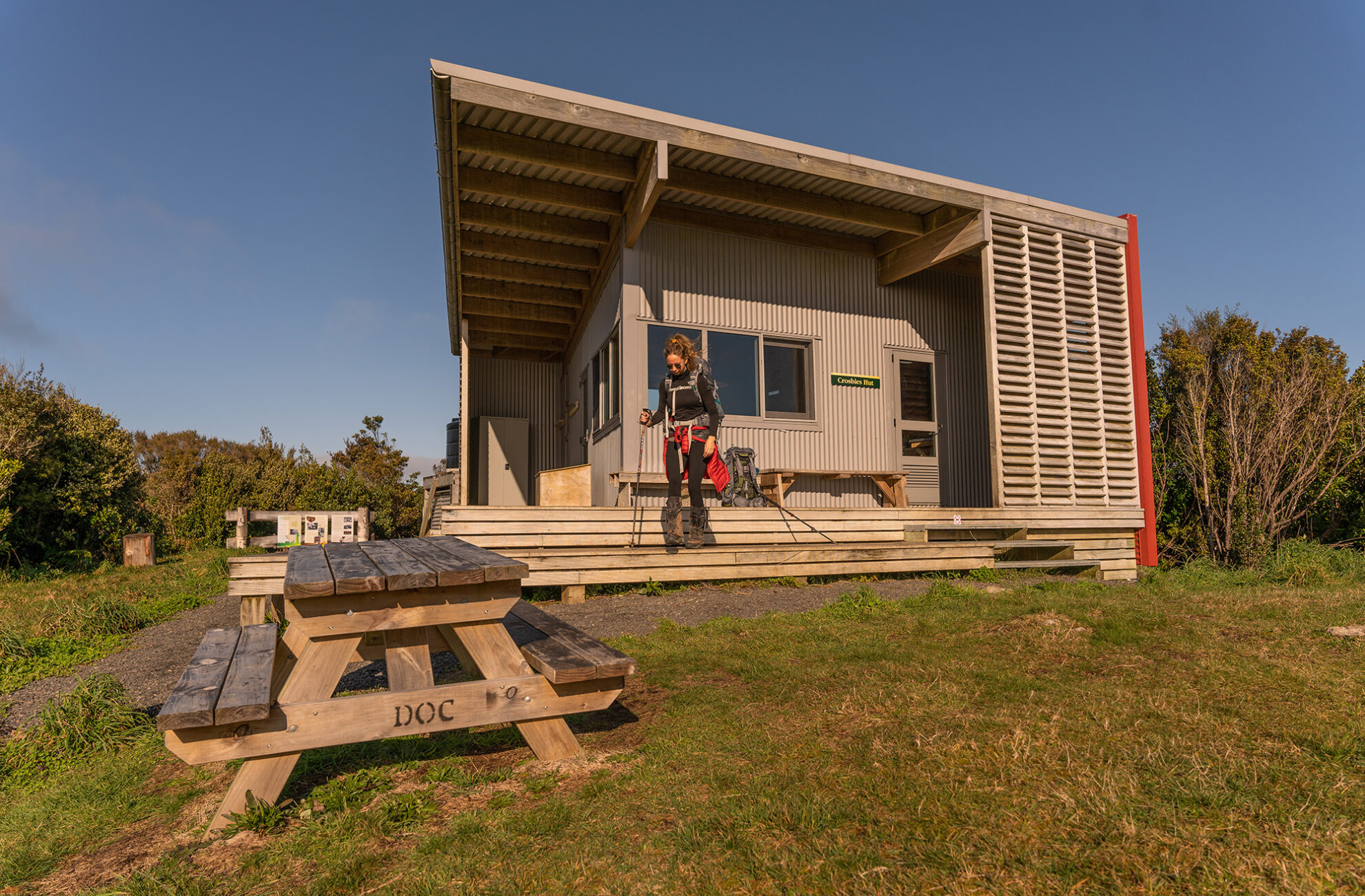
Crosbies Hut sits in an elevated clearing at 620m. There are panoramic views north towards Maumaupaki and Mercury Bay, east towards Table Mountain, and west towards the Firth of Thames.
The area, called Crosbies Settlement, is steeped in history. It dates back to 1880, when the settlement was established by Scottish immigrants Thomas and Agnes Crosbie, who cleared the bush and converted it to farmland. The Crosbies managed to stick it out longer than neighbouring families, eventually selling their block to the Lyes family in 1917.
Conditions could be very harsh and farming was challenging. Access was by foot, horseback or horse-drawn sledge. As such the settlement struggled to survive and was finally abandoned in 1926.
34 years of inspiring New Zealanders to explore the outdoors. Don’t miss out — subscribe today.

Questions? Contact us


