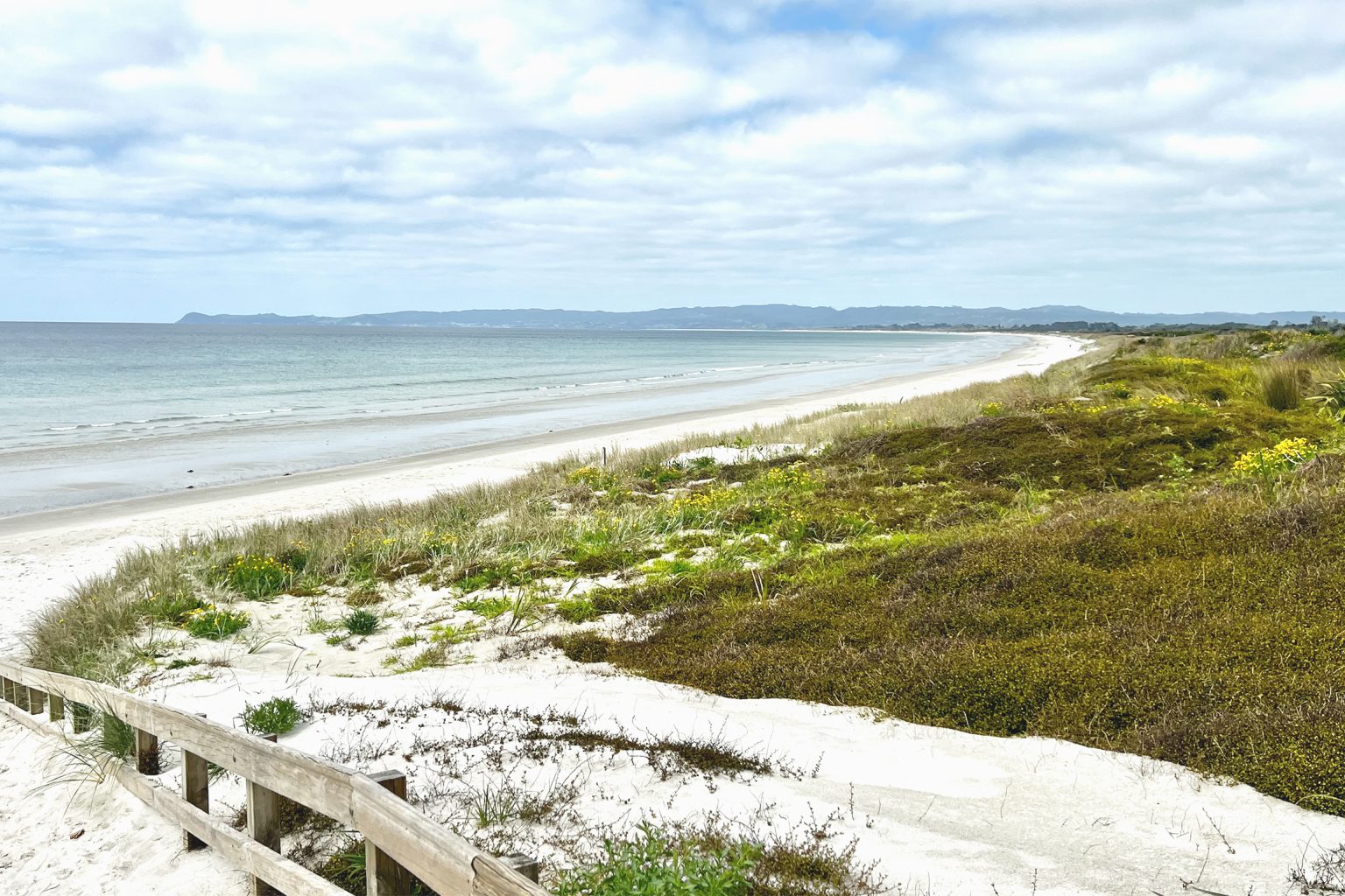
From Ruakākā, the sweeping curve of Bream Bay almost demands to be walked and will not disappoint.
From Ruakākā Beach car park, a climb up the dune boardwalk reveals the full sweep of Bream Bay. With Bream Head to the north and Paepae-o-Tu/Bream Tail headland marking its southern end, the bay is guarded by the Hen and Chickens Islands and Tuturu Sail Rock.
There is 6km of uninterrupted beach walking ahead.
Before setting off southward, check the tide table. A high tide and a strong nor’easter will see you pushed up against the dunes on soft sand and at risk of disturbing nesting birdlife, including dotterels, oystercatchers and terns. At low tide the wide beach is hard underfoot and easy going. You may share this part of the trip with the occasional Te Araroa walker, as it is part of the TA.
At 3.5km a pair of orange poles marks the path to DOC’s Uretiti Campsite. Instead, continue on to the 6km mark and turn inland at Tip Road. This is the only vehicle access point since leaving Ruakākā, so you can’t miss it. (If you were to continue down the beach to Waipū River mouth and it couldn’t be crossed, it would mean a long walk back out to the road bridge. You would also be at risk of disturbing nesting birds, including the endangered tara iti fairy tern.)
Walk up Tip Road for 1km, turn left into Uretiti Road and left again into Nova Scotia Drive. From here it’s 3km to Waipū. Caution is needed on this section as you share the roads with traffic for most of the way to the village.
Waipū and its cafés make a good mid-walk rest stop.
As many as 24 pā sites around Waipū reflect an area once densely populated by Māori and Patuharakeke hapū’s strong associations with the rich resources of the coast and surrounding hill country. Scottish and Nova Scotian pioneers settled in the area in the 1800s, and the Waipū Scottish Migration Museum is worth a visit.
Continue southeast out of the village along Cove Road using paved walkways for 1km. At the river, join the Waipū to Waipū Cove shared cycleway and walkway, which is all but complete to Waipū Cove. This community initiative allows safe, scenic walking as the Brynderwyn Range closes in on the right and the coastline on the left.
Just after the 13km mark, it’s worth turning left onto Hamon Road to visit Waipū Cemetery, on the banks of the river estuary. Established in 1851, it reflects the challenges, tough lives and inevitable tragedies of the European settlers.
Back on the shared pathway, continue to Johnson Point Road, the next road on your left. Another short side trip takes you to Waipū River Mouth Wildlife Refuge, where you can view the estuary and birdlife mentioned earlier.
On toward Waipū Cove, Te Araroa trail heads off to the right at Cullen Road. The road takes TA walkers up onto the Langsview Track, high above the coast.
Beyond Cullen Road, the shared walkway passes ponds, streams and farmland and finally drops into Waipū Cove, 18km from the start. Camp Waipū Cove on the left has good tent sites and facilities as well as a range of accommodation, and Waipū Cove General Store is a short stroll away.
This is an easy day walk along the beach and the shared pathway, with plenty to see along the way.