This accessible walk to an atmospheric old musterer’s hut is ideal for families or those short on time.
Built in 1948 when the land was part of Dusky Station, Baikie Hut is nestled against a grassy bank just above Twizel River. The old musterer’s hut has a hitching rail out the back, a precipitously slanting floor and an ageing wood burner to combat the draughts that work through the cracks when the wind gets up. Packed with rustic charm, it is a cosy spot to spend the night.
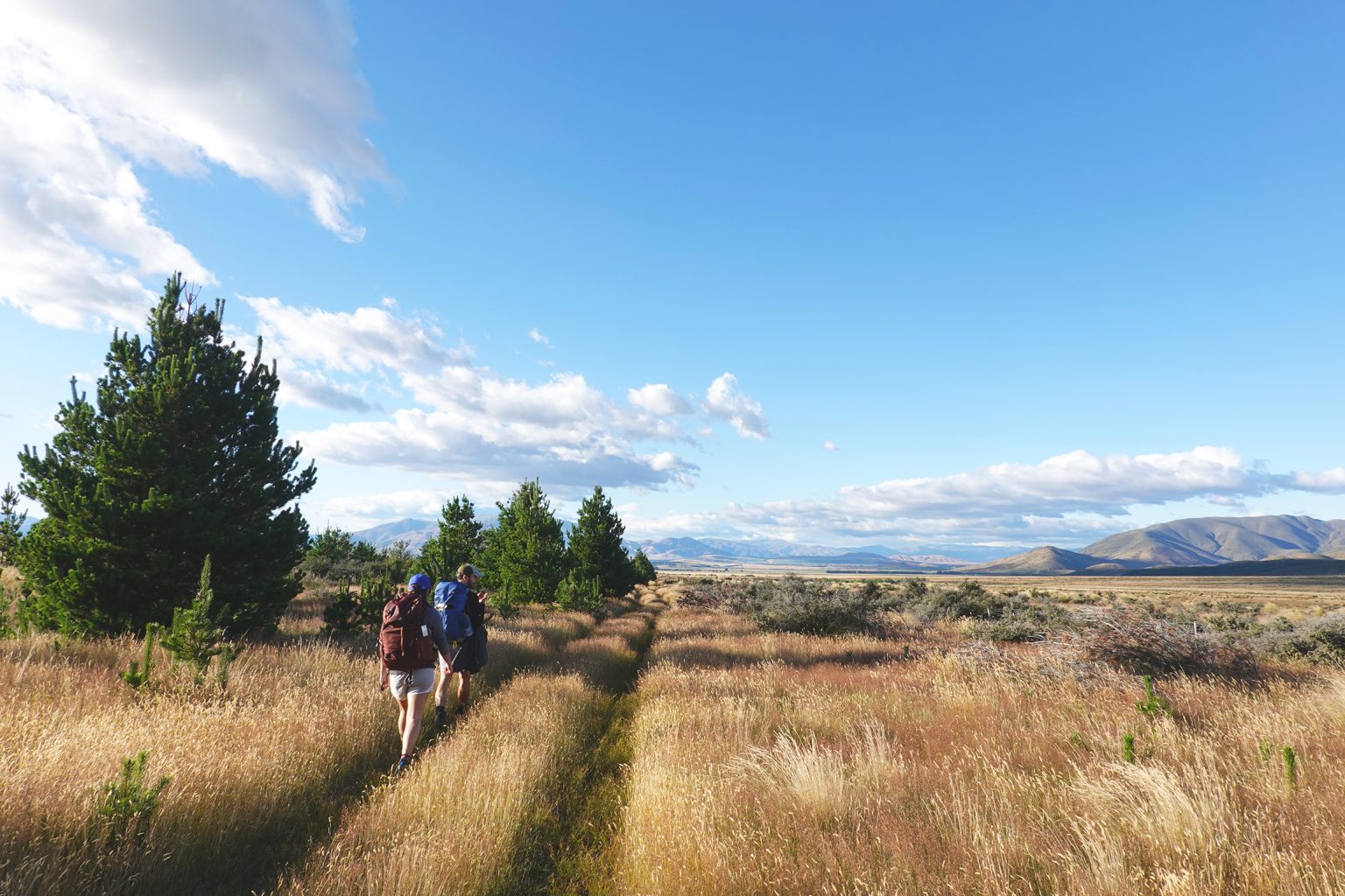
The track to the hut starts at the DOC car park just off SH80, about 3.5km towards Mount Cook Village from the junction with SH8. A 4WD track curves around the open hillside behind the car park. The track is a public easement across private farmland, so leave gates as you find them. Follow it through fields to a gateway with DOC signage, after which a switchback climbs to a partially felled pine plantation.
After 15 minutes the track exits the plantation and the view opens up across big-sky Mackenzie country and towards the Black Hills on the far side of Twizel River. The track then drops to cross a stream before curving north above the river.
At this point, just over halfway to the hut, there is a signposted junction with the Dusky Trail, which crosses the river. Stay on the true left of Twizel River and continue north through open grassland and intermittent wilding pines. The Ruataniwha Conservation Park boundary is reached after another 20 minutes or so, and tussock becomes more prevalent. The hut is about 40 minutes further on.
Baikie Hut is set back 20m from the river with panoramic views across to the brooding Black Hills. Although picturesque, the two or three-hour walk is short on shade and can be scorching, but the river is relatively shallow and fast-flowing here and perfect for a dip.
This easy tramp with gentle gradients can be completed on foot, mountain bike or horseback. It’s suitable for little feet and offers near-constant 360-degree views. The hut provides a cosy night in a historical setting, there is plenty of room for camping, and there’s a paddock just behind it for those on horseback.
Return the way you came and enjoy the expansive outlook across the sun-bleached grasslands of the vast and empty Mackenzie Basin.
Baikie Hut Track may be closed during periods of high fire danger.