
3. Spirits Bay (Kapowairua), Northland
4.5hr return
Climb the low hill above Kapowairua and look west to the 8km-long expanse of Spirits Bay, New Zealand’s northernmost accessible beach.
Two routes lead to its conclusion at the Waitahora Stream. If walking along the beach, the sand is soft, making progress arduous. In 1772, Marion du Fresne anchored nearby and sent parties ashore for water.
Behind the dunes, follow orange marker posts along the vehicle track. The impenetrable wetlands are a breeding ground for mosquitoes. Take insect repellent in large quantities.
To reach Pandora requires a low-tide crossing of Waitahora Stream.
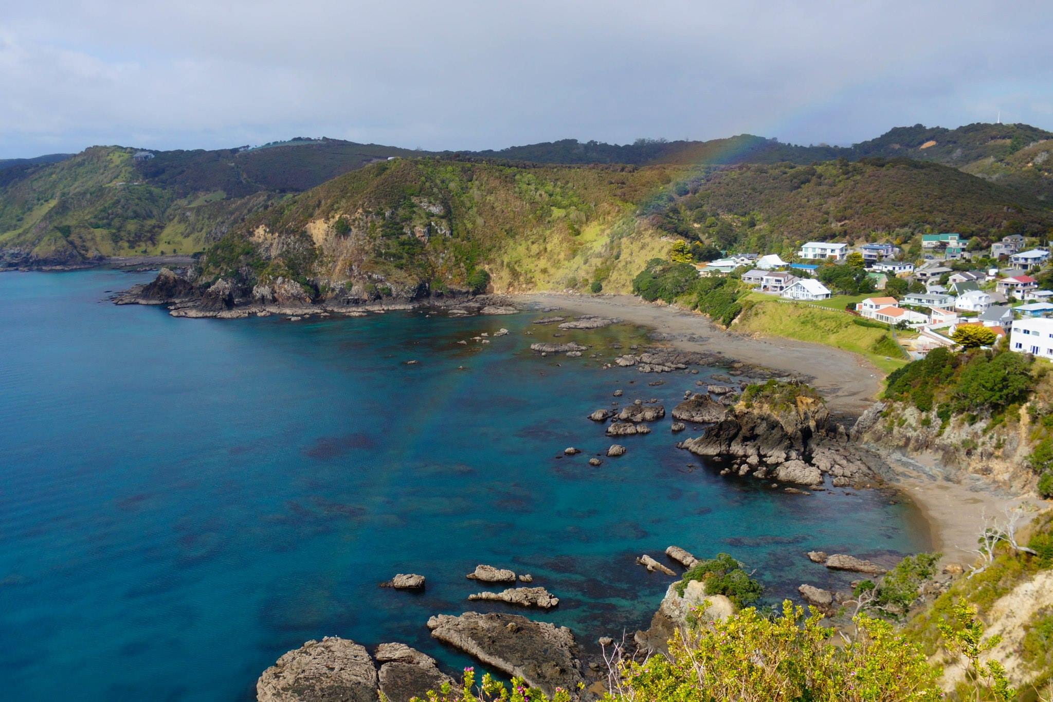
4. Moturua Island Track, Northland
2½ hours return
The track is well-formed and passes through long grass, forest and beaches.
The walk divides into four sections, each taking around 30 minutes and climbs a low hill between beaches.
From the eastern end of Waipao Bay, climb to Otupono Bay. On the way to Waiwhapuku Bay, look for the kumara storage pits on the trackside. The track to Mangahawea Bay can be muddy and slippery, but the shorter section back to Waipao Bay is firmer.
From May 11, 1772, Marion de Fresne and his French expedition camped on Moturua. In desperate need of water and supplies, and with fatigued sailors, Waipao Bay quickly became a hospital camp. At first they were greeted warmly by local Māori but relations deteriorated when clothing and a musket were stolen from the camp. While on a fishing trip to Orokawa Bay, du Fresne and his crew were killed. Later battles were fought and in the abandoned villages, the French found blood-stained clothes and evidence of cannibal feasts. It is suggested fishing in tapu grounds and cutting of firewood on burial sites contributed to the utu.
On July 12 of that year, New Zealand, known as ‘Austral France’, was formerly claimed.
Access to Moturua is by water taxi or personal watercraft.
5. Abel Tasman Coast Track – Marahau to Torrent Bay, Abel Tasman National Park
4hr one-way
Jules Dumont d’Urville originally visited New Zealand in 1824 aboard the Coquille, developing a fondness and curiosity for Te Ao Māori. An accomplished linguist, evocative writer and multi-disciplined scientist, he spent a fruitful week on the Abel Tasman coastline.
The walk starts across the bridges and causeways over the upper reaches of the tidal margins, where there’s a short detour to Coquille Bay. The track weaves in and out of gullies with some original forest cover and passes Simonet Creek and Lesson Creek, named after crew members of d’Urville.
Between Apple Tree Bay (La Grand Plage) and The Anchorage, steep cliffs tumble to the sea and brightly-coloured kayakers are framed with foliage of beech and podocarp trees. Adele Island (named after d’Urville’s wife) and Fisherman Island (Isle des pecheurs) fill the coastal views.
Other detours to Observation Cove and Cyathea Cove are now accessible via new tracks cut into the tea tree forest.
Another junction on the descent to The Anchorage leads to Watering Cove, immortalised in Louis de Sainson’s painting of the Frenchmen refilling their water stocks. From The Anchorage, either climb back up to the main coast track if the tide is high, or cross the lagoon at low tide to Torrent Bay.
6. Lookout Track, French Pass
30min return
Getting to remote French Pass in the Marlborough Sounds is part of the experience here. Don’t look left if you suffer from vertigo.
The Lookout Track shortly branches with the right track continuing the narrow zigzag through the forest to a lookout over the swirling waters of the pass. An information panel relives the day d’Urville navigated the channel. The left track is a slightly steeper path to a narrow soft shingle beach in Man-o-War Bay.
Once you’ve seen the confused frothing waters of ‘Passe de Francais’, you will conclude that only a Frenchman would be crazy enough to sail through.


