

Next day we set off early to make up for squandered time. Our route took us up onto Puketaramea (1338m), a good 500m ascent that got the blood pumping.
From Puketaramea the descent was gradual between massive old red beech trees, the sun filtering through onto fields of prickly shield fern. As spectacular as this was, it isn’t a healthy forest. Deer have cleared the understorey except for the unpalatable prickly shield. When the old beeches die there will be no trees to take their place.
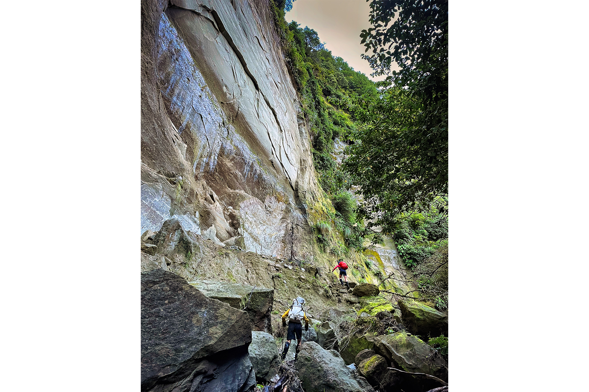
We went past Unknown Campsite, a grassy flat on a tributary of the Maropea River where a fireplace and neatly stowed tarpaulin were the only evidence of the semi-permanent tent camp that existed here in deer-culling days. We splashed up Unknown Stream, marvelling at the conglomerate overhang and streambed boulders. It looked like some extensive concreting had been going on – the type where they scatter pretty stones into the mix.
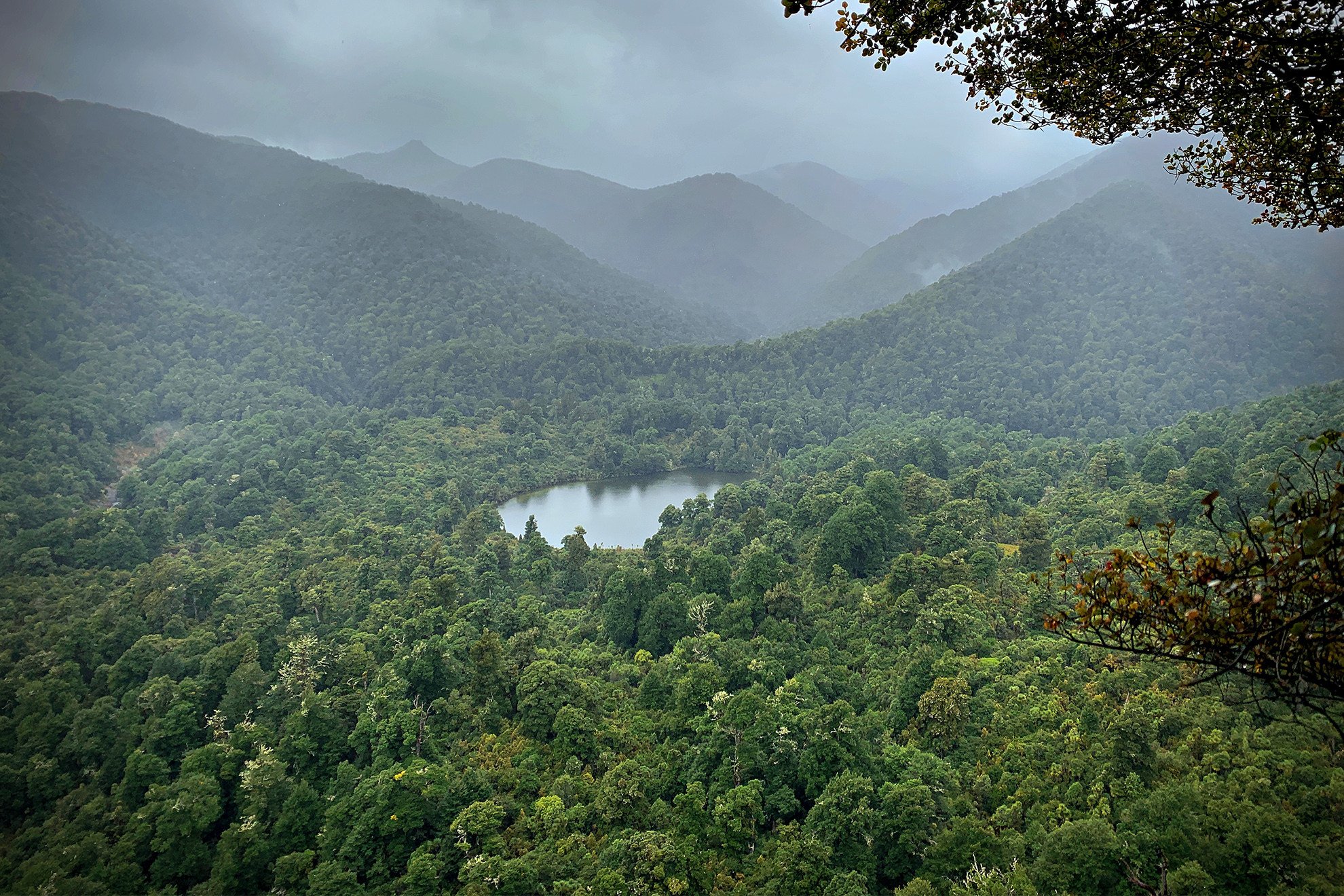
Another big climb took us from the stream onto a perilously narrow and rooty ridge. One mis-step and you’d be tumbling a long way. Here was a view of Lake Colenso, nestled under high limestone bluffs. Māori know this small lake as Kokopunui, and made seasonal hunting visits there to gather eel, fish and birds. With no introduced weeds or fish, the lake also has significant ecological value, and the surrounding swamp is the only area of lowland podocarp forest in the Ruahine Range.
We picked our way into the Mangatera River and followed the track towards Colenso Hut. An ancient boardwalk seemed to disappear into the bog and a couple of times I fell off it into thigh-deep mud. Clambering back onto the boards was effortful and undignfied.
Over Easter weekend, most Ruahine huts and bivs have resident hunters taking advantage of the roar to restock their freezers with venison. The hunters are helicoptered in and out, and the helicopter company tries to limit parties to one per hut. There are over 50 huts in the Ruahine Range, so lots to choose from.
Nobby, Prez and Murray were set up in Colenso Hut and the meat safe was already full, thanks to Nobby’s marksmanship. He was keen to fell many more in an effort to lower the area’s massive deer population.
We had a late and brief lunch stop here and regretfully cut the conversation short to set off for Ruahine Corner Hut, still trying to make up time. But we hadn’t spent enough time looking at the map. Travel was easy up the broad river bed and we strode up it quickly. However, our expected turnoff never came and we eventually consulted the GPS. Turns out we should have turned downstream from Colenso Hut: we’d walked an hour in the wrong direction.
The embarrassment of returning to the hut was eased by our new friends’ relaxed jocularity. They’d seen us going the wrong way and considered firing a warning shot but didn’t want to waste a bullet. Instead, they had cleared the top sleeping platform, knowing we’d be back.
Despite wet wood they’d managed to get a fire going. As the afternoon waned, we yarned away and moved from tea and hot chocolate to pre-dinner soups. There were the normal shared acquaintances to discover, and Nobby had spent 16 years as a ranger in the Ruahine so had some good tips and contacts.
It was dusk when we heard footsteps and voices on the verandah and another three burst into the hut. There were now nine in a small eight-bunk hut. The new arrivals were members of the Heretaunga Tramping Club. They’d had a long day from Otukota Hut.
Eight of us were over 55 so the chance of at least one snorer was high, and yes, the night was pretty noisy. We six trampers were up before dawn, keen to put in a big day now the weather had cleared. The hunters feigned sleep.
We’d now had two short days and needed to put the pedal down to get back. We turned downstream and rejoined the Mangatera River, following well-placed markers as we crossed from side to side. A couple of hours of this and we reached a fork and started the steady 600m climb to the sculptured limestone outcrop of Potae. The bush here is dominated by the conical dark green pāhautea mountain cedar.
On Potae, the Ruahine main range loomed to the east and we could see the expanse of bush we needed to travel through before starting another big vertical push onto those tops. We wouldn’t have time to visit Ruahine Corner Hut this time. Slave-driver Paul barely let us nibble a nut bar before we were hot-footing it off Potae.
We were unsure where our bunk for the night would be. Tiny Kylie Biv is part way along the Ruahine Range, Sparrowhawk Biv is at its far end, or we could drop back down Colenso Spur and have another night at Barlow.
We eventually clambered onto the range and into a beautiful alpine wetland. The persistent south-easterly had lessened and, although it was still chilly, there was sun and visibility and glorious tops travel for the rest of the afternoon.
Although some of it wasn’t that glorious, however. Leatherwood slowed us down but wasn’t too evil, and sword-like spaniards cut our hands and legs and were completely evil.
Colenso identified both these species and they are named for him: Olearia colensoi and Aciphylla colensoi respectively. Of spaniards he wrote: ‘It gave us an immense deal of unpleasantness, trouble and pain – often wounding us to the drawing of blood.’
We pressed on past two-bunk Kylie Biv, but hut bagging mania meant Paul and I descended 150m off the ridge to write in Kylie’s hut book. It was just as well we passed up the biv as it was occupied and the hut book showed that five people had sat out the two previous days of storm here.
At the trig on Tupari (1527m), the peak above Kylie, we stopped to yarn with a hunter. By now we’d realised we wouldn’t make Sparrowhawk, and were aiming for Barlow. He looked doubtful: “It’s a long way, have you been this way before?”
The day pressed on as we crested knolls and dropped into saddles. We needed to reach Te Atua Mahura and then down to the bushline before sunset, as navigation on the untracked tops in the dark would be too hard. By now I was flagging but there was no time to rest.
We made the bushline on dusk and dug out our headlamps. It’s slower in the dark but serene and beautiful. We tried to identify birdsong as ruru awoke and the others chorused before retiring.
It was another two hours to Barlow. We saw it through the trees from a distance and someone was down on the riverbed with a fire. Cyclone Gabrielle had ravaged the track and we couldn’t work out how to get through. With great relief Paul finally found the long drop, and 13 hours and 40 minutes after setting off that morning, we were back in Barlow Hut with another group of hunting hopefuls.
The hunters’ alarm went off at 5am. One of them muttered, “No point going out till it’s light”, and they all turned over and went back to sleep. Dawn wouldn’t be until 7am.
Paul delivered tea and muesli to my sleeping bag, and I felt an overwhelming sense of contentment. Sitting in a dark corner on a mouldy mattress, I hadn’t washed for four days and was covered in scratches and bruises. I’d been in the rain, hail and snow and stumbled around in the dark. But now I was warm and well fed and had traversed a piece of New Zealand I’d never seen before, with great companions.
“Make sure you turn down-river, guys,” quipped Mark as we left Barlow Hut, alluding to our navigational faux-pas from Colenso Hut. Paul and I weren’t going to make that mistake this time. We could almost smell the mushrooms and bacon at Eketahuna’s Lazy Graze.


