Rangitoto Summit via Rangitoto Coastal Track, Hauraki Gulf Marine Park
One of the most fascinating day trips from Auckland is to Rangitoto Island, less than half an hour’s ferry journey from the CBD.
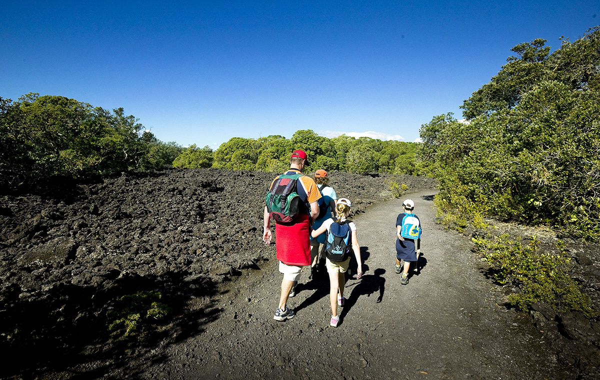
It would be hard to call the island beautiful – it’s covered in fields of broken volcanic rock that look like giant, smashed up Oreo biscuit. The rock is brittle and unstable, making trying to walk on it slow and fraught with ankle-turning risk.
But a good set of paths means you can enjoy the bizarre landscape without having to watch your every step.
Rangitoto emerged from the sea with a series of eruptions around 700 years ago – though new research suggests it could be older. Even if it is, the island’s still a geological infant.
A hundred years ago it was essentially desolate – bare, black and rugged. Since then, enough moss has formed on the rocks to provide nourishment for trees and plants and today Rangitoto has the largest pohutukawa forest in the country. That’s largest in terms of area – the trees are still rather small and sparse. The island, being black, also gets extremely hot in summer, and there’s no water to be found, meaning hats and several litres of water are essential.
Since August 2011, Rangitoto and adjoining Motutapu Island have been officially pest free and are now home to some rare species including North Island saddleback, shore plover, brown kiwi and takahe.
Rangitoto’s one of life’s unique experiences and I took advantage of the early bird ferry deal which means getting a lift to the island at 7:30am, when there are fewer people on the island.
When I disembarked the ferry, instead of following the majority heading straight for the summit, I headed right, along the coastal track. The track hugs the water for the first few hundred metres and I caught my first glimpse of the lava flows – it’s tempting to have a walk on the rubble, but this endeavour quickly ends with you scurrying back to solid ground hoping your ankles stay intact.
The track veers away from the sea and becomes a little rougher as it undulates over lava flows; the sharp rock edges can be harsh on your soles. Head through forest and the next time the sea becomes visible is as you approach Yankee Wharf and then Islington Bay.
The area is a welcome contrast with several mostly disused baches, private boats resting in the bay and the striking green of Motutapu Island.
It’s worth walking across the causeway between the two islands. There are chirruping birds, good picnic spots and particularly friendly fantails when you reach a small lake at the start of the walk to Emu point on Motutapu Island.
After relaxing at the causeway I headed for the summit of Rangitoto Island. The track is wide and ascends very gradually, only getting marginally steeper as you near the top. There are few views on the way until you reach the boardwalk, when you soon reach a bench with views back towards Motutapu Island and beyond to Waiheke and Great Barrier Island.
Soon you’re at the top and a wooden platform gives you spectacular panoramas of Auckland city, the Waitakere Ranges behind, the northern beaches and scores of islands in the Hauraki Gulf. It’s also worth taking the short crater walk, peering into the large inverted cone from the rim.
The walk back to the ferry terminal is an easy descent but it’s definitely worth taking a side track to Lava Caves. The best of the numerous holes in the ground is the last one you reach – you can walk right through. Bring a head torch, as it gets pretty dark in the middle, and enjoy the range of colours on rock never touched by sunlight.