
This terrain is rocky, undulating and slippery, requiring a good sense of balance and a head for heights. The track dives into v-shaped guts with considerable exposure and no margin for error. I find myself swearing under my breath: ‘Never again!’
It takes eight hours to reach a pathway to the hut, and suddenly life isn’t so bad. Cone Creek Hut has just been fully renovated by the Backcountry Trust. Mountain cedar, rātā, kamahi, Hall’s totara, quintinia and cabbage trees surround the 56-year-old S70 design. The hut book shows an average of 10 parties visit annually. We doze off as kiwi whistle amidst the relentless roar of the river.
The perfect weather continues as we inch up a precarious slope of shifting scree and loose rock. The climb steepens as we puff towards the skyline. At the 900m contour, a prominent cairn leads off through dracophyllum, leatherwood and cutty grass to a small saddle filled with rock debris. At a delightful stream, we fill up our drink bottles and quench our thirst.
From this basin we go up the toe of a steeply rising tussock spur. We’ve been on the go for four hours when we crest the top to find a couple of cairns. Sidling into a higher basin, we hear frogs croaking in a small, weedy tarn. With not a skerrick of a track to follow, we orientate the map and set a compass bearing for the ragged ridgeline to the north.
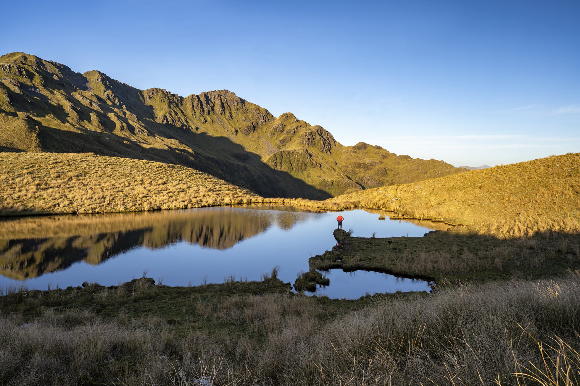
By now, high on the Morgan tops, the afternoon is slipping away. We follow tussock ramps down to Lake Morgan, an oversize tarn trapped among a cirque of jagged peaks, emptying over an impressive waterfall into the shadows below. The next hut is visible, a button building sited among a sprinkling of tiny tarns, far in the distance. A line of bluffs blocks our descent but we discover a grassy gut that angles gently downhill to boggy flats. The red tussock is waist high and there’s prickly speargrass. Circling a deeply-incised gorge, we march through acres of tussock, wary of myriad ankle-wrenching holes. A lone waratah betrays the location of Lake Morgan Hut, hidden below the hill.
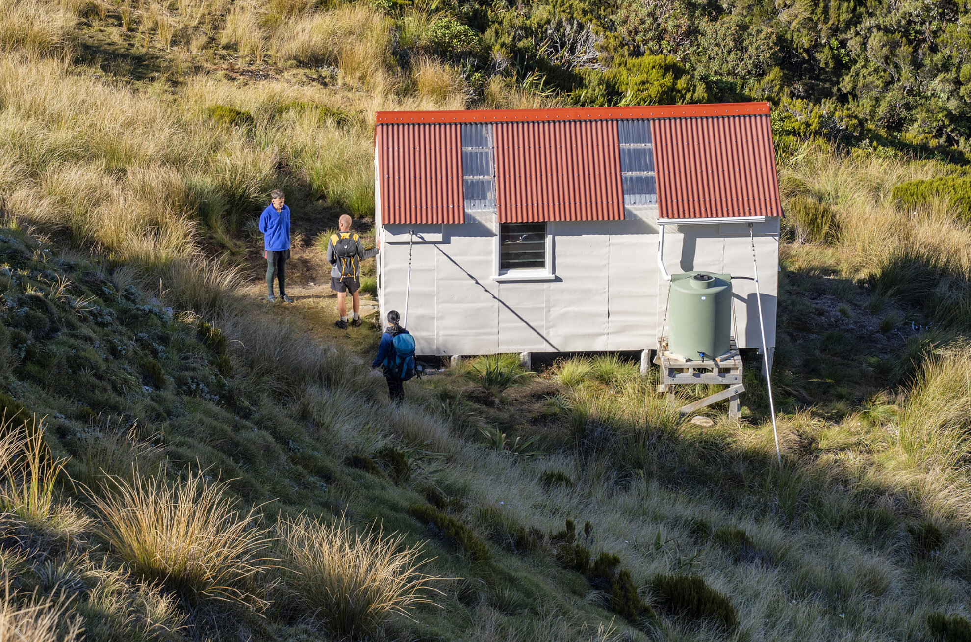
The six-bunker has a new corrugated iron roof, water tank and coat of paint. A crew from Gloriavale has built a beautifully-crafted longdrop. Over the past two decades, the most regular visitors to this cabin are from the Christian community – this is their wild backyard. The hut book is filled with intriguing entries from their annual school trips in late summer. On a Year Nine boys’ tramp, one lad had written in the visitor’s book: ‘Hut a bit small for 28’. One of the teenage girls had penned: ‘We made it! Never again!’ Others had mentioned sighting kea, chamois and red deer. Some clever soul had named the resident weka ‘Watchful Thief’.
That evening, two others arrive on an ambitious weekend trip from Christchurch. Kieran and Goldie have laboured for nine hours over the Brian O’Lyn route. We swap stories as the moon makes a staged appearance.
At dawn, the sunlight filters through skylights in the hut roof. Serrated mountain tops light up orange, contrasting with the cobalt sky. This is big country, glorious and majestic.
We have no set agenda, no timetable, no compulsion to hurry. We waste the day chatting, perusing hut literature, drinking tea, enjoying quiet solitude. Later, Malcolm makes a successful summit bid to the 1489m spire that presides over the lake. He enjoys a celebratory swim, a detox after four months’ Covid lockdown in the city.
The next morning we visit the remnants of the old hut, flattened by the wind on the plateau above the existing hut.
Lazy cumulus clouds crowd the sky as we head north, following marker poles up the leading ridge to Mt O’Shanessy (1462m). Here are views of Lake Brunner and the sheer walls of Mt Alexander. Turning north-west, we reach a hilltop where boulders are piled like scattered dice.
We follow the ‘Gloriatrail’, where dozens of young feet have made a well-worn path, keeping an eye out for snow poles. We are fast losing altitude along the narrow ridgeline into tussock and turpentine scrub. A profusion of colourful daisies and gentians are on display, as dragonflies hover above stagnant waterholes. Time is measured by the sun riding the ridgelines of distant peaks.
The route arcs onto a subsidiary mountain range. From the edge of these grassy clifftops, we gaze directly onto the Gloriavale community housing, airstrip, agricultural buildings and engineering workshops – a God’s-eye view of paradise, far, far below.
A cooling breeze is welcome under a fiery, midday sun. Bashing through scrub leads to a marked exit off the tops. The notorious Brian O’Lyn route is steep in places, overgrown in parts and definitely not for the novice. However, we reach the bottom in 90 minutes. A startled kererū flaps noisily above, its wings beat like the woosh of a whip. We return to the Haupiri River flats, the farm track, and the car.
This is a demanding four-day circuit for fit trampers with sound navigational ability who will be rewarded with ridges and rivers, tussock tops and tarns, hot pools and huts. Where human footprints are as rare as the whistling whio. Where track markers are as scarce as a fledgling kea. Would I return? Never say never.


