For some people, maps can be a confusing jumble of undecipherable information. Filtering out detail to see the basics can help you read it.
If you feel that you can’t read a map, the best thing you can do is practise often. Take a map with you on all your walks, no matter how short and get used to using it. You can download maps from the LINZ website, or find an alternative free online source to print and practise with.
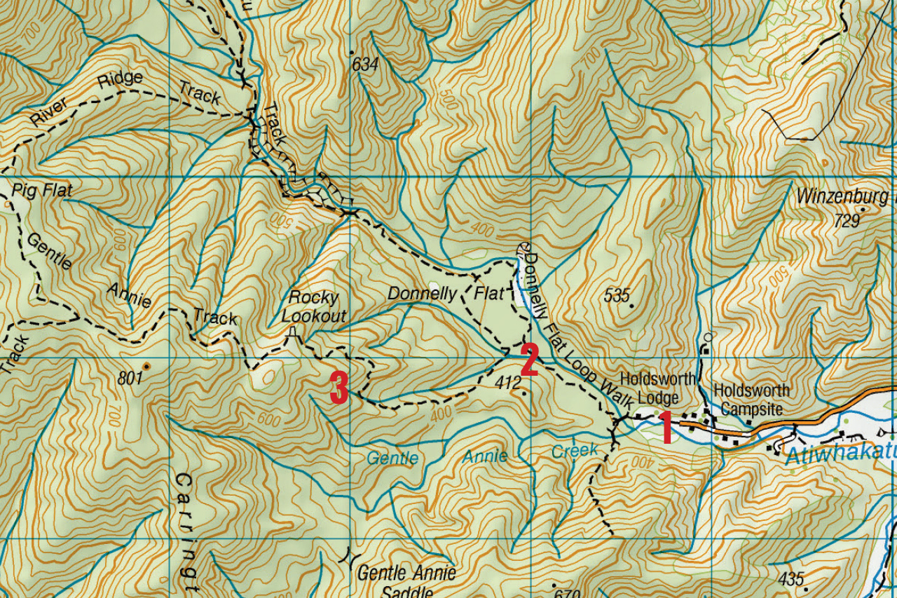
Let’s see what we can learn from the map above, showing the track to the popular Rocky Lookout in Tararua Forest Park. If it confuses you, try concentrating just on the road, rivers and track. It becomes much less confusing that way.
1. Orient the map
When you arrive at the car park, take out your map and orient it so it is aligned with the features on the ground. Note that the top of the map is grid north. Find the road on the map and turn the map so it aligns with the road you have just driven up. Check it is also aligned with the river. By doing this, you will now know where the track starts from.
2. Keep track of your progress
When you get to the first bridge, align the map with the track and the river once again. You might not notice the track junction immediately after crossing the bridge, people often walk straight past the sign up on the bank. But make sure to stop at the next track junction and orient your map again. Up till now, you have been walking more or less in the same direction – north-west, tending more northerly at the junction. To reach Rocky Lookout, you need to change direction to more or less west. There is another track junction shortly after and then the trail starts ascending.
3. Compare the map to the trail
After climbing a bit, stop again as you cross a small bridge where the trail passes over a stream (the bridge is not shown on the map). Face the stream and orient your map to see how the track curves around you and is now in front of you on your right and left. When you get to Rocky Lookout, you should be able to see the river in the valley and orient your map to it.
Use a track near you to use this same technique. Once you have got the hang of it, you will feel more confident with the map and can then add more information like contour lines and symbols. Do it slowly and eventually the map will come to life and you will realise that you too can read a map.
– Heather Grady is an instructor with Outdoor Training New Zealand.