
A wooden bridge over the Rock Burn transports us to the true left, and there before us is the vast expanse of rolling grassland known as Theatre Flat. We traipse over lumpy tussock to the commodious rock overhang mentioned in myriad guidebooks and tramping literature. I revel in the tangible sense of place; one can almost smell the wood smoke from fires long since extinguished beneath this hallowed wall. Towering over the valley and crowned with remnants of snow are muscular, proud peaks named after Greek gods – Nereus, Somnus and Momus. Somewhere up there cradled in an alpine basin is beautiful Lake Nerine, inaccessible to all but the hardiest adventurers.
A lone whio glides in the glacial green river, the valley resounds with the mournful cry of a kea and a gentle wind keeps the sandflies at arm’s length. I sleep under the comforting rock, tentless and grateful to be here.
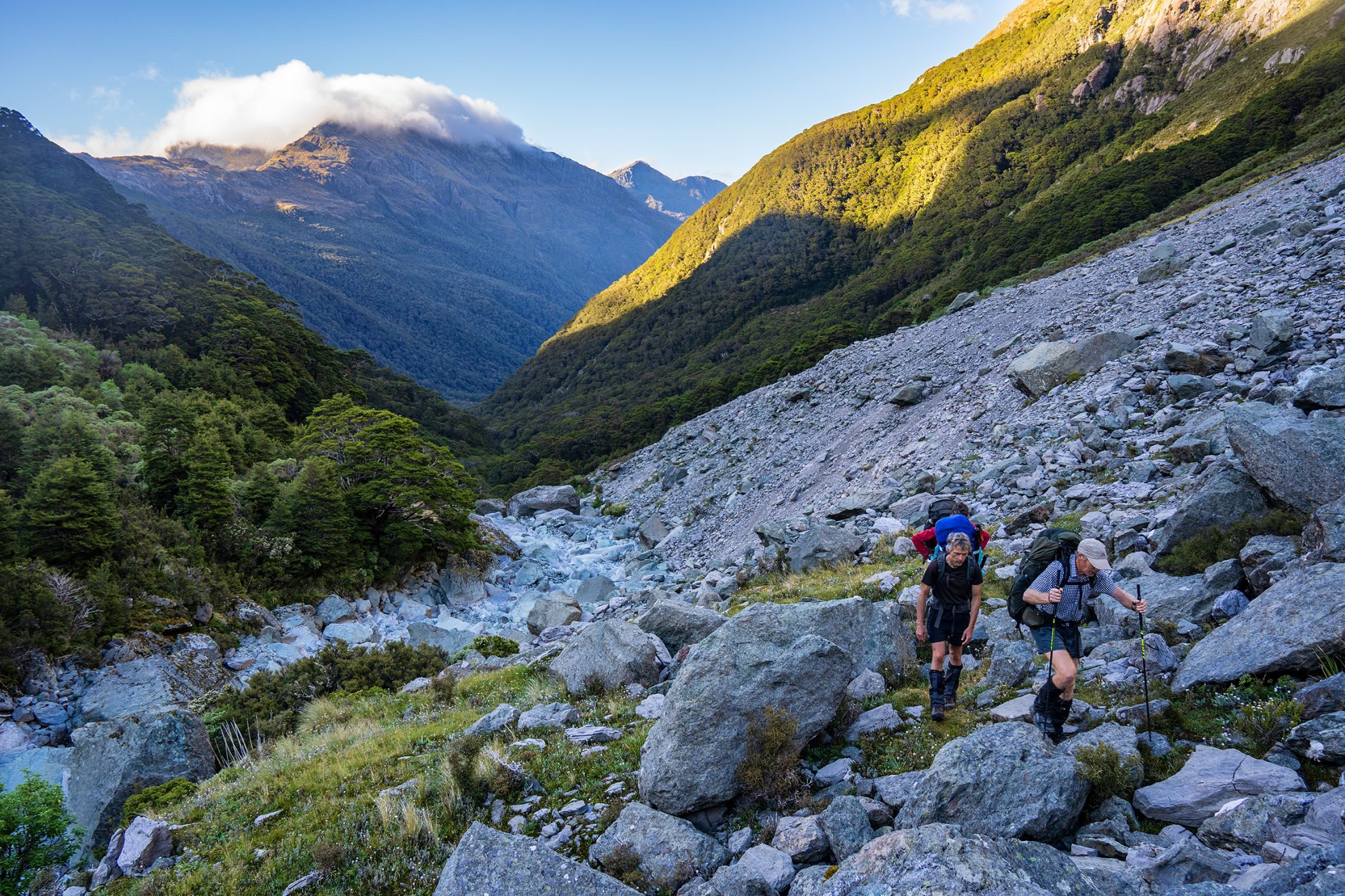
The next day we saunter along the grassy terrace and climb over a low bush saddle. Jim and I trace a lightly cairned route up to the Rock Garden, a bush-clad knob peppered with smooth, glaciated schist (marked on the map as Pt908). This worthwhile detour offers commanding views of the river flats below and the alpine pass ahead. We overtake our friends and emerge above the treeline. As the valley narrows we follow a line of cairns through a graveyard of fallen boulders, the largest of which is a well-established rock biv that could shelter six souls with a modicum of comfort.
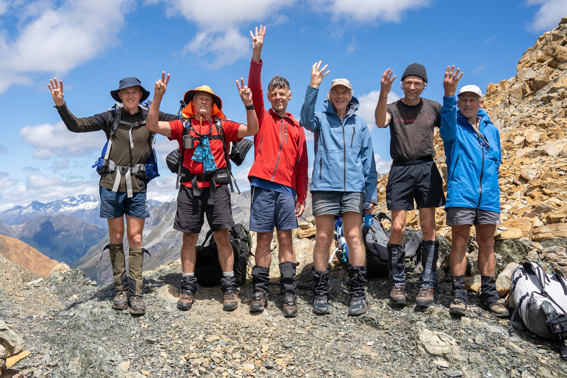
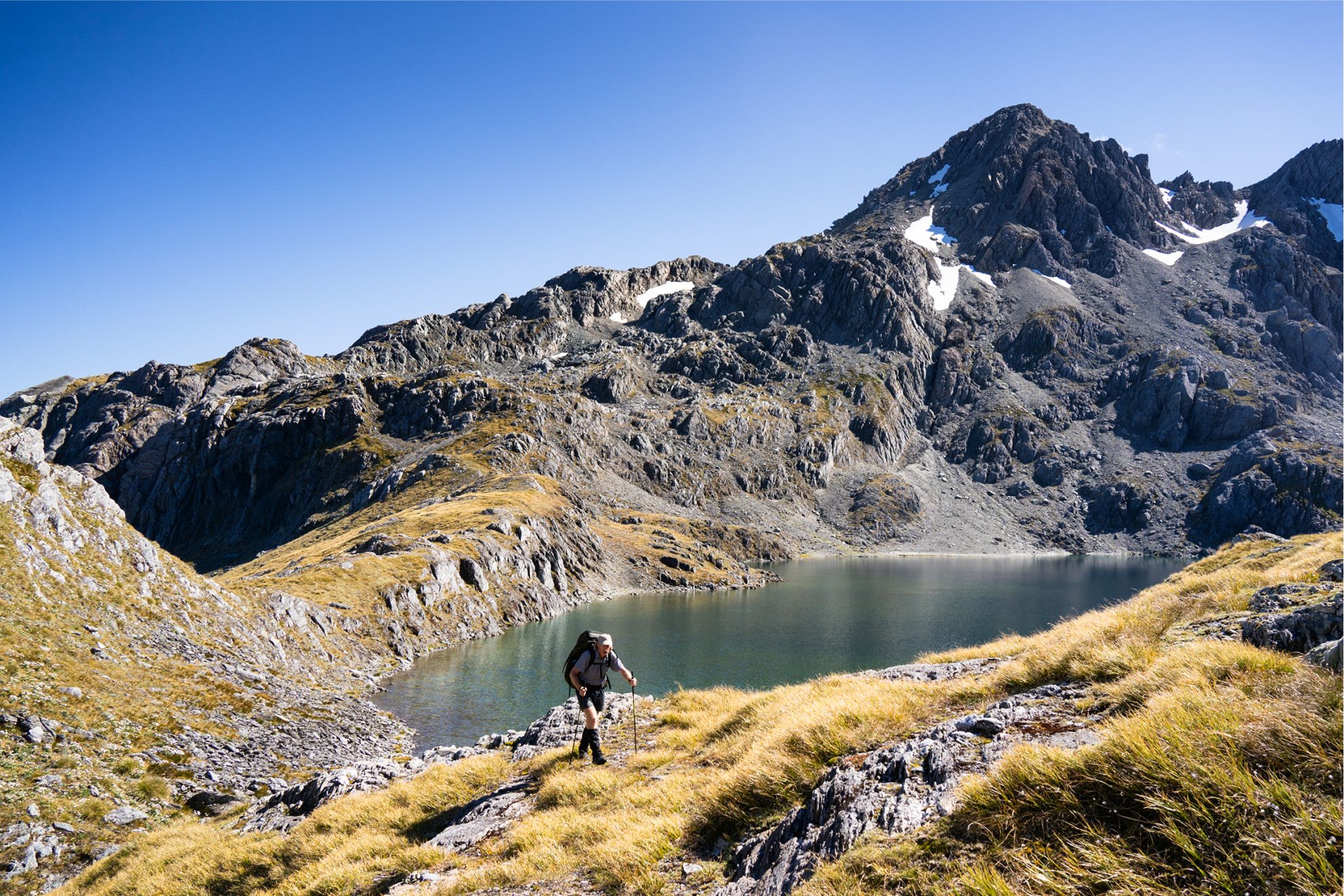
We rock-hop up to our second pass – Park Pass (1176m) – where I photograph the party giving me two-finger salutes (the peace sign, of course). We set up our four tents on the broad, flat saddle beside two tarns, presided over by a peak with a frowning countenance named Amphion. I suggest we explore the Park Pass Glacier to the east. We clamber up a grassy gut and traverse to a steep snowgrass spur, then scramble up a rock-strewn gully to attain a splendid view from Pt1588 of the melt-water lake below, its teal blue waters too cold for swimming.
By day’s end we are back at Park Pass, where we sit in silent reflection. A fingernail moon climbs above Poseidon Peak while the sun sinks behind Karetai Peak in the distant Darran Mountains. Majestic Mt Tutoko is revealed through shifting cloud. We drink it all in.
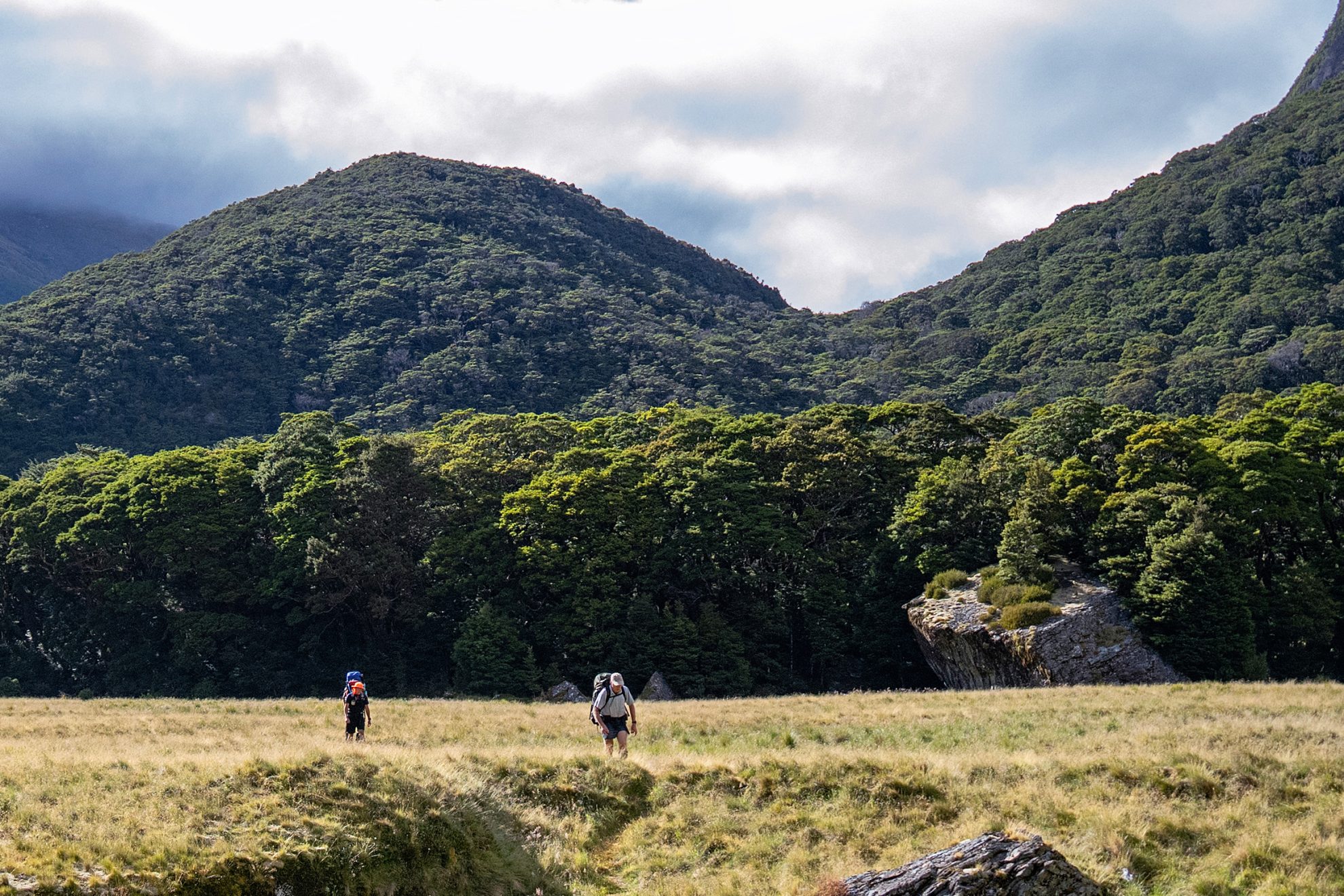
In the morning, we set off down a razorback spur that drops us into the eastern corner of Fiordland National Park. Although unmarked, the path through beech forest is well worn by the hundreds of boots that have come this way. Alongside Hidden Falls Creek a defined ground trail lined with crown fern and luxuriant moss leads upstream. It is a delight to discover each rock cairn, enticing us on to grassy flats where we soak up the summer sunshine and bathe in the river. We sit on logs playing cards. We allow ample time to relax in preparation for the next day’s exertion.
We wake early and pack up fast. We have an ambitious agenda: a 16km trek with some serious altitude gain. Jim and I scout ahead along the bush-lined stream where sporadic cairns identify the route. After a couple of hours we arrive on Cow Saddle (1025m), which straddles Mt Aspiring and Fiordland national parks. Three passes down, two to go!
Descending into the headwaters of the Olivine River we wade through tussock and find a passage above the deeply incised gorge below. Jim remembers his earlier forays here and leads us to an impressive waterfall ahead. A steep scramble over red rocks grants us access to a snowfield below the formidable pyramid of flame-coloured Fiery Peak. We gain our fourth pass easily by zig-zagging up the coarse, ultramafic rock debris to the small saddle, Fiery Col (1546m), the highest point of our trip.
We descend scree into Fiery Creek, our pace slowing in the heat as we search for water. The Olivine Ledge is a pleasant grassy terrace that we stroll along for three kilometres. Late in the afternoon we choose a route up to Fohn Lakes, opting for a grassy spur to connect with a climbing traverse that turns anticlockwise above the outlet stream. As we haul our weary bodies skyward over schist slabs, bursting lungs and aching thighs remind us: ‘This is not the Routeburn.’ Upon arrival we camp on terraces between the twin lakes that shimmer in glorious golden sunlight. In the sky above, a lone kea soars over its domain. After an energy-sapping 10-hour day, sleep comes quickly.
Before dawn, Andrew, Josh and Jim climb Sunset Peak in time for a perfect sunrise. The rising sun sends shadows scurrying away. We decamp then follow our noses up to the fifth pass, Fohn Saddle, where we exchange more high fives. Our destination is the Beans Burn; far below our boots, the meandering river is a braided white ribbon. Progress is fast as we drop down an alpine basin onto a vertiginous spur. This becomes steeper and scarier, and I resort to bum-sliding down the tussock, trying not to pick up speed in this ankle-breaking terrain. We reach the valley floor breathless and glad to be on flatter ground. Splashing across the river, we penetrate the scrubby river terrace.
After four hours on our feet we find Split Rock Biv, a colossal landmark that can shelter half a dozen trampers in its cavernous interior. We eat lunch in the shade. Progress becomes pathetic as we negotiate dozens of V-shaped gullies, all choked with fallen timber or rockslides; the original marked track is seriously overgrown and tests our resolve. After a five-hour slog down the Beans Burn we set up camp in long grass under the face of Mt Chaos. We have travelled 17km and are besieged by an army of ferocious namu.
Our final day is also 17km long but our weariness is offset by eagerness to complete the expedition. A marked route over a bush saddle is followed by a swingbridge over an impressive gorge. A steady pace through mixed beech forest sees us emerge onto the sandy reaches of the Dart River, where we chat with rafting guides while laden jet boats cavort in the rapids.
In the final stage of our journey we splash alongside the Dart River then use a high-level track to reach Rock Burn Shelter, where we are entertained by robins. We drop packs to visit a spectacular slot canyon nearby, then meander among delightful forest as sunlight streams through the canopy. Following the tourist trail that is the Lake Sylvan Track, we crane our necks toward the lofty heights of Mt Earnslaw. We ford the Route Burn where a recent flood has demolished the bridge, and enjoy a luxurious dip in a swimming hole – bliss to our sun-baked bodies. We exchange high fives: mission accomplished!


