There’s a plan afoot – watching sunset on the crest of the Craigieburn Range.
A warm afternoon greets us as we wend our way along the Mt Cheeseman Ski Field access road, through the beech forest and clearings, until we reach the first locked gate. It’s much lower than expected, but undeterred we park the car, don boots and packs, camera and food and soldier on, the expected short hop to the top having now turned into a 5km walk climbing 900m.
It’s easy though and we cut out some of the zigzags by taking a direct line up the tussock slopes to reach the snowline and base buildings of the ski field. From here it’s less than 1km and 300m to the ridge top. There’s not a soul to be seen and the warmth of the evening makes for delightful walking conditions, the only problem is the soft snow pack that fills the upper basin.
With a little assiduous route selection we scamper almost to the ridge top by following thawed sections of the basin where rock and tussock are exposed.
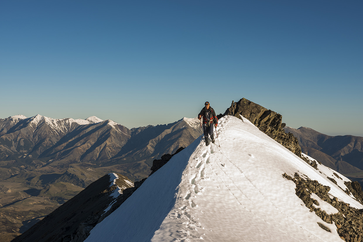
The last steep pinch is tough going but we swap the lead to keep up the pace and arrive at the final slope to the crest.
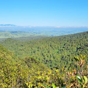
The sun is still up but sinking fast and creating some wonderful lighting effects over the Alps and Harper River catchment directly below. A magnificent evening is seeping into the ranges, a somnolent breeze is wafting out of the Harper and we are good to go for a wander along the crest where more views await.
This snowy landscape is a far cry from the busy streets of Riccarton which we left just four hours earlier and a welcome reminder of what can be achieved in an afternoon from the city centre if you set your mind to it.
Each issue of Wilderness celebrates Aotearoa’s great outdoors — written and photographed with care, not algorithms.Subscribe and help keep our wild stories alive.