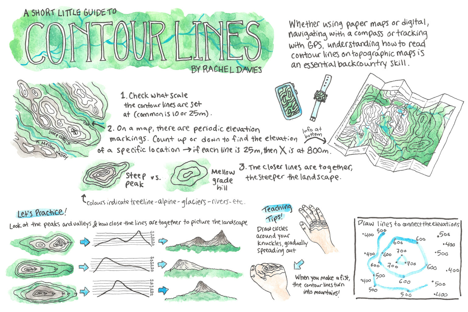
Whether using paper maps or digital, navigating with a compass or tracking with GPS, understanding how to read contour lines on topographic maps is an essential backcountry skill.
1. Check what scale the contour lies are set at (common is 10 or 25m).
2. On a map, there are periodic elevation markings. count up or down to find the elevation at a specific location – if each time is 25m, then x is at 800m.
3. The closer lines are together, the steeper the landscape.
Let’s Practice!
Look at the peaks and valleys & how close the lines are together to picture the landscape.
Teaching tips!
Draw circles around your knuckles, gradually spreading out.
When you make a fist, the contour lines turn into mountains!
The 2026 Wilderness Outdoor Photographer of the Year competition
25 huts to visit in 2025
A lofty location for Brass Monkey
Tongariro Northern Circuit huts no longer first-in, first-served during winter
Why we’re putting on weight
Subscribe!
Each issue of Wilderness celebrates Aotearoa’s great outdoors — written and photographed with care, not algorithms.Subscribe and help keep our wild stories alive.