Gibbs Hill, Abel Tasman National Park
With much time spent hiking the ranges of the South Island and elsewhere, often through wild and sometimes dangerous terrain, it’s a pleasure to find an easy walk with a degree of effort; one which can be walked in a morning without a pack.
Such is Gibbs Hill in northern Abel Tasman National Park. Gibbs, 405m, is a modest summit with a 4km approach along the ridgeline which climbs from Totaranui beach.
This is what I most enjoyed about this hike: though relatively easy, there is still some effort involved as you have to climb every one of those 405m from the sea level camp at Totaranui, and what better time to go than dawn, before the camp has awakened.
It was cool and fine with a little cloud cover hugging the hilltop forest where I was headed, which I hoped would disperse by the time I arrived.
The first section of the track was flat, then it eased slowly into Kaikau Stream, crossing it and heading for the top. Steep and sometimes slippery, the route up was relentless until 200m where the spur flattened off and I could see the main ridge ahead. I was glad to get that section over and done with so I could ease back and enjoy the remainder of the walk, undulating above forest and stream.
A signpost indicated the Gibbs Track junction with the Pigeon Saddle Track, this heads south and onto the Inland Track, deep inside the park. From here it’s just 1km and 100m of ascent to go.
The cloud hadn’t moved much, my early start had me up there too quickly. A short sharp ascent through some overgrowth of scrub and gorse (DOC hasn’t done much track clearing) brought me to the top. Unfortunately, the view was obscured by both the scrub and cloud cover so I was unable to see into Golden Bay and out to Farewell Spit, though there was a nice view towards Totaranui.
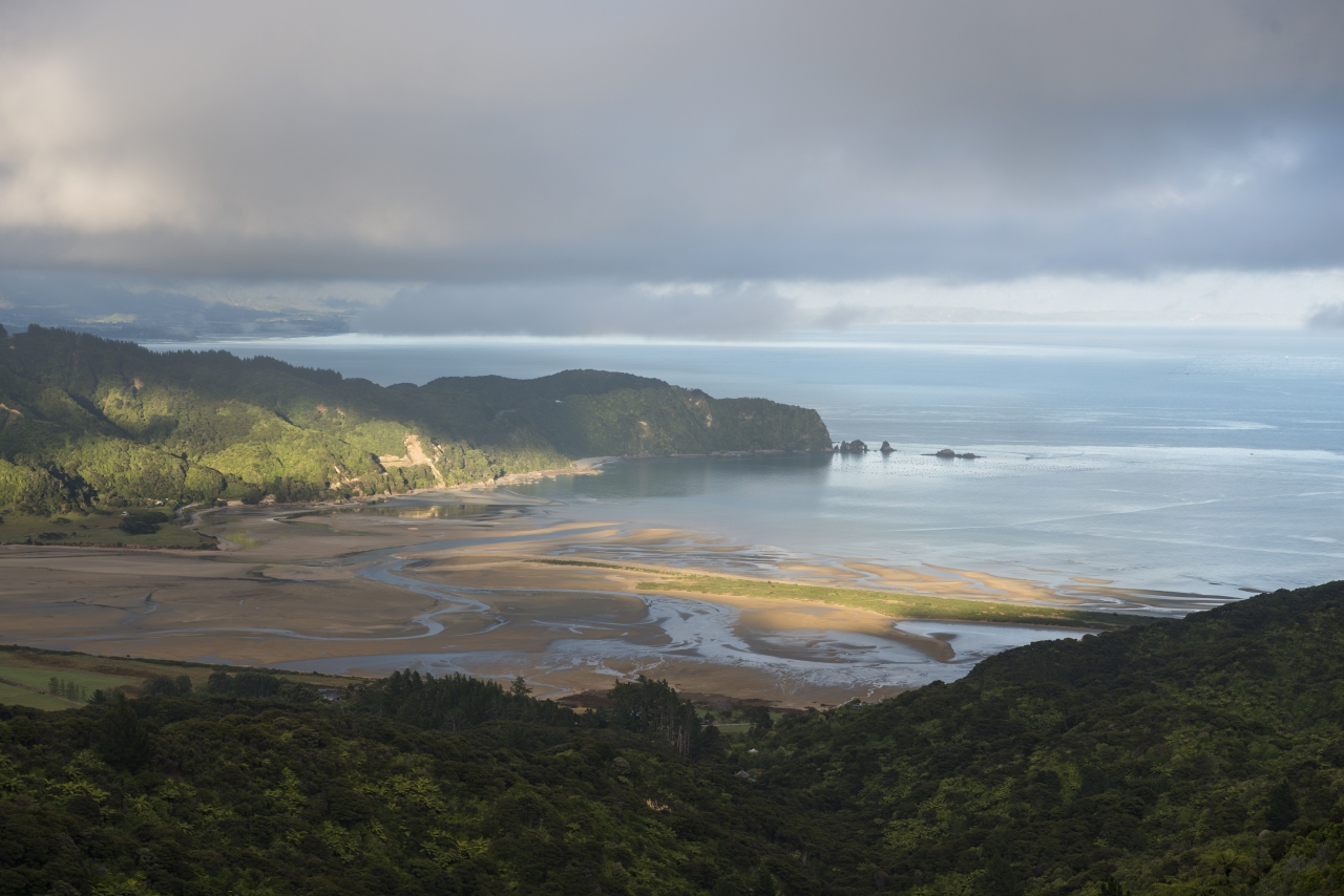
I didn’t stay long and soon started the return leg. On the way up I spotted some better locations on the ridgeline where I could take a few photos and sure enough they delivered a better view than the frustrating summit. I wasn’t too bothered though: I was out for the exercise and the bush scenes, which were quite beautiful and I collected a few on the way back down.
The forest scenes increased as I descended, with some particularly striking ones near the base of the ascent onto a face in the Kaikau Stream catchment where punga dominated.
Soon I was out onto the grassy flats and road where I picked up my bike to cycle the last 1.4km back to Totaranui.