

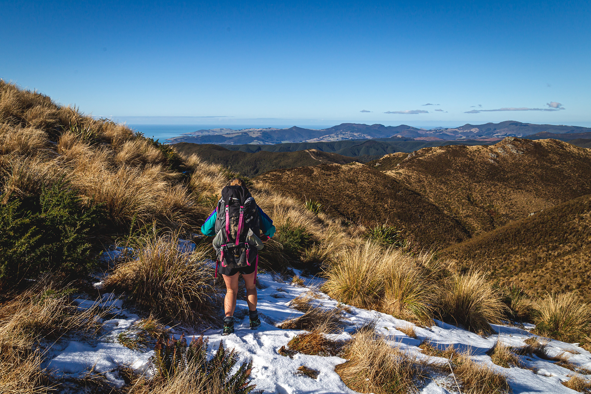
2. Rangiwahia Hut, Ruahine Forest Park
Easy access to the tops for beautiful sunrises and sunsets.
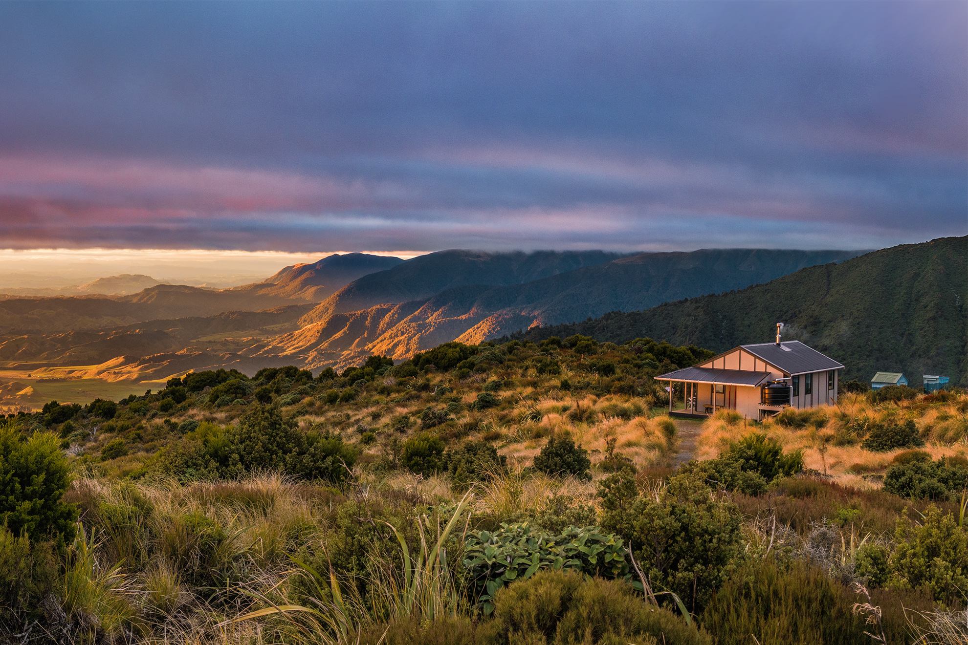
Rangiwahia Hut is perched above the bushline at 1327m on a broad spur that extends 3km west off the main Ruahine Range. It offers unimpeded views that take in Ruapehu and Ngauruhoe to the northwest.
The trailhead car park is at 920m, leaving a one- to two-hour 500m climb up a well-formed track to reach the hut. En route the trail crosses a spectacular and photogenic arched bridge at about 1000m.
Rather than simply retracing steps on the return journey, continue up the spur to the summit of Mangahuia (1583m) where even better views can be enjoyed. The trail beyond Mangahuia leads about 5km down another spur back to the car park.
Rangiwahia is a serviced hut with 13 bunks. It’s popular on weekends and holidays, so booking is required.
Grade Easy–moderate Time 1–2hr Distance 3km
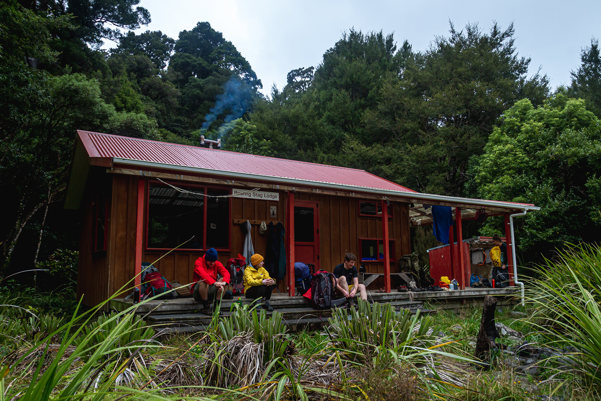
3 Roaring Stag Hut, Tararua Forest Park
Relax on the veranda as the soothing headwaters of the Ruamahanga River flow by.
Surrounded by lush native forest, 12-bunk Roaring Stag Hut sits on a sun-drenched bench at 440m on the true left of the Ruamahanga River. Originally an NZ Deerstalkers Association hut built in 1961, the hut was upgraded in 2005 by DOC and NZDA to include a wraparound veranda.
Access is from Putara Road end, about 15km west of Eketāhuna. Take the trail for about 2km up the Mangatainoka Valley to a swingbridge, followed by a steep climb to a junction at 760m on a ridge. A right turn at the junction ascends to Herapai Hut. Turning left (south), the trail drops gradually to the Ruamahanga River. Several unbridged side streams normally present no difficulty but can rise significantly after rain.
Roaring Stag Hut is a standard hut and does not require booking.
Grade Moderate Time 3–4hr Distance 7km
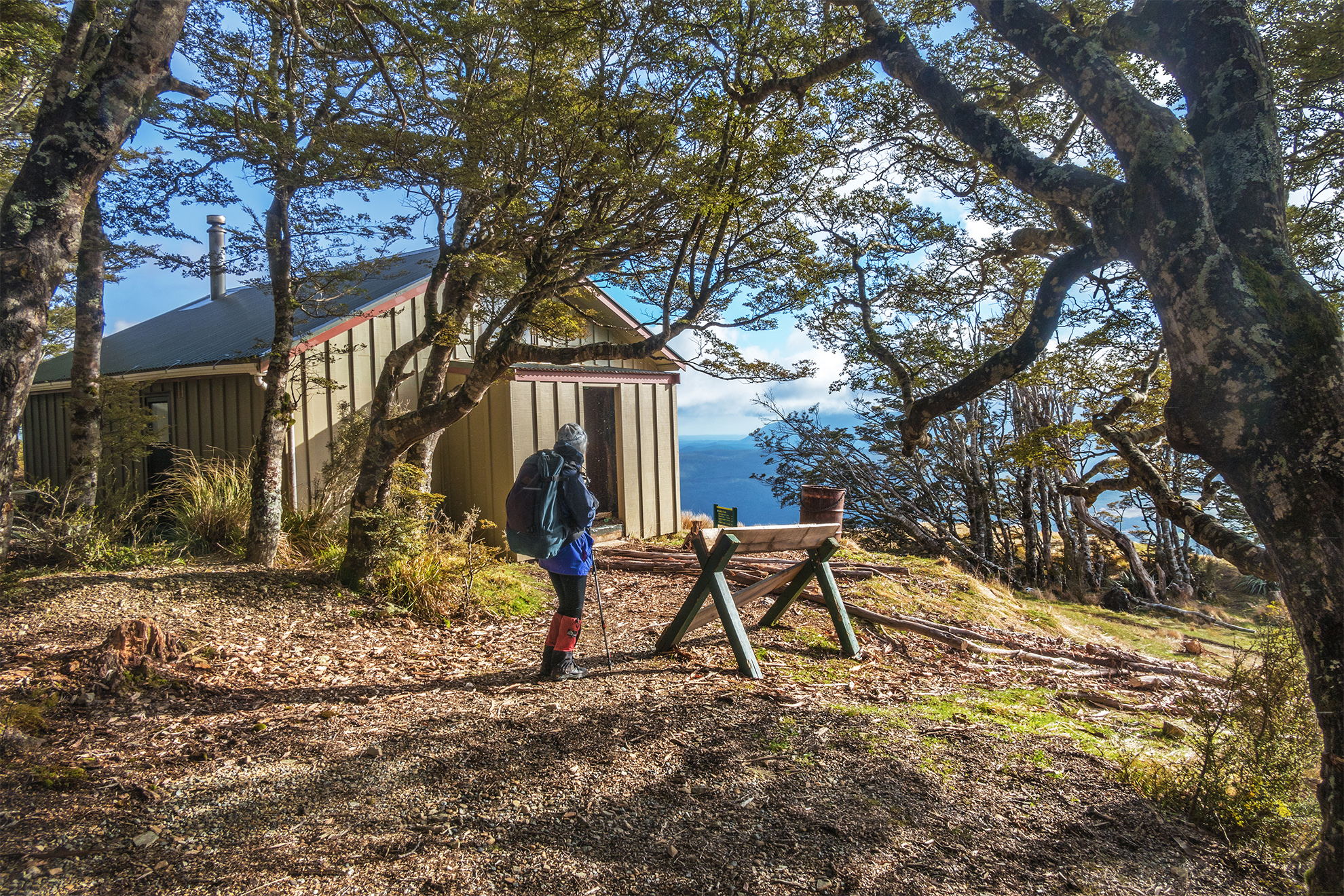
4 Bushline Hut, Nelson Lakes National Park
Tread a well-maintained loop trail through beech forest and alpine tops with stunning views of Lake Rotoiti
The original Bushline Hut was built in 1944 at the tree line, at 1280m, but it burned down in 1987 and was reincarnated in 1987 as a 14-bunk hut. The views over Lake Rotoiti and across to the St Arnaud Range are stunning,
The hut is located at the midpoint of a superb 9km circuit that can be walked from either end. To go clockwise, take Paddy’s Track. This starts 500m down the road from the Mt Robert Road car park and sidles across the mountain’s open face, crossing several scree-filled gullies before climbing to Bushline Hut.
To complete the circuit, from the hut continue west on Paddy’s Track above the bushline, into alpine herbs and shrubs, to a junction with Pinchgut Track at 1420m. This is also the flat summit of Pourangahau Mt Robert. The left turn at the junction leads past 2nd Basin and the old Mt Robert ski field buildings to Lake Angelus. The right turn leads down, past Relax Shelter, into beech forest and a sometimes steep but well-graded zigzag track to the car park.
Bushline Hut is serviced; bookings are required.
Grade Moderate Time 2hr Distance 4.5 km
5 Waiaua Gorge Hut, Te Papakura o Taranaki
Perhaps the best-kept secret of Te Papakura o Taranaki.
North Islanders will be familiar with the huts on the eastern side of Te Papakura o Taranaki (formerly Egmont National Park), but relatively few venture to the mountain’s undeveloped western slopes. Waiaua Gorge Hut comes with a cosy fireplace with a supply of firewood, and is a wonderful opportunity for a winter family adventure.
The hut is perched on a spur above the Waiaua Gorge where there are views over the western flank of Taranaki. It is most easily reached via the Ihaia Track, which climbs gently from the trailhead at Ihaia Road for several kilometres to a junction with the Upper Ihahia Track.
Until 2021 the Upper Ihahia Track continued to the northeast and lead to Waiaua Gorge Hut. This way became impassable following a storm in 2021. Instead, turn right at the junction onto a rough but well-marked track (not yet shown on topo maps) that heads to the southwest. The Waiaua River is soon reached, providing views of the mountain and easy travel to the bottom of the spur on which the hut sits. Expect a bit of mud here and a short but steep climb to reach the hut.
For those looking for more adventure, a trip to view Braemes Falls is worthwhile. To reach the viewpoint, head into the forest immediately in front of the hut before descending a ladder to reach the Waiaua River. A steady climb follows and is rewarded by spectacular views of Braemes Falls cascading off a shelf in the gorge.
Waiaua Gorge Hut is serviced but bookings are not required.
Grade Easy–moderate Time 2.5–3.5hr Distance 5.9km
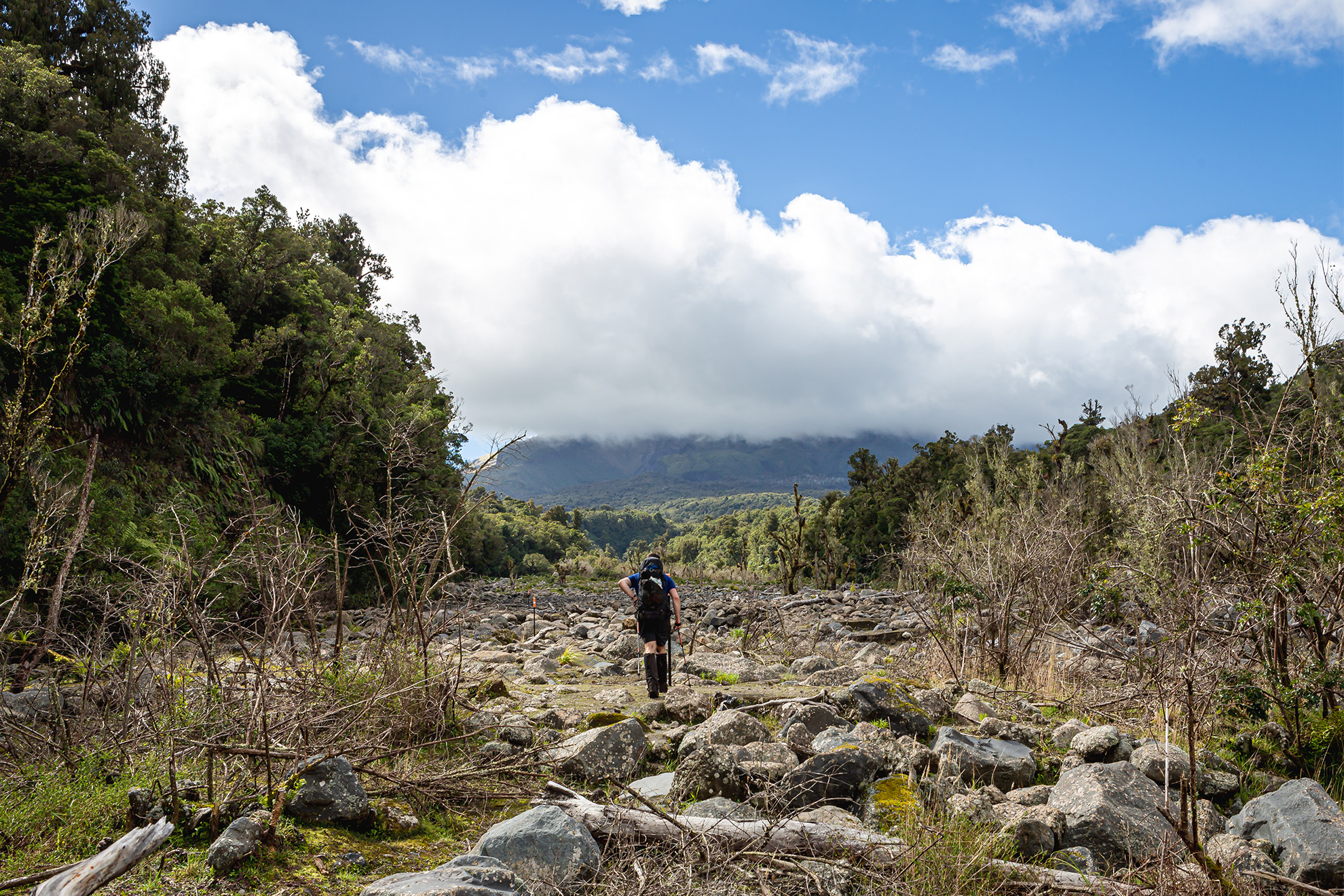
6 Crow Hut, Arthur’s Pass National Park
A legendary base at the foot of Mt Rolleston and the Crow Glacier
Crow Hut was built in 2002 and is a suitable base for exploring Arthur’s Pass National Park. It sits on the edge of the beech forest, nestled at the foot of Mt Rolleston and the Crow Glacier.
The easiest way to reach the hut is from Klondyke Corner off SH73. From the car park, cross the Waimakariri River’s braids heading northwest before picking up Crow Valley Track. The route alternates between short sections under beech canopy and open sections next to Crow River before the hut is reached on a terrace above the true right bank.
For more experienced parties, Avalanche Peak offers an alternative route in the right conditions. Climb steeply along Avalanche Peak Track to the summit at 1833m. Leave the marked route behind and head northwest down broken scree slopes. Stay on the ridge and head north for a kilometre to the saddle on the far side of Pt1658.
From here the headwaters of the Crow River should be visible at the bottom of 500 vertical metres of scree, which offers a quick route down. In the valley, it’s an easy walk to the hut. Following heavy snowfall, the area should be avoided due to avalanche risk.
Crow Hut is a standard hut; bookings are not required.
Grade Moderate–difficult depending on route Time 4hr via Waimakariri River; 4–5hr via Avalanche Peak Distance 10.5km via Waimakariri River; 6km via Avalanche Peak
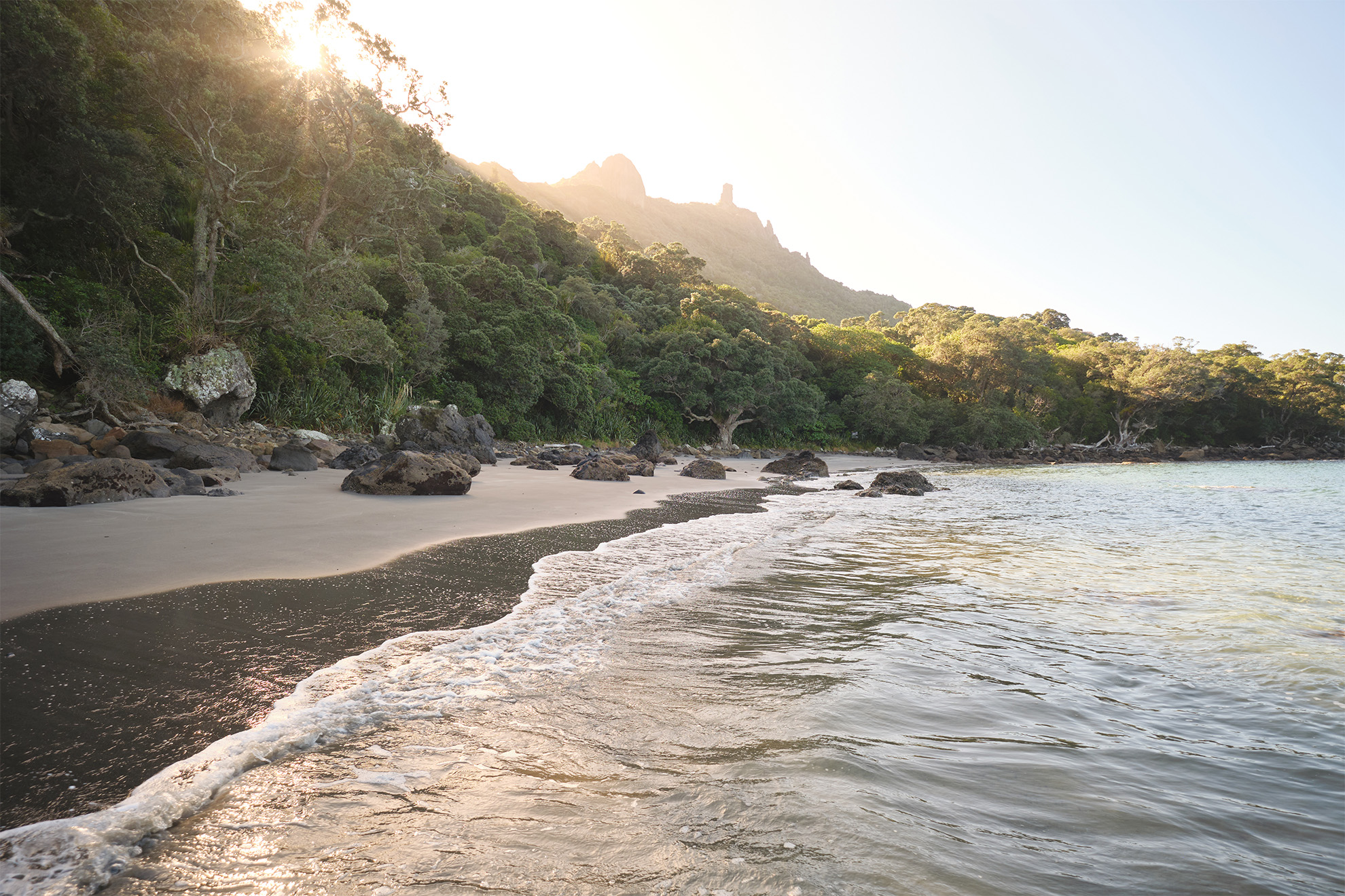
7 Peach Cove Hut, Bream Head Scenic Reserve
An easily accessible beachside hut for Aucklanders.
A night at 8-bunk Peach Cove Hut near Whangārei, in the winterless north, is an enticing proposition for beginners and families. It is set in bush, so expect to hear kiwi and morepork at night and a dawn chorus. There’s a lovely little sandy beach.
The track goes up one side of Bream Head Ridge through attractive coastal broadleaf forest, then drops into Peach Cove via lots of steep and narrow steps.
Peach Cove Hut is serviced and bookings are required.
Grade Easy–moderate Time 2–3hr Distance 5.5km
8 Shallow Bay Hut, Fiordland National Park
The magic of Manapōuri without the crowds
Trampers in their thousands walk the Kepler Track each year, but few venture far from the Great Walk itself. Just across the misty waters of Lake Manapōuri from the gigantic 40-bunk Moturau Hut is the cosier 6-bunk Shallow Bay Hut. Tucked by the lakeshore at the edge of the beech forest, the hut’s doorstep offers views over the expanse of Manapōuri and its many islands to the peaks of Fiordland far beyond.
The hut is an easy walk from the Rainbow Reach car park. Follow the Kepler Track west beside the Waiau River for 4km before turning off and following Shallow Bay Track to the lakeshore. It’s another 15 minutes of easy walking west to the hut. No bookings are required.
Grade Easy Time 1–2hr Distance 5km
9 Cedar Flat Hut, Toaroha Valley, Central Westland
Here is a taste of Central Westland tramping and history, with the treat of nearby hot pools.
Cedar Flat Hut (standard, 12-bunks, no bookings required) is a worthy winter destination and is frequently visited as part of the classic Toaroha–Hokitika–Lower Whitcombe tramping route. It’s surrounded by its namesake trees, the distinctive mountain cedar/pāhautea (Lebocedrus bidwillii), and is an attractive location making a hub for further exploration.
The route to the flats is rough at times and occasionally follows the edge of the Toaroha River, but it’s well marked.
The palpable history of this region begins right away as the route commences on an old logging tramline. Although there’s little left of it these days, the original track to the hut was built in the 1930s to facilitate access to the hot pools at Wren Creek. It’s a 15-minute walk to the hot pools (take the hut shovel to dig them out if required).
Near the modern hut stands a historic cullers’ hut (2-bunks), built in 1957. Resplendent in orange, it’s one the best surviving examples of these huts and features hand-adzed timber.
Adventure Bivouac (2-bunks) and Yeats Ridge Hut (4-bunks) can also be reached via steep climbs to the bushline. Their positions provide views of the Toaroha Valley and Diedrichs Range. Both offer additional overnight spots, or can be walked as day trips from Cedar Flat Hut.
Grade Moderate–difficult Time 4–5hr Distance 9km
10 Jubilee Hut, Silver Peaks Scenic Reserve
A slice of wilderness on the outskirts of Dunedin
Wellington’s Tararua Forest Park and Auckland’s Waitākare Range are well known, but Dunedin’s Silver Peaks are practically unheard of outside of the region. Silver Peaks is a series of rugged schist peaks encrusted with tors and can be accessed after a 30min drive north of the city. Jubilee Hut (bookings necessary) is the range’s most popular hut.
It was originally built by Otago Tramping and Mountaineering Club in 1951 and served several generations of trampers before being replaced in 2007 by the current hut, situated just across the valley.
The hut is located on the Silver Peaks Yellow Ridge Route, an overnight tramping loop that begins on Mountain Road. From the car park, climb through regenerating bush to Green Hill. Soon, the tops offer 360-degree views of the surrounding ranges and the coast. The track then drops to Cave Creek via Devils Staircase, an unbenched, steep 340m descent, then heads downstream through occasional glades of silver beech to the turnoff to Jubilee Hut.
To complete the loop, return to the creek and climb past the old hut site to the ridge beyond. The track wanders along the tops to palatial ABC Cave before climbing past The Gap and following Yellow Ridge for several kilometres. A spur at the end of the ridge leads to the cosy 4-bunk Phillip J. Cox Memorial Hut. A short descent from this hut leads to the Waikouaiti River, where an old forestry road climbs to Mountain Road, several kilometres from the car park.
Grade Moderate Time 3–4hr to hut. Additional 6–8hr to complete the loop Distance 9km to hut. Additional 10km to complete the loop.
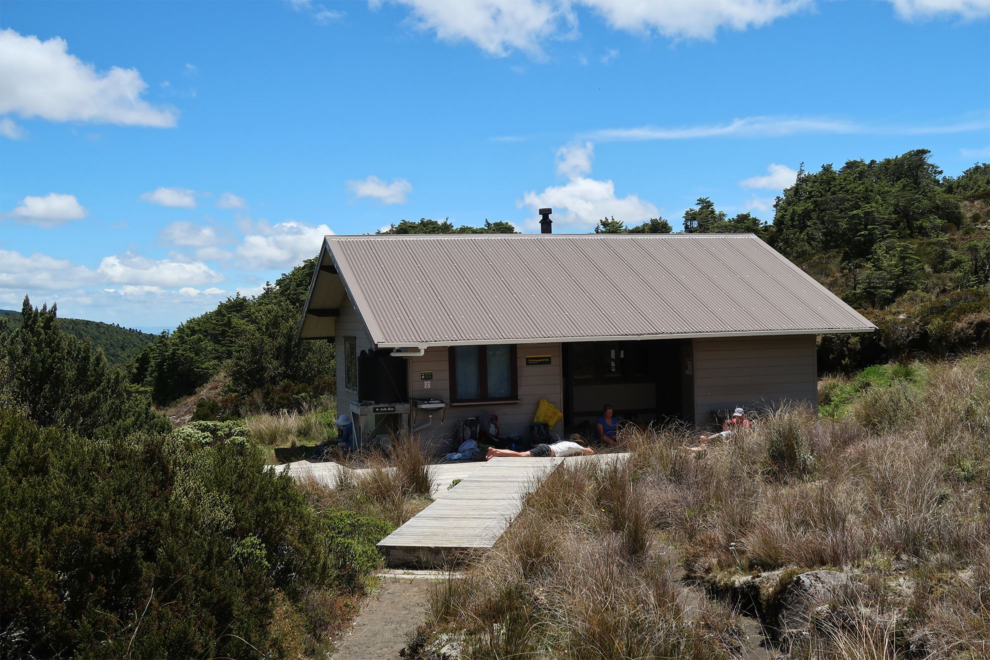
11 Whakapapaiti Hut, Tongariro National Park
A comfortable hut located on the northwest slopes of Mt Ruapehu
Whakapapaiti is an 18-bunk hut with a wood burner. It’s set right at the edge of beech forest at an altitude of 1250m. If weather and snow conditions are favourable, it’s quickest to follow the poled route from Bruce Road across open volcanic landscapes with great views. However, the best option in winter is the lower-altitude Whakapapaiti Track from Whakapapa Village, though you will have to cross Whakapapaiti Stream.
Whakapapaiti Hut is serviced; bookings are not necessary.
Grade Moderate Time 3.5hr Distance 8km


