
Kaikoura’s landscape and seabed was changed dramatically by the November 2016 earthquake, but most of the regular hiking trails have reopened. The following walks provide the opportunity to explore idyllic coastal trails spectacular mountain tracks.
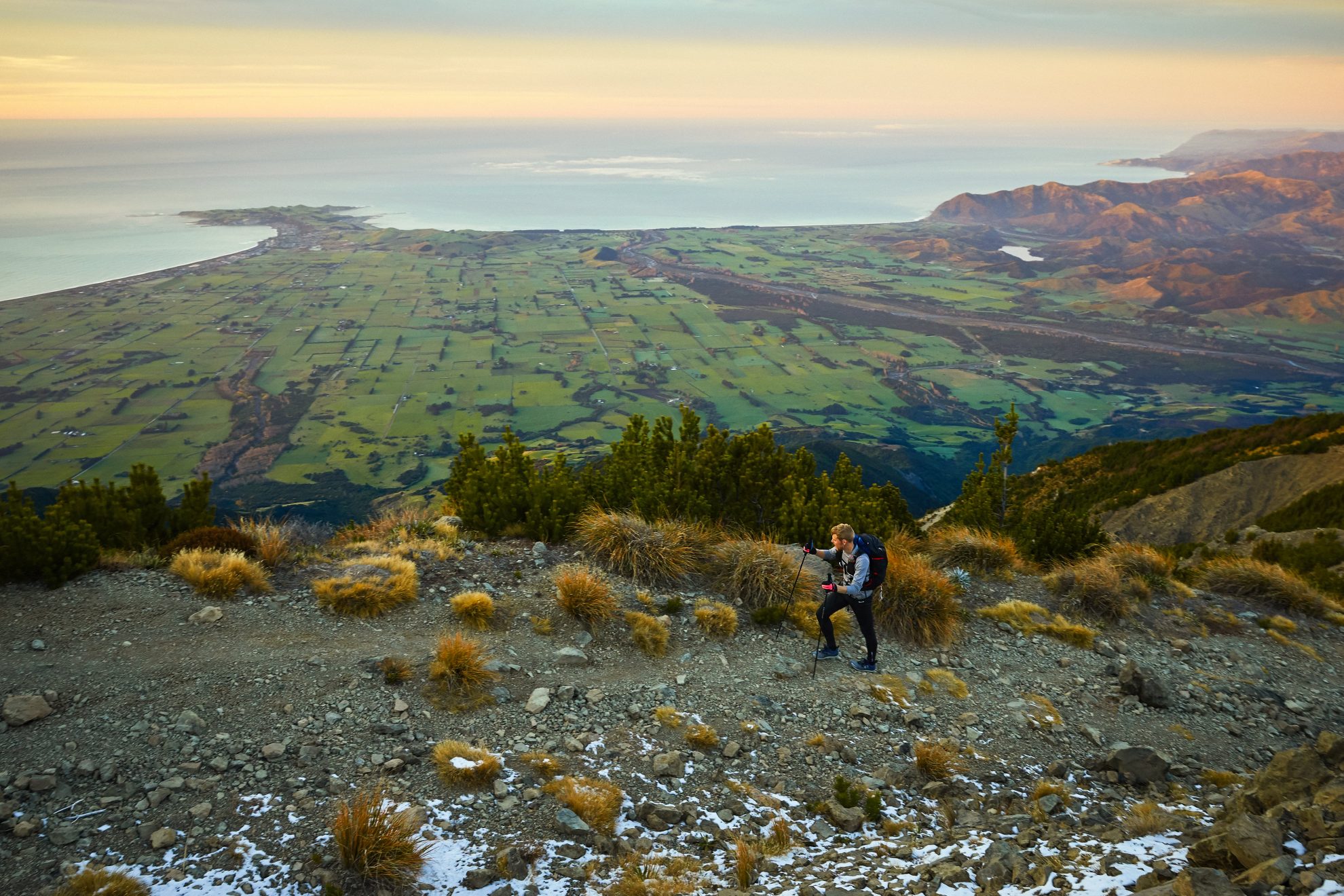
Mt Fyffe and Seaward Kaikoura Range
The eight-hour return Mt Fyffe Track to Mt Fyffe Hut and onto the summit offers rewarding views over the Kaikoura plains and peninsula. On a clear day, the view from Mt Fyffe extends to Banks Peninsula and the North Island.
From Mt Fyffe car park, follow the 4WD road up the mountain’s long south-west ridge. The road goes right to the summit. Those wanting a shorter journey could go as far as Mt Fyffe Hut (5hr return) or the lookout point near a fire-pond, which is just an hour above the car park.
Mountain bikes are permitted on this track, though both the ascent and descent is very steep and it will challenge those who try it.
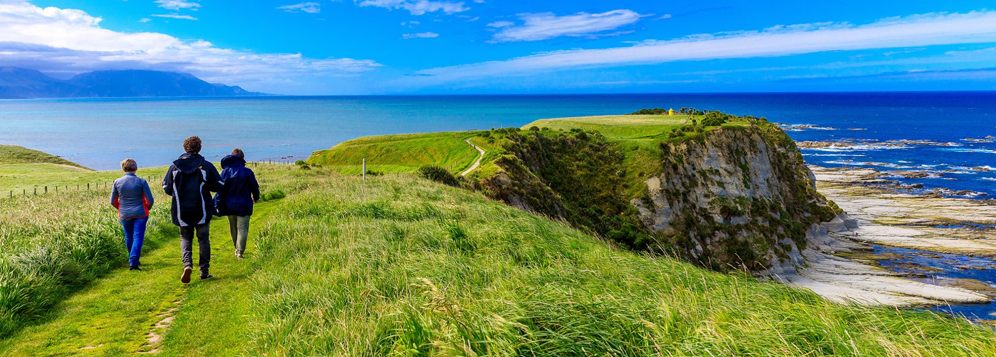
Kaikoura Peninsula Walk
The district’s signature walk is 4km from Kaikoura township. It takes walkers from the Point Kean seal colony and across the peninsula to South Bay. Apart from a short five-minute climb to get to the top of the peninsula, it’s an easy walk.
The power of the earthquake is on dramatic display from the peninsula. Aside from the wonderful views along the coastline, from here the upthrust seabed is visible. What was once covered by water at high tide is now green-coloured rocks. At low tide, it is possible to walk 1km on the seabed and visit the new ‘teenage seal hangout’ on the right-hand side of Point Kean.
The Peninsula Walkway is a two-hour return walk – add more time to explore the uplifted seabed.
It’s also possible to walk around the entire peninsula at low tide. This was not possible pre-quake.
What’s new
The 7.8 magnitude earthquake occurred at two minutes after midnight on November 14, 2016. It was the second most powerful earthquake recorded in New Zealand and caused two deaths, widespread devastation and $900 million in insurance claims.
Here’s what’s new:
1. The upthrust seabed has created New Zealand’s newest coastline
2. A 1km low tide walk around the seabed at Point Kean seal colony
3. A 60km cycleway and walkway between Okiwi Bay and Mangamaunu
4. At Whaler’s Bay there’s a new phenomenon dubbed ‘Hope Springs’, where kayakers can witness bubbles issuing from fissures in the seabed
5. A new surf beach along the Esplanade
6. The craypot-shaped Kaikoura Museum
The Kaikoura Coast Track
Discover a coast with abundant marine life, tussock-covered tops and farmland on this two-day private coastal track.
You’ll relax at lunch shelters with great views while enjoying a hot drink. You’ll tramp through bush-filled gullies to views of the Seaward Kaikoura Range, which seems to rise straight from the Pacific Ocean.
The track covers 13km each day, with the number of walkers limited to 10 a day. The track is open from October to April and bookings are essential. Visit www.kaikouratrack.co.nz for details.
Short Walks
There are numerous short walks to fill time in your day.
Fyffe-Palmer Track: A 75-minute loop starting at the Mt Fyffe Road car park, a 10-minuteOhau Stream Walk is closed and won’t be reopening in Dcember. drive from town.
Hinau Walk: A short 45-minute loop track highlighting different tree species of hinau, mahoe, putaputaweta, broadleaf, tree fuschia, pigeonwood and a stand of kanuka. The track starts at Mt Fyffe car park.
Haumuri Bluffs: A moderate to difficult walk around limestone bluffs. Sometimes you can spot marine life. The bluffs are 15-minutes south of town. Tidal access required and there is no entry through Oaro settlement.
Puhi Puhi Reserve: A flat 10-minute loop track in a scenic reserve with lowland podocarp forest. Access is 12km north of Kaikoura on the metalled Puhi Puhi Road.
What’s closed?
Getting there
34 years of inspiring New Zealanders to explore the outdoors. Don’t miss out — subscribe today.

Questions? Contact us


