Cross beneath Taranaki Maunga and striking rock formations, through one-of-a-kind Ahukawakawa swamp and to mirror-like Pouākai Tarn.
Pouākai Circuit rivals some of the Great Walks for its dramatic, pristine landscapes, views, variety of plants and wildlife.
The circuit can be walked in either direction. This description proceeds clockwise and includes the sidetrack to Bells Falls.
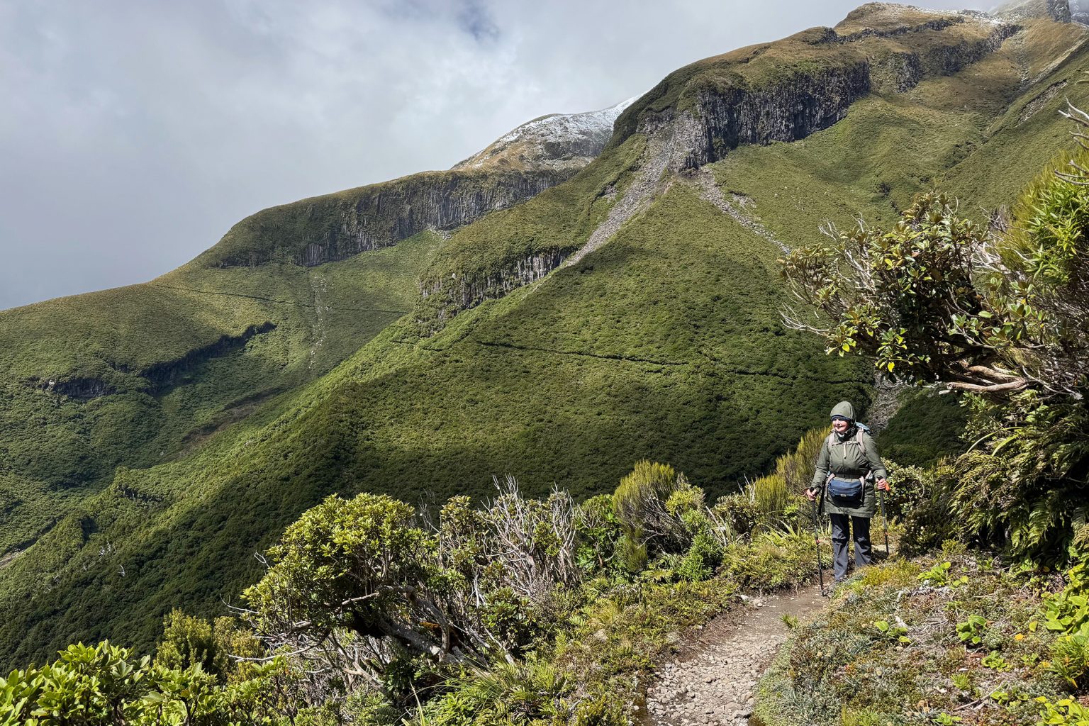
Take Holly Hut Track from the Camphouse past the visitor centre. It’s well-formed, metalled and flanked by dense montane forest that thins during the climb. The circuit’s highest point is on Razorback Ridge (1182m), about 1.5km from the trail head, and serves as a useful barometer: is it safe to proceed? The weather can change rapidly and snow and gale-force winds can occur even in summer.
Unusual rock formations tower above, among them Ambury Bluff and Humphries Castle.
At the junction with Plateau/Maketawa Track, turn right and continue on Holly Hut Track, gently ascending through hardy sub-alpine scrub. There are numerous small gullies to cross, some with rockfall warnings. Pass beneath Dieffenbach Cliffs – named after Ernst Dieffenbach, the first European to summit of the maunga in 1839 – to reach Boomerang Slip. Proceed with care.
Keep left at the intersection with Kōkōwai Track and descend 2.5km to the Ahukawakawa Track junction. Keep left again. Cross Minarapa Stream – an easy rock-hop in dry weather – to reach Holly Hut, 5min further on.
The side trip to 31m Bells Falls (allow 1.52hr) edges down around The Dome on a rooty, uneven track that ends with a distant view of the falls. Most impressive is the sheer cliff-face over which the water tumbles.
Return to the Ahukawakawa Track junction and descend the steps to a viewing platform that overlooks fragile Ahukawakawa, a sphagnum moss wetland that was formed about 3500 years ago when debris from an eruption blocked Hangatahua Stony River between Taranaki Maunga and Pouākai Range. A boardwalk snakes across the wetland before a stepped climb along the spur through pockets of wind-sculpted mountain cedar.
At the junction with Pouākai Track, turn right and pass beneath the Hump. Turn left onto Mangorei Track at the junction soon after and walk 5min to reach Pouākai Hut (1190m).
Pouākai Tarn is a further 10min along Pouākai Track.
Continue along Pouākai Track, which sidles past Maude Peak – it’s boardwalked and stepped all the way to the bushline on the far side of Henry Peak. The ascent of Henry Peak is stepped and laddered to the 1224m summit and offers possibly the best view of Taranaki Maunga.
It’s now down Kaiauai Track for several hours. Once in the bush, track conditions deteriorate. Eroded in places, there is some tree fall, it’s rooty and you’ll need to watch for markers. After passing Kaiauai Shelter, cross the swingbridge over Kai Auahi Stream. The constant negotiating of streambeds feel never-ending, but quite abruptly, after crossing Waiwhakaiho River, the short track to Egmont Road is reached.
The quickest way to the start point is up the road (4km), or follow Ram Track, which runs parallel.