Venture into the wild along clifftop and coast at Whatipu.
The walk begins at the carved pou by the car park. Take Gibbons Track to the right. It crosses Whatipū Stream before climbing briefly to a fork where it continues up boxed steps to the right. The track is easy to negotiate all the way to the wetlands past Pararaha Valley. After 900m a kauri bench offers expansive views.
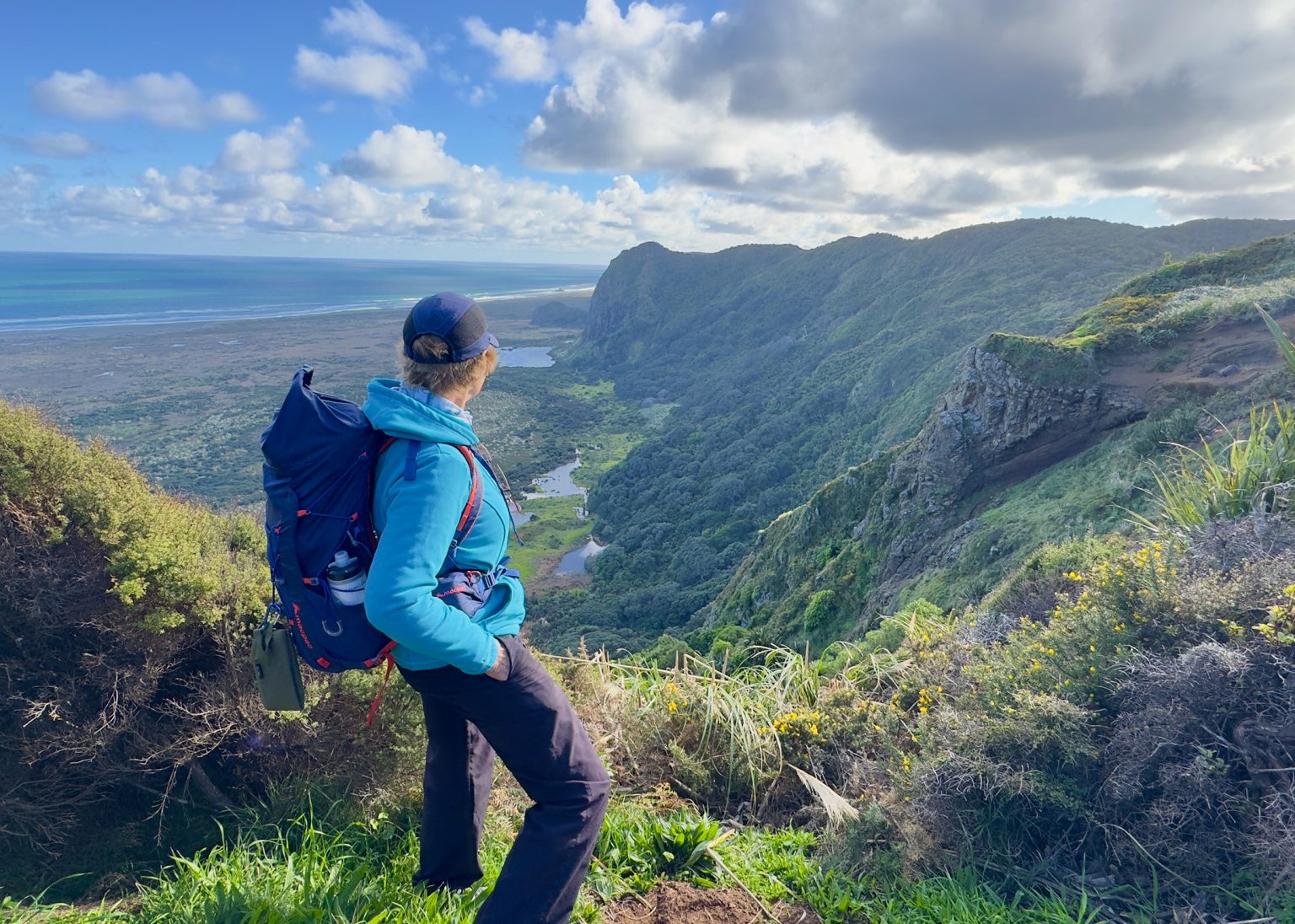
After a further 600m of steady climbing the gradient eases as the trail follows the ridgeline, first past Pt225, then Pt257 and Mt Gillies (289m). There are glimpses of the ocean through the trees, and just north of Pt225 a lookout facing north provides views across the wetlands of Taranaki Bay to Ohaka Head. Isaac’s Seat, 600m further on, looks west over the bush to the Tasman Sea.
Flanked by wind-shaped kānuka, regenerating kauri, tōtara, rimu, horoeka and tānekaha, the track rises gently with some boardwalked sections until, in 4.3km, it meets Muir Track, named after a couple who farmed the lower Pararaha Valley in the 1940s and 50s. The track descends alongside picturesque Muir Stream. It’s worth lingering to enjoy the sounds of bird life and stream as the track weaves steeply to the valley floor and Pararaha campsite. Here there’s seating, information panels, a shelter with running water (advised to boil) and toilets.
Take Pararaha Valley Track to the coast on a series of boardwalks and a curved bridge that crosses Pararaha Stream. On reaching the wetland, the boardwalk skirts the cliff before turning left through the wetland (Buck Taylor Track, straight ahead, is currently closed). It is part of Whatipū Scientific Reserve that comprises sand dunes, wetlands and salt meadows between Karekare Point and Whatipū. The wetlands are home to rare plants and diverse wildlife, including white-faced herons, fern birds, bittern and pied stilts. Once there’s sand underfoot it’s disconcerting to be heading north when you need to be turning south, but the path through the dunes finally branches left to the beach at 7.85km. Straight ahead there’s the option to visit Tunnel Point and campsite.
Allow 1.5hr to reach Whatipū along the black-sand beach. It’s easier walking on the hard exposed sand within a couple of hours of low tide, and more pleasant in cool, calm weather. Take extra water over summer and in any season prepare for strong winds on this wild, exposed coast. Don’t be tempted to take a shortcut across the dunes: there isn’t one.
The sight of Ninepin Rock indicates that Whatipū isn’t far off. You can’t get lost if you keep to the beach. There are several streams to wade across before the path through the dunes to the car park comes into view.