Located in the heart of the Richardson Range, Major Peak is one of the few easily accessible 2000m mountains in the Queenstown Lakes District.
Major Peak towers over a vast landscape spanning the Thomson and Ailsa mountain ranges to the west of Lake Wakatipu and the Harris Range to the east.
Although mountaineering equipment isn’t required in summer months, standing atop the 2126m peak is no easy feat. Tough scrambling and vital navigation skills are keys to success.
The track begins at the Lake Face Creek Falls car park. A poled route leads through a small forest where the base of the falls can be accessed. The route then ascends sharply on the waterfall’s edge until a fence is reached. Climb this and follow the orange marker poles across farmland.
The poled route eventually ends at a barbed-wire fence where Whakaari Conservation Area begins. Follow the fence line to a gate.
Good navigation skills are required from here. After the gate, ascend the spur straight ahead, keeping Lake Face Creek on your right. The first glimpse of Major Peak can be seen at the top of this section. Continue along this spur, following several rocky hills up to Pt1443m. Traversing the west side of each of these hills will save time and avoid unnecessary climbing and dead ends.
At Pt1443m the next stretch of the ridge can be abandoned at any point, as the best exit spot is subjective. However, leaving around the 1600m mark allows quicker access to the Major Peak face.
Now for the tricky part: which is the best route to the summit? Ascending the ridge too early will lead to a dead end at several steep bluffs with knee-trembling drops, and climbing back down can be a dangerous task.
The best place to begin the climb is where the western ridge of the summit appears to smooth out from the jagged peaks. After some rock-hopping across a boulder field, the terrain changes to relatively demanding scree slopes for the climb’s conclusion. Stay close to the solid rocky edges to access a strong surface for extra leverage. A few scrambles over solid rock may be required along the way to gain a higher slope to the summit.
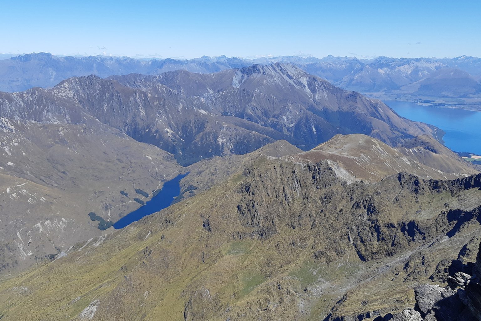
One last steep scramble is eventually rewarded by phenomenal 360-degree vistas. Stone Peak and Mt Larkins dominate the skyline to the north, and Ben More and the Richardson Mountains surround the rarely frequented Lake Luna to the south. Mt Bonpland and Tooth Peak tower over Lake Wakatipu to the west, and views to the east stretch as far as Coronet Ski Field and the Macetown peaks.
It’s a tough tramp for experienced trampers with good scrambling and navigational skills, but the breath-taking views make the hard going worth every second.