If you are time poor or can’t secure a booking for the full Routeburn Track, an out-and-back hike to Harris Saddle makes a spectacular day out.
Starting from the Routeburn Shelter car park, head west along the wide, well-graded track to cross the Route Burn. From here it’s a gentle ascent, just 200m over the next 7.5km, through beech forest to 20-bunk Routeburn Flats Hut. The track stays close to the river, providing glimpses of the clear blue water tumbling down the valley.
Soon after entering the Routeburn Flats, the track crosses the river. The hut is just over 1km from here, 200m off the main track, and its views over the Humboldt Mountains make it well worth the detour.
The main track now climbs 300m over the next 2km. Numerous waterfalls and views back over Routeburn Flats allow you to catch your breath. Kākāriki and kea can be seen in this section as well.
Routeburn Falls Hut is perched just below the bush at 1000m with impressive views over the flats below. This 48-bunk hut requires bookings from 1 November to 30 April.
A short scramble just above the hut offers multiple viewpoints of the Routeburn Falls tumbling down the mountain above and below. The return trip to the falls is a worthy day trip itself, especially if the weather is looking poor in the saddle above.
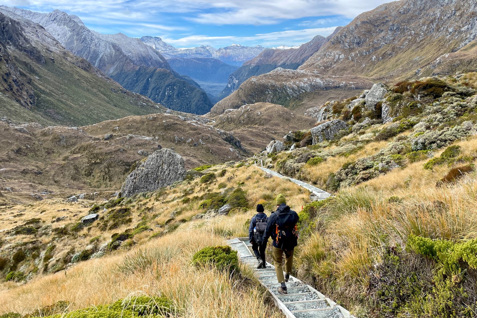
Past the hut, the terrain becomes more rugged and steep. After a short climb the track levels out and enters the alpine meadows and tussock grasses of Harris Basin. Wildflowers dot this section in summer; in winter, snow can be present. Note that there is a risk of avalanche here, so be sure to check the alert levels in winter.
As the track heads through the basin, the views become increasingly dramatic. Near Lake Harris the path starts to skirt around the steep slopes to the left of the lake’s edge. Lake Harris sits just below the saddle at 1225m with towering Mt Xenicus behind it.
Harris Saddle is wide and flat and has an emergency shelter. At 1255m, it is the highest point on the Routeburn Track. It has phenomenal views of the Hollyford Valley and Darran Mountains, and the vista back down the Harris Basin is equally impressive.
If there’s a bit left in the tank, the steep but short 300m climb up Conical Hill offers 360-degree panoramic views. Otherwise, head back down the track the way you came. From Routeburn Falls Hut, the wide, clear track allows fast walking back to the trailhead.