Overlooking Lake Ōhau, the 1522m Ben Ohau imposes its tussocked body onto the land and entices day walkers upwards. By Ashlyn Oswalt
With stunning views from Ben Ohau summit and the ridgeline traverse, the Greta Track is worth walking in every season.
Beginning at the car park on the southern bank of Gretas Stream, walkers are greeted with signs warning of wallabies and rolling hills ahead.
Just a few minutes after starting out, the derelict Back Hut is reached. This hut dates from the 1890s and is a relic from the area’s musterer heritage.
From the hut, continue south-east onto a well-worn and well-signposted track. The grassy track zigzags along a 4WD road to the top and though this trail is no longer used by vehicles, it is shared with mountain bikers. It’s a wide easily walked pathway with space for all users.
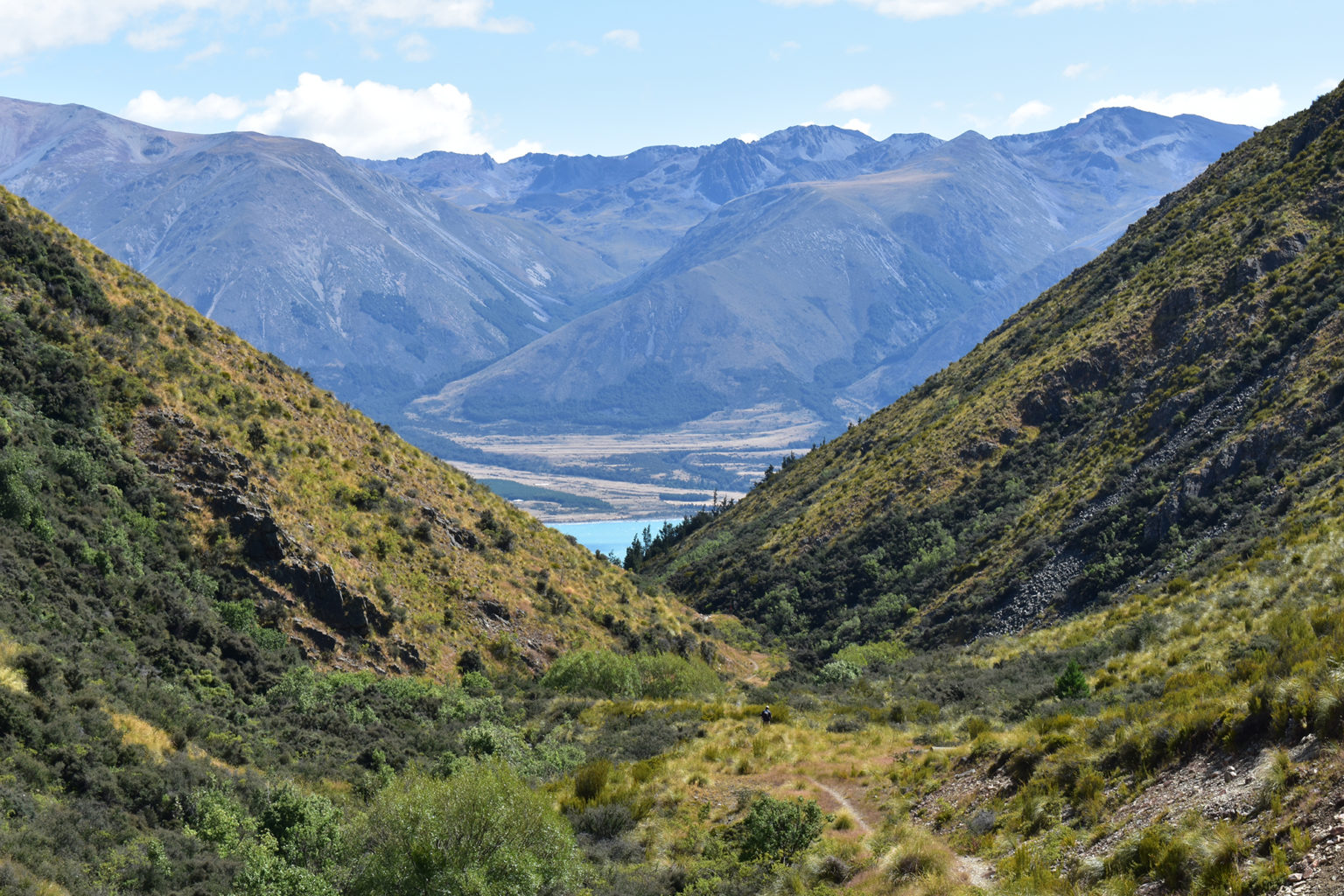
The trail weaves through tussock and a mix of native and non-native plants, some large enough to offer shade on hot days. After about 45-minutes, the track opens to an exposed, relatively straight ridgeline where the route ahead, along the exposed tops, can be seen. It looks slightly daunting, so if you discourage easily take in the stunning views of the lake and valley below instead. Directly opposite, on the western side of Lake Ōhau, is the Ohau Ski Field.
The trail continues on a gradual uphill gradient to pass along the western and northern slopes of Ben Ohau to reach a saddle between Pt1387 and the 1522m peak.
Ben Ohau’s summit is a 10-minute deviation from the track at this point – a straight shot up to the top, though it can be unpleasant in windy conditions. In such cases, opt instead to satisfy yourself with the views from the ridgeline, which are equally as stunning and are less gruelling to achieve.
Back on the track, the ridge stretches out for just over 2km in a gradual descent towards the track junction leading to Gretas Stream.
The views on this side of the summit are a change of scenery, falling upon the Ohau River and canal. The trail though is still a wide easily traversed 4WD track.
Around 200m east of Pt1150, the trail branches northwards to begin the descent into Gretas Stream. The landscape here is a sharp contrast from the yellow and orange, almost desert-like landscape above. Lush greenery awakened by the stream, pokes out amongst native beech, tōtara and mānuka and offers a cool reprieve from the exposed tops.
The trail now follows Greta Stream and walkers can expect to get their feet wet as the track crisscrosses the stream several times on the 7km descent back to the road. The crossings are not treacherous – only ankle or shin-deep – but it’s icy mountain water.
The descent is consistent and as altitude is lost, tree cover returns to provide shade on hot days. Directly beneath Pt1012, there’s a final climb of 60m to get out of the stream. From here, the trail passes through farmland before popping out onto the road at Greta Lodge. Turn left (south) to walk the remaining few hundred metres back to the car park.


34 years of inspiring New Zealanders to explore the outdoors. Don’t miss out — subscribe today.

Questions? Contact us


