From Holdsworth Lodge, we hauled our heavy packs along the family-friendly gravel track, over a bridge across the Atiwhakatu Stream and along a pleasant trail up the valley for lunch at Atiwhakatu Hut.
My energetic pace was abruptly curtailed by Raingauge Spur, a relentless climb on a natural staircase of tree roots. We were slower than a herd of turtles stampeding through peanut butter. After an age the gradient eased, the forest thinned, and we topped out above the bushline to find Jumbo Hut resplendent in white livery. As darkness fell, the wind came howling over the ranges. Far below, Masterton twinkled in the night.
By dawn the weather had changed but the forecast was not good. We were at a critical point and were troubled with indecision. Should we proceed north over the notorious Broken Axe Pinnacles, or abandon the dream and head south to safer destinations? We chose the latter, climbing Jumbo (1405m) then traipsing along a tussock ridge to the trig station on Mt Holdsworth (1470m). I’d been here before in a cyclone – my girlfriend was knocked over like a skittle.
Predictably, the rain arrived and we scuttled down to the welcome refuge of Powell Hut. Next morning we watched dozens of athletes running up Mt Holdsworth in marginal conditions. While a race crew diligently identified each runner, the annual Jumbo–Holdsworth Trail Race was called off. The bedraggled participants reluctantly headed back down the mountain. Winds were gusting at 70km/h, visibility was minimal, and rain lashed the hut without reprieve – it was a mission just to visit the longdrop.
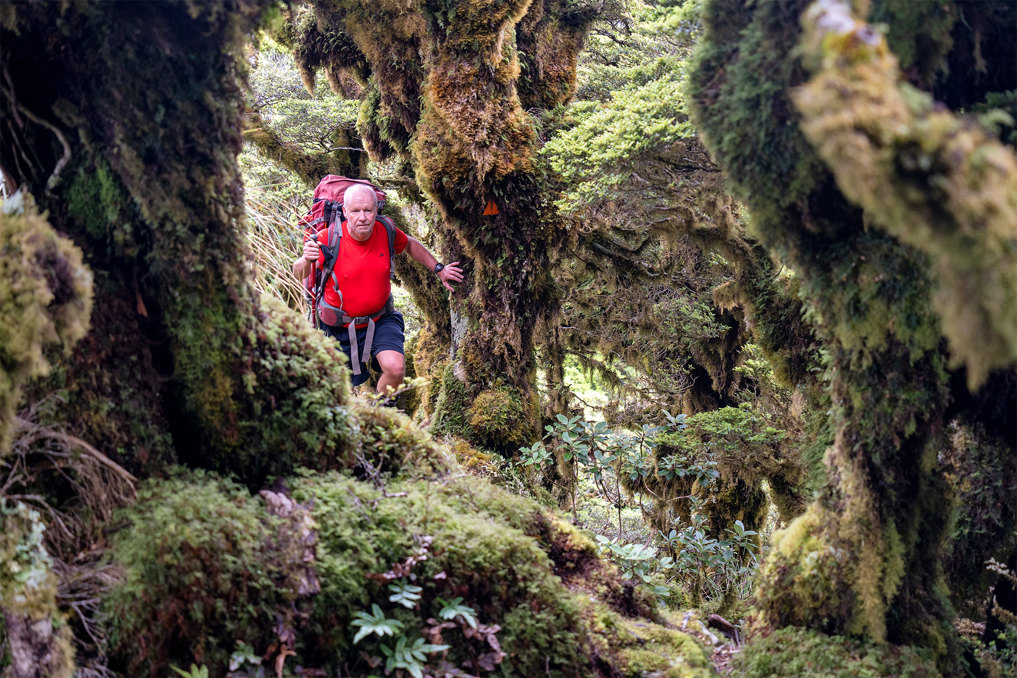
We stayed for two nights and once again we considered our options. Should we abandon this journey or attempt a shorter, five-day circuit? Malcolm talked me out of my ambivalence, and we donned raincoats and clambered up the rocky path into a monochrome world of swirling mist and silhouetted shapes. We tentatively moved westward, down a sculpted spur toward the triangular form of Isabelle (1385m). Below the bushline the track wove through goblin forest where broccoli trees and mossy rocks were clothed in lush green – beautiful.
We lost 1000m of altitude and arrived beside the lovely Waiohine River, sparkling in summer sunshine. Time for a swim.
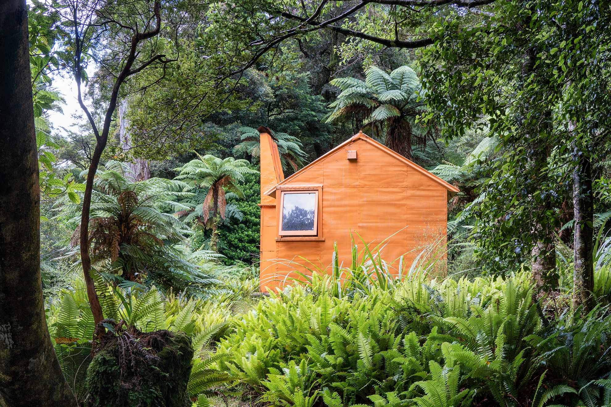
Author Mark Pickering once wrote, ‘It was the NZ Forest Service that had the will to scatter orange huts across the wilderness like Jaffas sent rolling through the landscape.’ Mid-Waiohine Hut, a six-bunker painted rescue orange, was built in 1962 and is the sole S70 design in all of Tararua Forest Park. There’s an open fireplace, wire bunks and a new rifle rack. It sits above the roaring river among towering rimu and crown ferns and is maintained by a volunteer group of ex-cullers.
We woke to the promise of fine weather. Five goats were moving slowly upstream as we took half an hour to negotiate the high sidle track above the river. Crossing a vintage swingbridge, we faced two rock steps and a side creek before a gruelling climb up the prominent spur on the eastern flank of Aokaparangi (1354m).
It took three hours to reach the luxuriant goblin forest where the gradient was easier. We pushed on to the summit as mist enveloped the mountain and then, further south, a signpost sent us downhill to bag the modern two-bunk Aokaparangi Hut, where we filled our drink bottles from the rain tank.
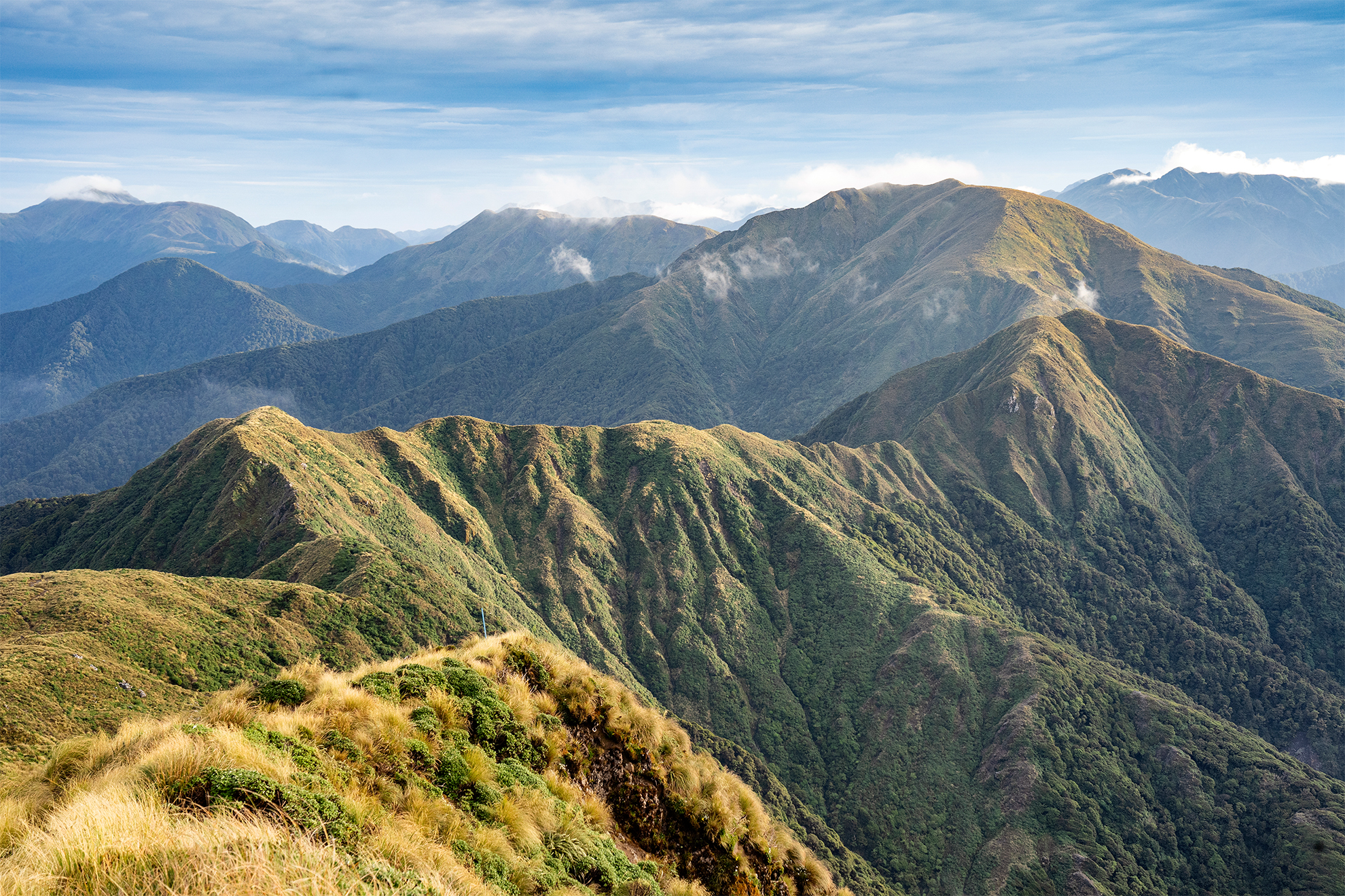
Back on the Main Range, we recalled the tragic history of hypothermia-related deaths in these hills. We gained four false summits before reaching the top of Wright (1196m). I was enjoying this ridgetop ramble, balancing on the backbone of the North Island, the spine of Māui’s fish, as mountains materialised from the mist. Three rock steps required care as we dipped into a saddle. The meandering tussock ridge rose to the top of Simpson (1174m) before our progress was slowed by two more rock steps.
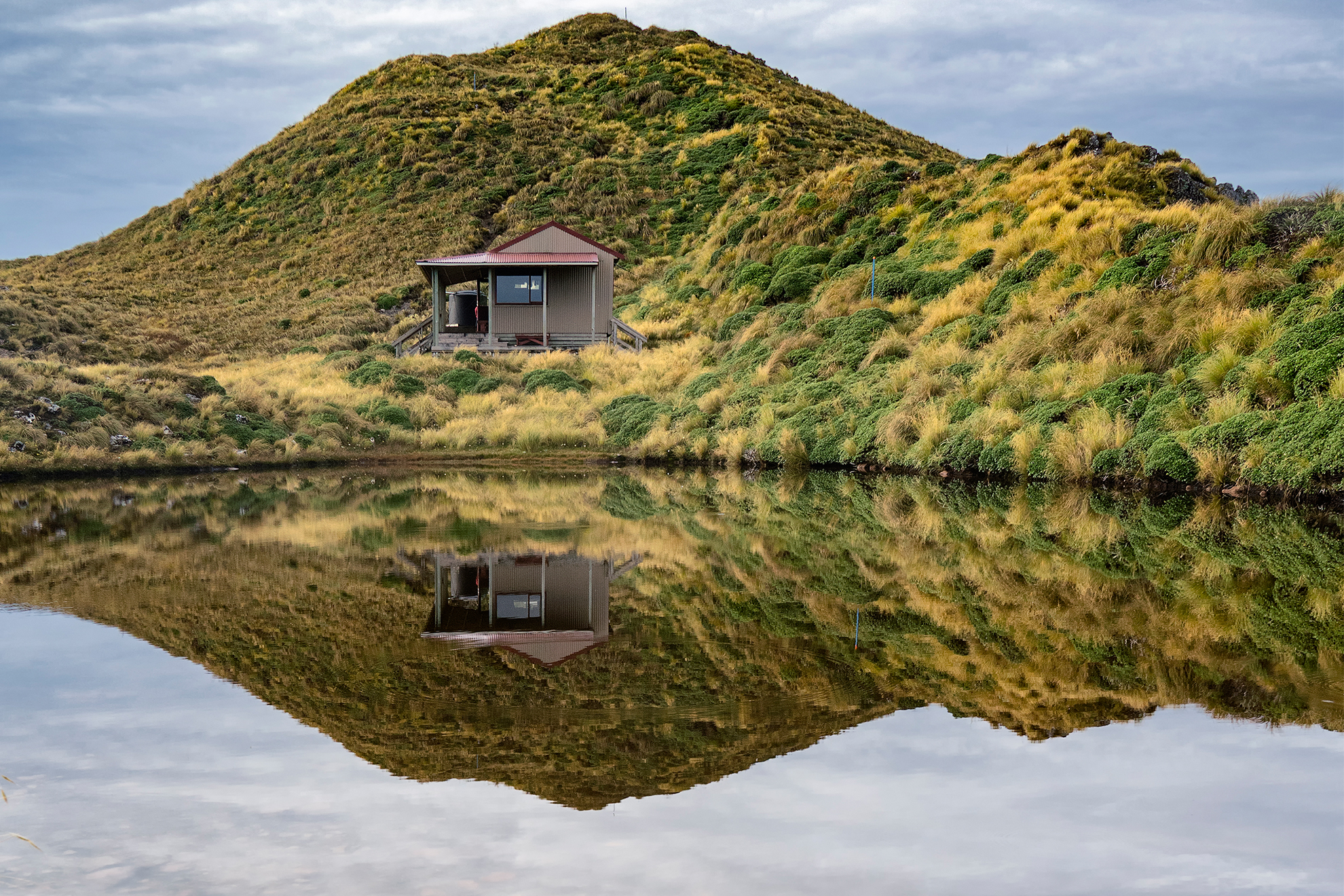
It had taken nine hours to reach the grassy plateau below Maungahuka (1330m) with its namesake hut reflected in a small tarn. These red-roofed 10-bunkers are my favourite design: simple, modern, well-sited tops huts with a generous balcony. Thumbing through the hut book I saw that ultra-runner Tim Sutton had slept here a fortnight earlier while attempting to traverse the length of the Tararua Range in a single weekend. In 2017, Sutton succeeded in climbing all 15 of the 1500m peaks in two days, nonstop, solo and unsupported.
We rose from our lofty seclusion at Maungahuka Hut. In the east the clouds parted to reveal a commanding view. Kāpiti Island floated in the western sky. We chose to tackle the Tararua Peaks (1325m), merely 500m from the hut. On top of Maungahuka we made a decisive right-turn to face the twins, Tunui and Tuiti, fantastical monoliths that thrust up from the depths. A ground trail threads up and over vertiginous slopes, negotiating tricky rock steps and culminating in a 25m steel ladder climb. Malcolm was excited; his engineer’s brain loves solving puzzles and this was the ultimate in problem-solving. As we began the approach, however, anxiety got the better of me and I turned back.
My mate soon disappeared over the first scrubby knob. I waited. Silence. Twenty minutes later Malcolm was vaguely visible on a tricky traverse. Swirling clouds erupted from the Hector Valley below, engulfing the peaks. To the southwest the dark green folds of Pukemoumou Mt Hector were revealed – ‘the Hill of Desolation’. Silence. Some 45 minutes elapsed before I spotted a lonely figure on the high peak. He had conquered ‘the ladder’.
Malcolm returned safely, and back at the hut we were surprised when a trio of thru-hikers arrived on a detour from Te Araroa Trail. After walking for two months from Cape Rēinga, they were lean, mean tramping machines. We pulled ourselves away from the temptation to socialise and shouldered our packs.
From Maungahuka’s jagged summits we dropped down an undulating ridge that broadened below the bushline. For the third time we were in goblin forest, a verdant corridor of green. From Concertina Knob the pleasant trail switched to the south. We descended a moderately steep spur to the Hector River. Over a swingbridge lay Neill Forks Hut, another six-bunker standing above a rocky river.
It was our seventh day in the wilderness and the rain held off. We walked along picturesque Neill Creek before a steep spur track rose to gain 600m. At times both hands were required to haul ourselves heavenward; at other times the spur levelled out to a more manageable gradient.
Again we topped out into glorious goblin forest, this time to join with Cone Ridge. Finally, we headed northeast along a delightful avenue that dropped into the Waiohine River. Time for a swim! Skinny-dipping in the sunshine, we were mindful of our exposed position on the river bank, but it was worth the risk to enjoy a wash in the wilderness. Inside the capacious 20-bunk hut at Totara Flats we spent a decadent afternoon reading a pile of Wilderness magazines and drinking tea. The forecasted front arrived and rain drummed on the roof.
It was our last day, and we left the empty hut to climb through bush to rejoin the Jumbo–Holdsworth circuit and onto the Gentle Annie Track back to the car. A hot pie, custard square and cappuccino awaited us in a Masterton café.
In eight days we had added eight new huts to our tally and summited eight peaks. We’d walked the popular Jumbo–Holdsworth loop and completed a demanding circuit in the mid-reaches of the Waiohine catchment. Not our original scheme, but in my books, any time spent in the mountains is a good time.