Iron-infused rocks create unique red landscapes where plant life struggles and boots are torn asunder.
Where Te Araroa Trail passes through the southwest corner of the Richmond Range towards St Arnaud, jumbles of curious rusting red rocks, stunted beech trees and boggy alpine wetlands combine to form unique natural landscapes.
The red rocks are part of an ancient and long arc of rocks called ophiolites or ultramafics that are high in minerals such as manganese, iron, chrome and copper. They were originally parts of the oceanic crust, since uplifted. Te Araroa founder Geoff Chapple’s exquisite book Terrain (2015) offers an absorbing explanation of the geology of Red Hills that far exceeds my ability to describe it, but here’s my attempt: iron lends these rocks their literally rusty colour, while the other minerals create toxic soils that make plant colonisation difficult. Hence the stunted beech trees and curious alpine plants that have adapted to the soils.
Areas of this rock exist across a swathe of Te Wai Pounamu mountains, having been dragged apart over millennia by the grinding separation of the Australian and Pacific continental plates. The maunga of our several so-named Red Hills are fascinating places to visit, although some – famously those of Otago – are remote. A word of advice: take a decent pair of boots. Ultramafic rocks can destroy even the hardiest of footwear.
Dun Mountain, Mount Richmond Forest Park
Nelson’s accessible Dun Mountain Trail is the route of a former coppermine track, now popular with mountain bikers and trampers. Rocks Hut is a pleasant and comfortable place to stay overnight, allowing more time to explore the fascinating nearby area.
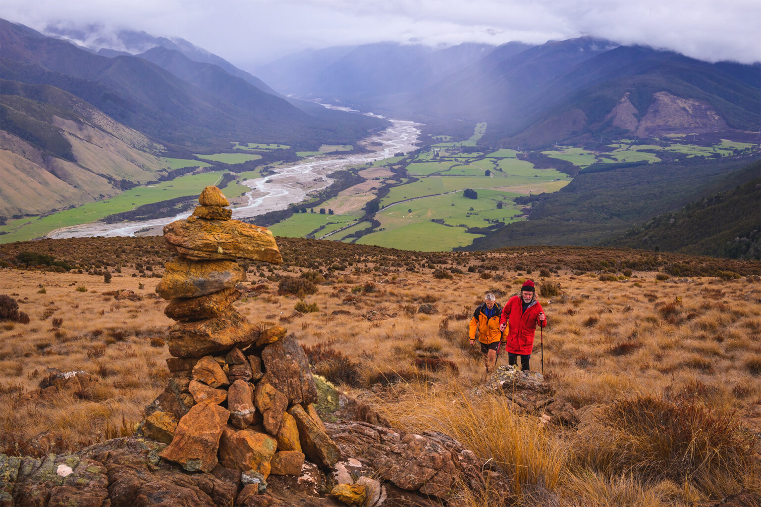
Red Hills Hut and Plateau, Mount Richmond Forest Park
Red Hills Hut was originally built in the 1960s by New Zealand Air Force personnel as a mountain retreat for weekends away from their Woodbourne base. DOC replaced the old hut with a six-bunker in 2010, which was excellent timing considering the subsequent popularity of Te Araroa. Red Hills Hut is easily accessible in 2–3 hours on an old vehicle track from Six Mile Creek near SH63.
Trampers could explore the long ridge leading northeast from the hut, which culminates in the craggy summit of Red Hill (at 1791m it’s the highest peak in the Richmond Range). Allow time to visit The Plateau, where a mosaic of small, dark peaty tarns, red tussocks, curious rock stacks and boulder jumbles make for a fascinating few hours of walking.
It’s also possible to link the Maitland Ridge MTB Track with Beeby’s Knob and hut to make an interesting circuit ending at Lowther Road.
Red Mountain, Mount Aspiring National Park
Red Mountain (1705m) is in the heart of the Olivine Wilderness Area. It requires a high level of experience, good navigational ability and several days to get there. While there are various routes (consult Moir’s Guide), most parties opt to travel up the Cascade Valley.
Cow Saddle, Mount Aspiring National Park
Those without the time or skills to reach Red Mountain could consider tackling the famous Five Passes route, a rugged but well-defined route between the Beans Burn and Rock Burn in a more accessible section of the Olivine Wilderness Area. The route traverses gorgeous valleys and five passes: Sugarloaf, Park, Fohn and Cow Saddle plus Fiery Col. The latter name reflects the area’s ultramafic rock, which lies in prominent jumbles on this pass.
There are no huts, but camping spots are plentiful and there’s a handful of rock bivouacs. A reasonable time to complete the circuit is 5–6 days, but allowing a week leaves time for exploration as well as flexibility around weather changes and river levels.