Three places to see beautiful lakes created from colossal destruction
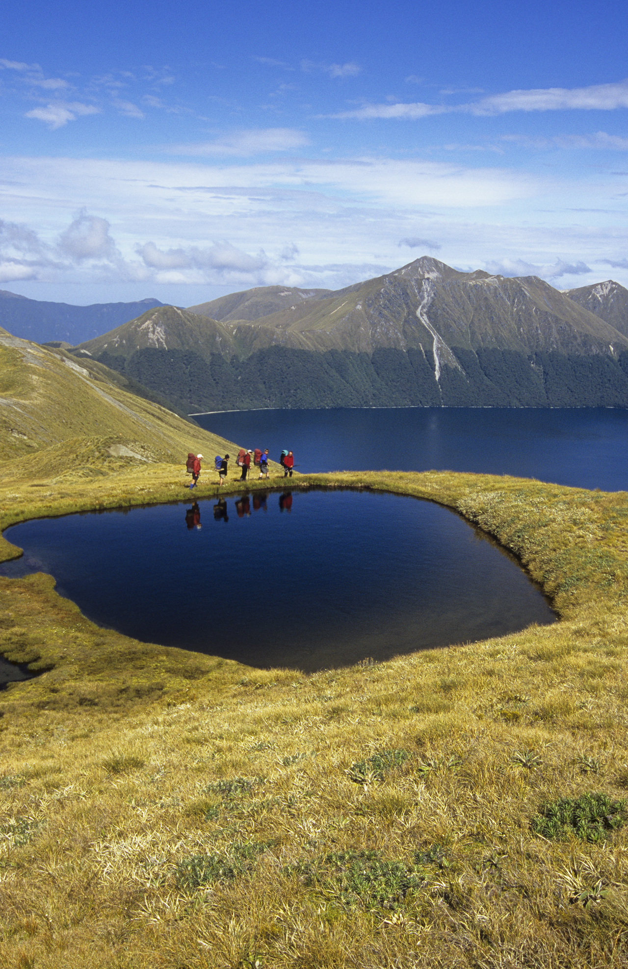
Perched high on Panekiri Bluff, overlooking Lake Waikaremoana, the arms of the lake sprawl in every direction like a great tentacled creature. Entirely surrounded by bush, the 56km2 lake is one of largest in the North Island after Taupo, Wairarapa and Rotorua.
It’s a hauntingly beautiful place. I’ve tramped around the lake a couple of times, overlooked it from nearby Mt Manuoha, and paddled its waters in a Canadian canoe. A rough translation of the Maori name, sea of rippling waters, refers to the tempestuous nature of the lake’s surface, which is often tested by gales and storms. Strange to think the lake has only been inexistence for some two millennia.
Approximately 2200 years ago, an immense rockfall off the Ngamoko Range dammed the Waikaretaheke River, creating the lake. Humans undid some of the effect by creating a hydro scheme at the outlet in the 1940s, lowering the lake level slightly.
Nearby Lake Waikareiti, arguably even more lovely than its larger neighbour, was likewise created from a similar, much older, event around18,000 years ago.
Such events in a mountainous, unstable country like New Zealand are not uncommon, and indeed some lakes have been created this way very recently. In the North Branch of the Young River, Mt Aspiring National Park, a landslip created a new lake in September 2007. At first geologists feared that the dam could collapse, sending a wash of pent-up water and debris down river, and DOC temporarily closed the Young Valley Track to trampers. The dam seems to have settled, with the lake a semi-permanent feature, although DOC still warns trampers to stay away from the valley during periods of high rainfall – when high lake levels could cause the dam to collapse.
Many lakes formed from the aftermath of landslides prove short-lived. After the 1994 Arthur’s Pass earthquake, debris damned the Anti-Crow River, forming a small lake that lasted some months before the waters filtered away through the boulder jumble.
Lakes Waikaremoana and Waikareiti, Te Urewera National Park
Both these lakes are scenic highlights of the North Island. The 4-5 day Waikaremoana Great Walk circles the southern and western sides of the lake, while an overnight track leads from Aniwaniwa to Sandy Bay Hut at Lake Waikareiti.
Lake Daniell, Lewis Pass National Reserve
This tranquil, blue-green lake occupies a forested basin beneath beech-clad hills. The lake is thought to have been formed by a landslide, as was nearby Lake Christabel. Reminders of these destructive forces struck tragically in 1974 when three trampers occupying an angler’s hut on Lake Daniell’s shore were killed in a small rockfall. The existing Manson-Nicholls Memorial Hut, built in 1976, commemorates them. To reach the 24-bunk hut, tramp on the easy three-hour track from the Marble Hill camping area, near Springs Junction.
Green Lake, Fiordland National Park
According to a DOC information panel overlooking the Hunter Mountains from Borland Saddle, Green Lake resulted from the world’s largest known landslide some 12,000-13,000 years ago. The GNS Science website says about 9km of the Hunter Mountains collapsed, with the debris stretching over some 2.5km. Such is the scale of it that its full extent can only truly be appreciated from the air. The debris cut the already-existing Lake Monowai in two, creating a second long lake in the Grebe Valley that has now infilled. Green Lake, the site says ‘is a large landslide pond formed at the foot of the head scarp.’ Amazing.
DOC built a 12-bunk hut beside the lake in 2006 which is reached on a pleasant track from the Borland Road. Alternatively, from Borland Saddle, a spectacular route leads over untracked tops to the lake.