Mt Richardson, Mt Thomas Forest
Mt Richardson lies along the first rank of foothills to the north-west of Christchurch between Mt Oxford and Mt Thomas. While it is neither an imposing summit, nor difficult to access, it is one of my favourite short hikes as the 600m climb to the 1047m summit includes a great diversity of flora and the view from the top is impressive.
On this particular occasion I was ridge-top bound in the small hours of night, hoping to crest the top in time for sun-up and some extra-special predawn photos.
I had weathered the night at the picnic area at the base of the mountain, eschewing a tent and camping under the stars on a stretcher with my sleeping bag. The night was fantastic, particularly when lying on one’s back amid the warmth of down and just gazing upwards at the slowly passing parade of celestial majesty. Yes, the simple pleasures are often the best.
Rousing myself wasn’t easy, but a quick cuppa and some breakfast helped get me under way. Then I was into the forest with headlamp and pack, spooking a few deer as I passed, summit-bound.
The hike up was pretty brief, though steep in parts, and by the time I reached the upper mountain there was a cool breeze sweeping in from the north-west and the sky was just bright enough for me to turn off my headlamp and proceed in the twilight.
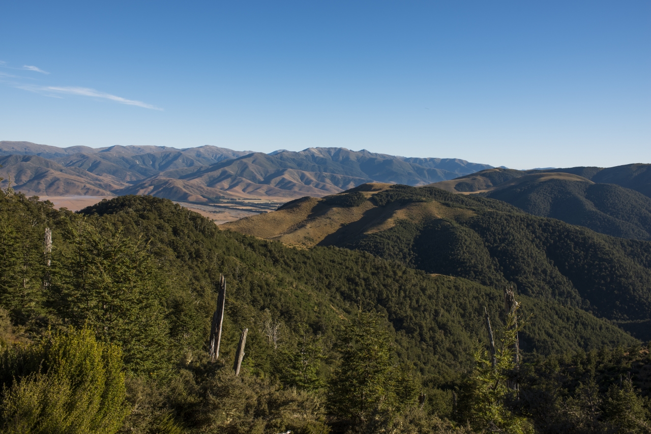
The summit, if you can call in that, was an anticlimax. I rolled out of the final vestige of forest cover onto a tussock mound and that was it. There’s a trig and sign to confirm you have actually arrived at the top and a few rocks to sit on while savouring the view, which is a good one.
Stretching from the wasted flanks of the Puketeraki Range, beyond Lees Valley, over Mt Oxford, past the gaunt Torlesse Range and on south to Mt Hutt, your eye follows the curve of the ranges south and then east out over the Plains to Banks Peninsula and then north again to Mt Grey and the coastal plain near Amberley. It’s a good reward for the hike up, yet there’s more. Just along the summit ridge, where the track continues through tussock and forest there are intimate views of Lees Valley and the Plains, glimpsed through a forest window or across a tussock clearing. It is these that I find most appealing about Mt Richardson. Some trampers have camped up here, though water is scarce.
I prolonged my stay and headed north of the track through forest to an open space dominated by tussock and then back into the bush again where a feeling of remoteness pervades. There is no proper track on this section and some good bush skills are required to keep your bearings, but the sense of discovery and isolation is remarkable considering I was barely a kilometre from the track.
The day was especially beautiful and I was in no hurry to leave my summit of seclusion so took the time to seek out a few new routes and camping spots amid the mosses and forests beyond the summit.
I will need to return, there’s much more to Mt Richardson than a summit view.