The Great Barrier forest clings to the spine of the island and is the home to a number of threatened species. It was ravaged by loggers in the early part of the 20th century, with the Kauri Timber Company in particular removing a huge amount of native forest.
Then in the 1950s the New Zealand Forest Service bulldozed a road through the island that now provides easy walking or mountain bike access into the heart of Great Barrier.
From Port Fitzroy an easy walk took us along the start of the Forest Road and into Kaiarara Hut, a large but comfortable hut set in attractive forest next to the pleasant Kaiarara Stream.
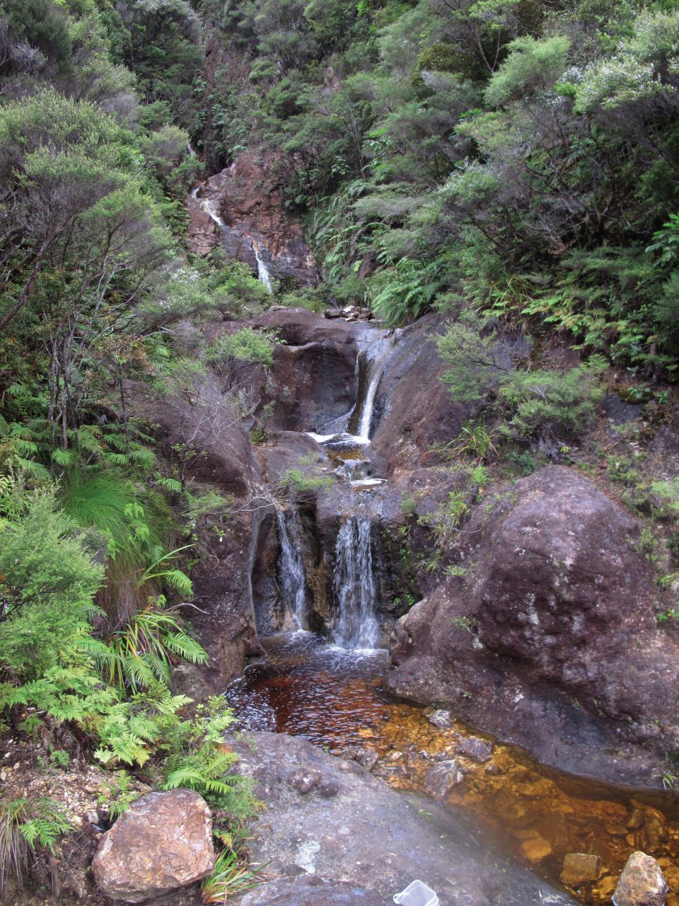
We followed an easy track up the north branch of the stream. Glimpses into the streambed itself revealed open but difficult travel with lots of bedrock and small falls. This is the result of the logging techniques that were practised on the island. Once the kauri was felled, the trees were held behind dams in the steep streams. A mechanism was then tripped and a man-made flash flood of water and trees roared down the valley carrying the logs to the coast. Decades later, the streambed still shows the damage caused by this practice.
We soon arrived at the sign that marks the short track down to an extant kauri dam. This is an impressive feat of bush-engineering and is an important relic.
The track continues to climb and occasional glimpses of the stream revealed the same scoured bedrock and derelict remains of other dams. At the last stream crossing the track begins a very steep climb, assisted by modern engineering: hundreds of steps carried us towards the summit of Mt Hobson the highest point on the island. Just below the summit is a major intersection with tracks (and further steps) leading towards Windy Canyon (worth a look in its own right) and Mt Heale. The steps here are not just to assist the tramper – they protect the endangered taiko (storm petrel) which nest in the cloud forest up here.
We headed up to the trig for great views of the island and neighbouring Little Barrier, and signed the ‘summit book’.
Then it was back to the intersection and South towards Mt Heale. Mt Heale is an impressive ‘thumb’ of volcanic rock and the good track sidles it. Just past the junction with the Peach Track is the new Mt Heale Hut. This has stunning views and is a real asset for recreation on the island.
We then completed our day trip by descending the track on the south side of Kaiarara Stream back to the forest road and Kaiarara hut.
– Richard Davies


34 years of inspiring New Zealanders to explore the outdoors. Don’t miss out — subscribe today.

Questions? Contact us


