Excelsior Peak, Takitimu Conservation Area
When driving the Te Anau-Mossburn Highway, your eyes are drawn to the south where the Takitimu Mountains tower above the surrounding farmland. Those who venture up one of these peaks in good weather are rewarded with fabulous views of lakes Te Anau and Manapouri and the Southern Alps stretching along the horizon.
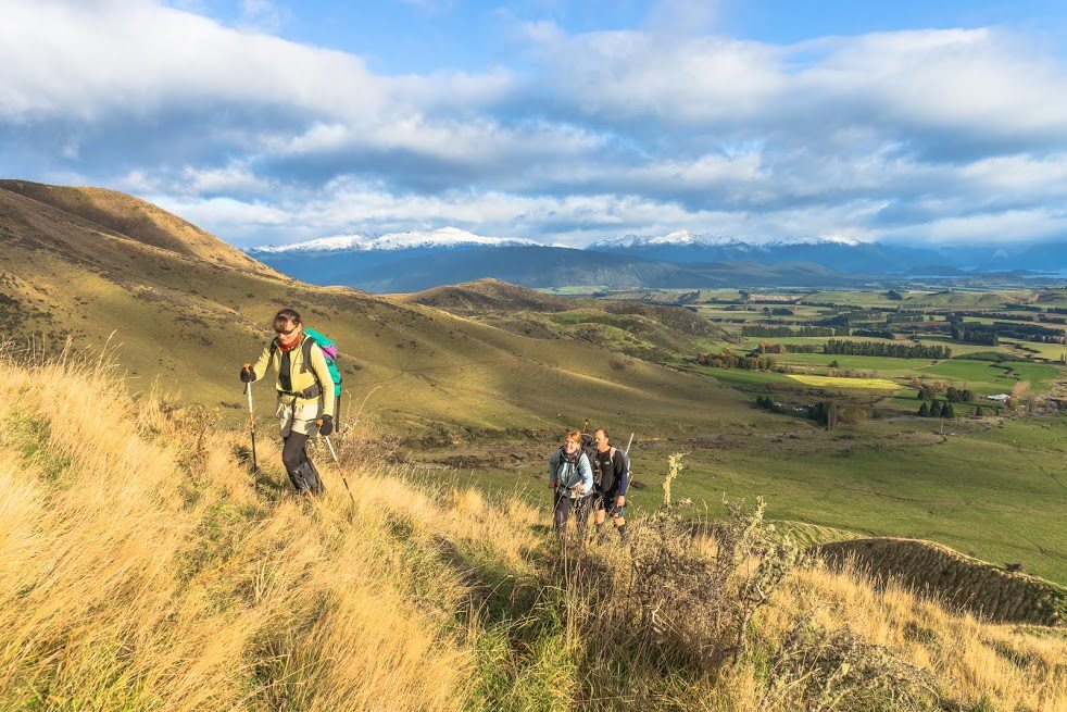
It is one of those enticing peaks that our group of six decided to scale one Saturday. Excelsior Peak is situated at the northern end of the Takitimu Mountains, between the Mararoa Valley and Whare Creek. It’s an open ridge walk ascending from farmed hillsides to alpine tops.
We met at 7.30am in Te Anau, from where we could see thick cloud obscuring the Takitimus. We deliberated our options, considered cancelling the trip or doing another track, but in the end decided to take a chance and see how far we could get without jeopardising anyone’s safety. It had been snowing in the mountains surrounding Te Anau during the previous week, so most of us brought crampons and ice axes.
Access to Excelsior Peak is through a farm and anyone wanting to climb this mountain must have the owner’s permission to cross it. When we arrived, the mountain had its head in the clouds and a herd of horses at its foot. The horses trotted towards us, but galloped away when they realised we had no food for them. We walked up a spur and for part of the way followed a farm track that went straight up – no zigzags!
As we gained height, the clouds lifted and the view improved. We crossed the fence separating grassy farmland from the rest of the mountain, where red tussock, silvery celmisia, golden spaniard and burgundy-coloured dracophyllum competed with broom for space.
After about two hours we reached the snowline, although the snow cover was thin and crampons weren’t needed. The terrain was now very steep and, in some places, we had to grab any vegetation we could to maintain balance and pull ourselves up. As we neared the summit, we found it shrouded in mist and we lost the long-awaited view. We wondered whether it was worth continuing, but the desire to reach the top prevailed and we proceeded carefully along a knife-edge ridge. Three times we were fooled by false peaks but at last we arrived at the top, marked with a cairn and with a vertigo-inducing precipice below.
With very little space to sit and not much visibility, we didn’t linger.
Walking down was harder than climbing up. Once we emerged from the cloud, a stunning panorama opened up. Te Anau Basin – like green tartan delineated by roads and hedgerows. Streams, rivers and ponds illuminated by the afternoon sun shone like quicksilver. Far away, Lake Manapouri, with its many islands, came in and out of view as the clouds moved north revealing and obscuring the mountains.
When we reached the paddock, the horses were still there, waiting, stretching their necks over the fence to check us out.
We were on a high – happy to have conquered the mountain.