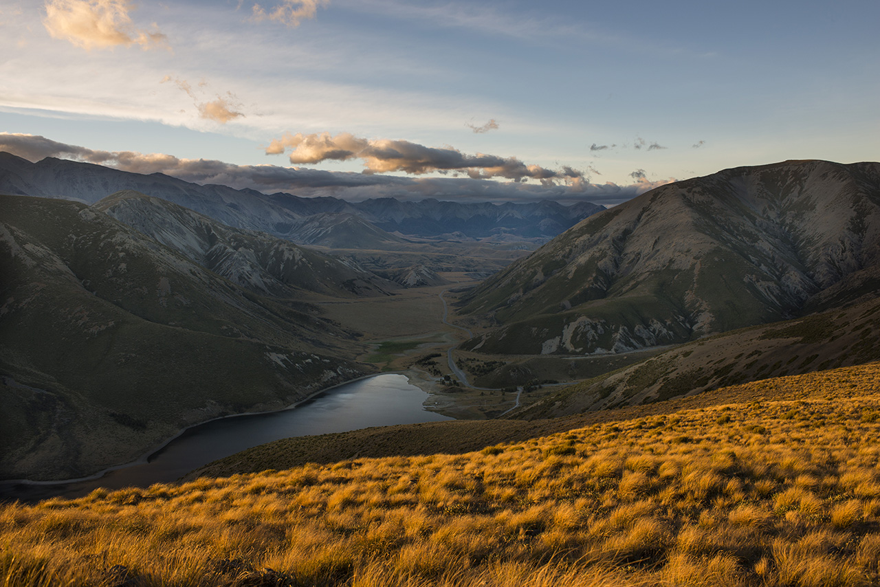
Coach Stream Route, Torlesse-Korowai Tussocklands Park, Canterbury
In the late afternoon I slipped out of Christchurch, travelled across the Canterbury Plains and pulled up at the small lay-by in a sharp bend on the eastern side of Porters Pass.
I planned to walk the coach road to the summit of the small range lying between the gaunt Torlesse Range to the north and the rounded shoulders of the Big Ben Range to the south. I’ve often spied this now popular track when heading off to Arthur’s Pass and have heard many good reports of it, so it’s time I walked it myself.
I’m not new to this area, having often been on both the aforementioned range tops and the ridgeline above Lake Lyndon, but this approach is novel. It begins with a very pleasant meander up Coach Stream, where the Cobb & Co coachlines, using teams of horses in the late 19th Century, drove over to the West Coast, taking three to four days. Some of the line of that historic route is still visible, and walk-able, where it runs up the stream and then begins the climb to the pass above.
Not far up-valley the track begins to ascend the hillside to the south, zig-zagging until a high point is reached at 1000m. From here the first of the views begin to open up of the plains and nearby Torlesse Range, seen through a gap in the ridgeline above the present day highway. There are also some striking rock tors here worth investigating and some fine stands of tussock.
It was a short stay for me, though because the wind was rising and the daylight declining so I pressed on, circumnavigating the head of Coach Stream through a copse of beech forest and climbing out onto the track junction with the Starvation Gully route (coming up from the west side of Porters Pass) at 1150m.
Vibrant evening light flooded the hillsides and created some striking effects so I paused for photographs before heading higher to reach Trig M as the suns set over the Southern Alps. Trig M has a grand view of Lake Lyndon and the Waimakariri Basin as well as towards distant Lake Coleridge. By this stage it was getting cold, windy and dark so my best option was retreat.
Picking a different route back is always rewarding so I scampered down to the track junction and followed the northern branch across to the opposite ridge encircling Coach Stream. From this point an unmarked, though easily followable ground trail, heads along the crest before dipping steeply down to meet the line of the old coach road. It’s a trying descent in the dark, but I had a companion to guide me – a full moon, sweeping over the eastern skyline.
A car or two passed on the nearby highway and as I gained the coach road proper I could see the valley floor not so far below lit in the eerie light of the moon.
Almost done; cruising the coach road.