Whatipu to Mt Donald McLean, Waitakere Ranges Regional Park
At the south-western tip of the Waitakere Ranges, at the mouth of the Manukau Harbour, lies the much weather- and ocean-beaten Whatipu.
This beach is a great example of how quickly the coastline can change with rough seas on its doorstep. An image close to the present-day beach shows how dramatically the shoreline has changed in recent years. It’s remarkable that knobbly cliffs, more than a kilometre from the water, were once pounded by waves.
The entrance to Manukau Harbour was also the scene of the worst maritime disaster in New Zealand’s history when 189 people aboard HMS Orpheus lost their lives in 1863.
I headed away from the beach, along the gravel road. After crossing a bridge I climbed left over a stile and stayed to the right of a clearing, which looked very lush and green after a dollop of rain that morning.
A narrow muddy path and one or two orange arrows led me through a gate into the forest and I continued alongside Whatipu Stream. The next 1500m was easy – a gentle, flat stroll along Kura Track. The only slight worry was the need to cross the stream four times in quick succession; fine on this particular day, but with potential for soggy feet after heavy rain.
A short climb took me away from the water, then there’s a final grunt up the valley side to a junction of footpaths, shortly before reaching the road.
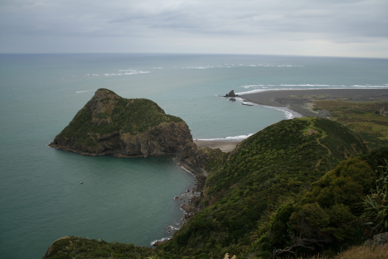
I turned left along Puriri Ridge Track. This is a straightforward backcountry track with the odd steep sections which were slippery in places. Without warning an unexpected clearing allowed a brief glimpse back down the valley and the impressive ‘lumps’ over which I would later climb on the return leg.
A nasty looking shower was moving slowly across the Tasman Sea in my direction. Not wishing to waste time trying to work out whether it would catch me, I continued along the ridge, which had now flattened out, eventually joining Donald McLean Track to the road end.
From here, a very well graded track spirals clockwise to the top of Mt Donald McLean, named after a colonialist who was head of the Native Land Purchase Department when the crown bought the Waitaks.
Two wooden platforms – one at either side of the summit – give contrasting striking views. One points south-west towards South Head. Apparently, on a very clear day, you can just make out Mt Taranaki on the horizon. The other platform looks north-east over the Manukau Harbour with what looks like a miniature Auckland city in the distance. The Sky Tower looked like a tiny syringe, two bumps to its right must have been Mt Eden and One Tree Hill, and behind these features was the molehill of Rangitoto.
I retraced my steps to the junction of Puriri Ridge and Kura tracks where I crossed the road to the start of Omanawanui Track. The track heads through bush and brushes the road one more time before descending through forest and climbing the first of the bumps mentioned earlier – Pt241.
Though steep, it doesn’t take as long to climb as you’d expect and the scant, low-level bush towards the top allows frequent views towards South Head and a good excuse to stop for a breather.
From here, the track descends sharply before climbing a second, smaller bump which allows a better view out to sea.
I was tempted to catch the sunset from this point, as it’s only a 15-minute descent to the car park from here, but a bitter wind had picked up, so I decided to view it from sea level. I was out of luck this time – a cloud blocked the sun as it reached the horizon – but on a clearer evening it would be a lovely place to watch the day shut up shop.