(Listen to Sarah read her story with a follow-up Q&A about the trip with our editor.)
Every track and hut has its own story, its reason for existence. On this trip in South Westland, the routes we followed and the huts we stayed at harked back to a bygone era of New Zealand pioneering, farming and backcountry history.
Paul and I followed a historic Māori pounamu route, a track to access a mine and the cattle-drive route used before there was a road. The huts we slept in were variously built to shelter deer cullers and roadmen, were purpose-built for tramping or erected as a memorial.
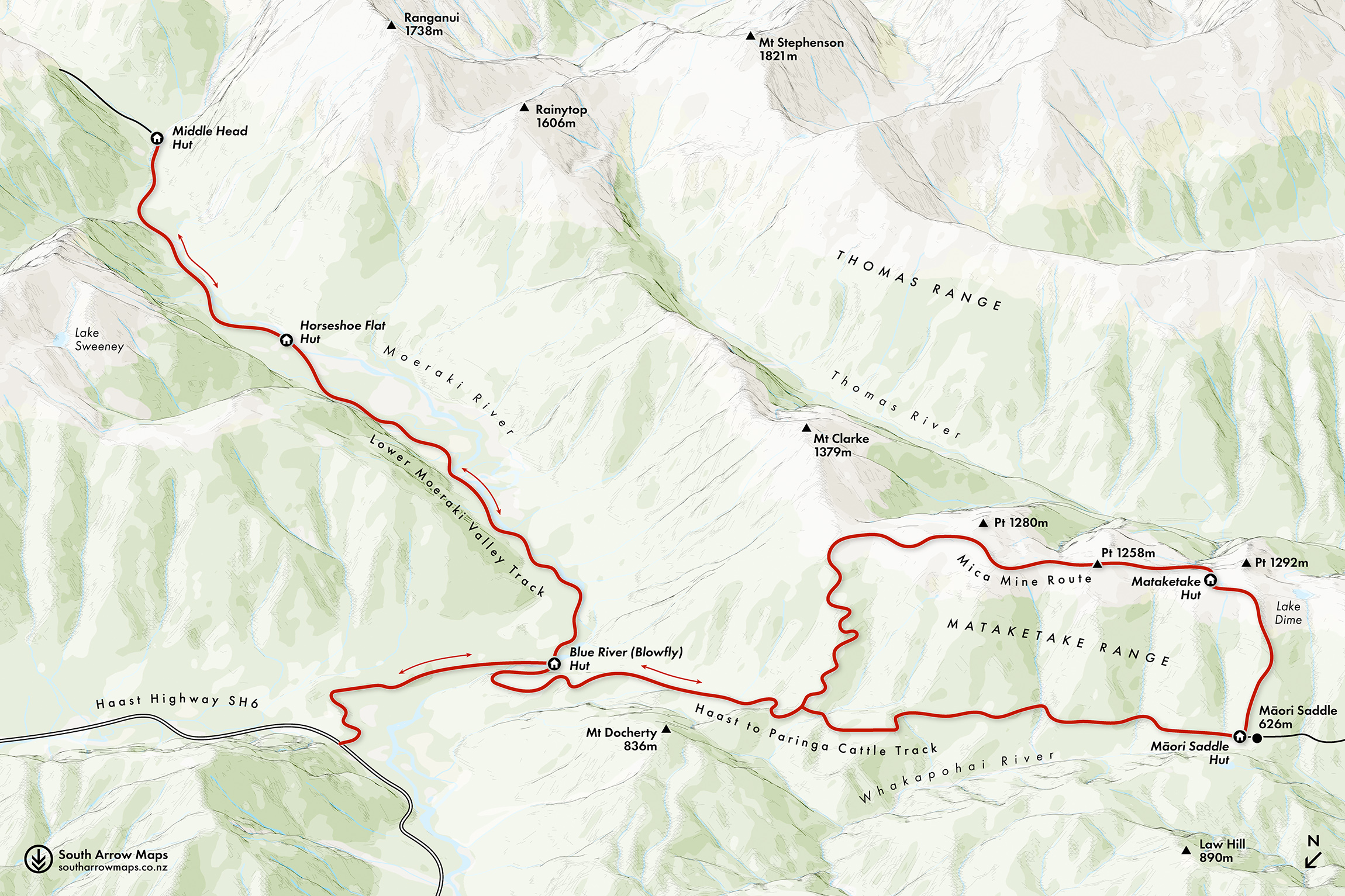
It’s hard to believe that the final section of the road from Paringa to Haast was only completed in 1965. Before this, farmers in the Landsborough and Cascade valleys used the Haast to Paringa Cattle Track to drive their cattle to the sale yards in Whataroa – a two-week journey. Construction of the cattle track began in 1875 and followed the route of a Māori pounamu trail. To avoid the steep cliffs and rugged coastline around Knights Point, it heads inland along the Waiata and Moeraki rivers, crossing Paringa Saddle.
For 90 years this was the only land access to the settlements of Haast and Jackson Bay. Mail was transported fortnightly by packhorse, and a telephone line was installed along the track in 1910.
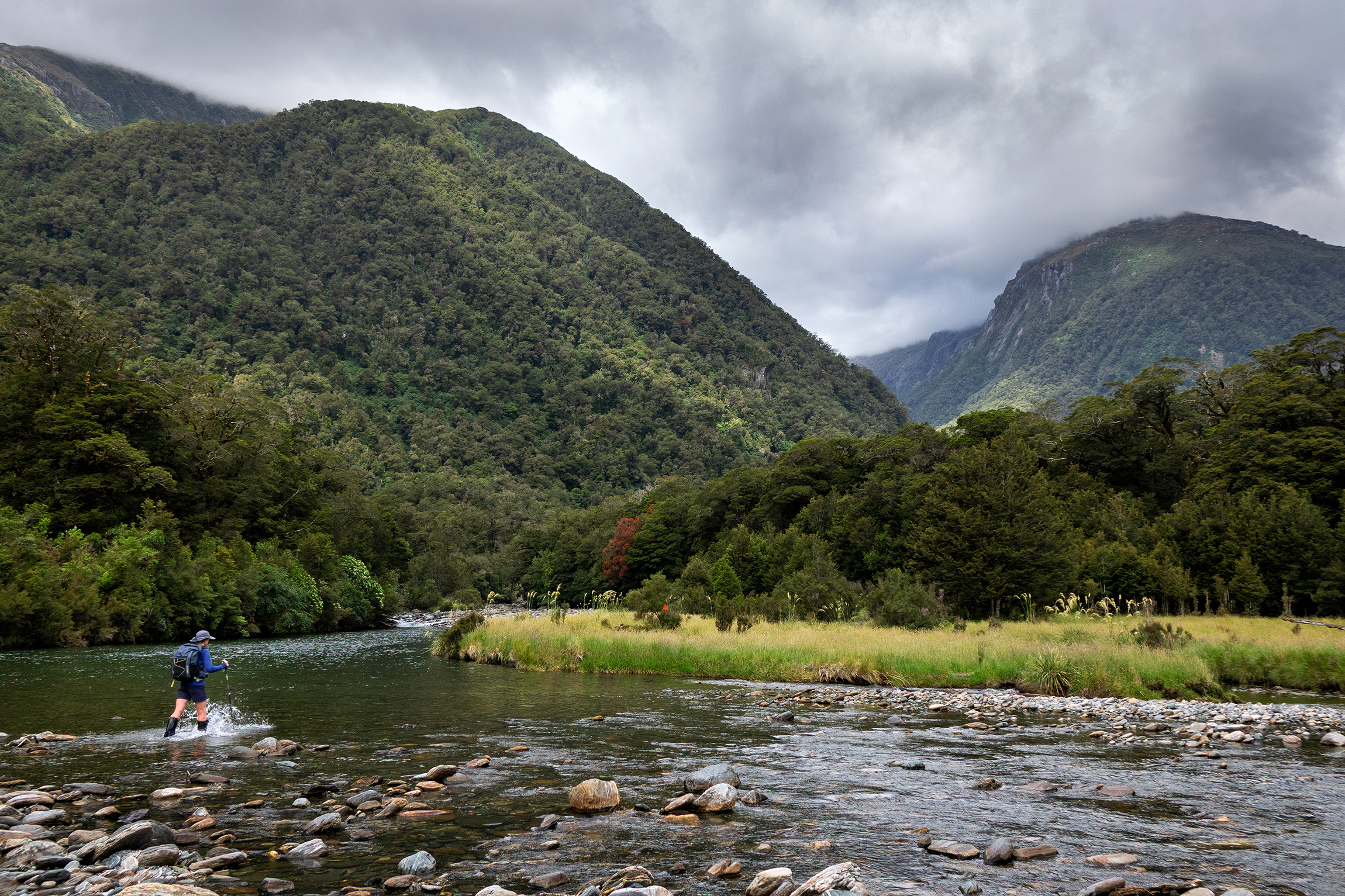
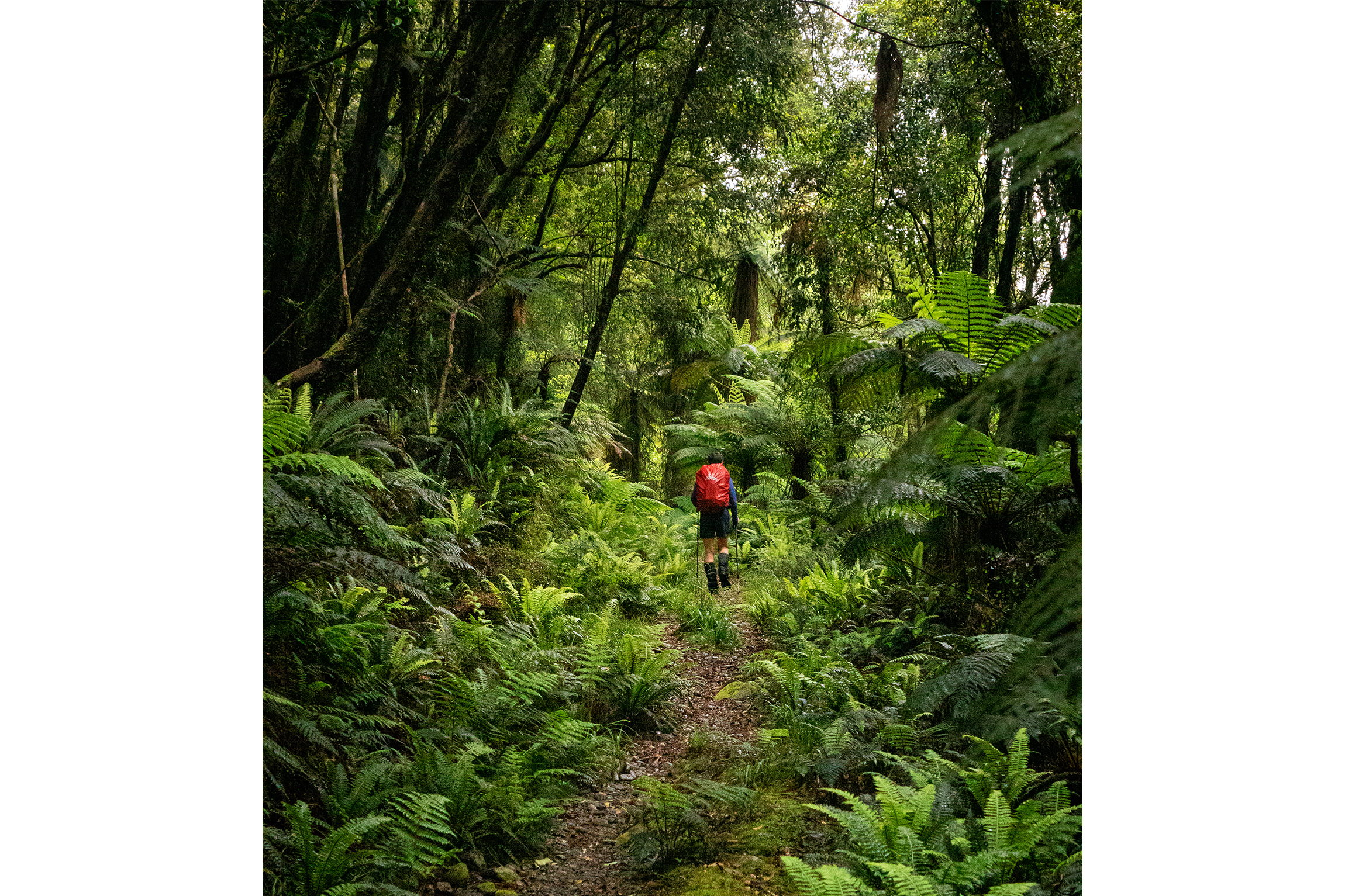
We began our trip at the northern end of the cattle track. The craftsmanship and hard work of those early track builders was immediately apparent. It’s two metres wide and metalled with a deep shingle bed. The track was suitable for pack mules, horses and even drays. Drystone culverts built to divert water off the track are still in place, testament to their effectiveness. The walking was easy.We followed the cattle track for half an hour before turning onto the Lower Moeraki Valley Track, which would take us to Horseshoe Flat Hut. As we tramped through mixed southern beech and podocarp forest, dappled sunlight played on the track. The Moeraki sparkled beside us, alternating lively rapids with stretches of tranquil blue. We could see why this river is popular for fishing.

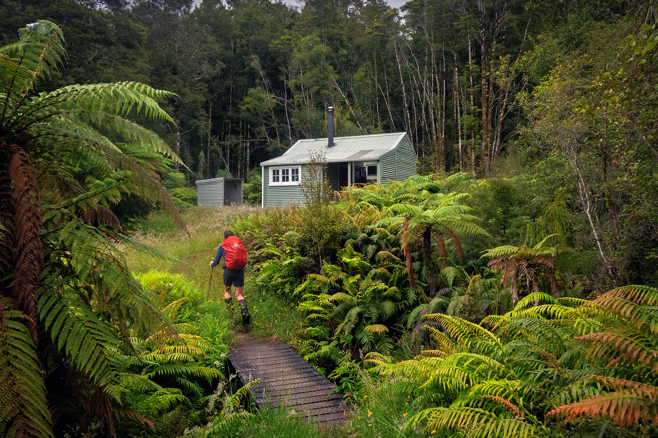
The track emerged into a series of open wetland clearings and we had views of the mountains at the head of the valley before arriving at Horseshoe Flat Hut, a classic New Zealand Forest Service (NZFS) deer cullers’ hut built in 1970.
Although they’re a devastating scourge, we do have deer to thank for the extensive collection of NZFS huts built in the mid-twentieth century to house the cullers employed to control them. For North Island trampers like us, used to roaming the forest parks of the Tararua and Ruahine ranges, arriving at a classic NZFS six bunker is like coming home. The rectangular, gabled form is lined with ply, a stainless-steel bench stands in one corner, six bunks are arranged along two walls, and a fireplace and small porch complete the set up. We had lunch here, taking shelter from the bright sun.
Another couple of hours took us further up the Moeraki, crossing gravel flats before following markers through open beech forest to Middlehead Hut, another NZFS gem. It was mid-summer and the hills were ablaze with flowering southern rātā.
Next day we retraced our steps down the beautiful Moeraki Valley to rejoin the cattle track and make our way to Blowfly Hut, named for the flies that swarmed here, attracted by cattle dung during the annual drives. A roadman employed to maintain the track lived here until 1960. Over lunch we studied an impressive large-format book on the history of the cattle track.
From Blowfly Hut to Māori Saddle the track sidles gently uphill southwest through beech and kāmahi forest before following the 600m contour line along the western edge of the Mataketake Range. By now it was raining and we pushed on quickly, grinding out the kilometres on the easy-to-follow cattle track. There were some detours around slips and a couple of deep gullies to negotiate. Telephone poles complete with drooping wires and ceramic insulators are still in place.
We were glad to arrive at Māori Saddle Hut late in the afternoon, to dry off and warm up with a mug of soup. This hut was built in 1980 by the NZFS as a dedicated tramping hut when the cattle track, no longer in use for cattle drives, was upgraded for trampers. It is a Fraemohs hut, much like a Lockwood, its all-wood interlocking construction providing solidity and insulation. It features some architectural flourishes reminiscent of its era, including a timber arch between the bunk and living areas. From Māori Saddle Hut you can continue to follow the cattle track to Coppermine Hut and out to the Haast Highway, but we had other plans for the following day.
Next morning the southerly was still roaring but we had ample incentive to be up and moving. We’d booked bunks in Mataketake Hut, high on the Mataketake Range, and were keen to get up there quickly and treat ourselves to a rest day. A push factor was the horde of hungry mosquitoes in Māori Saddle Hut.
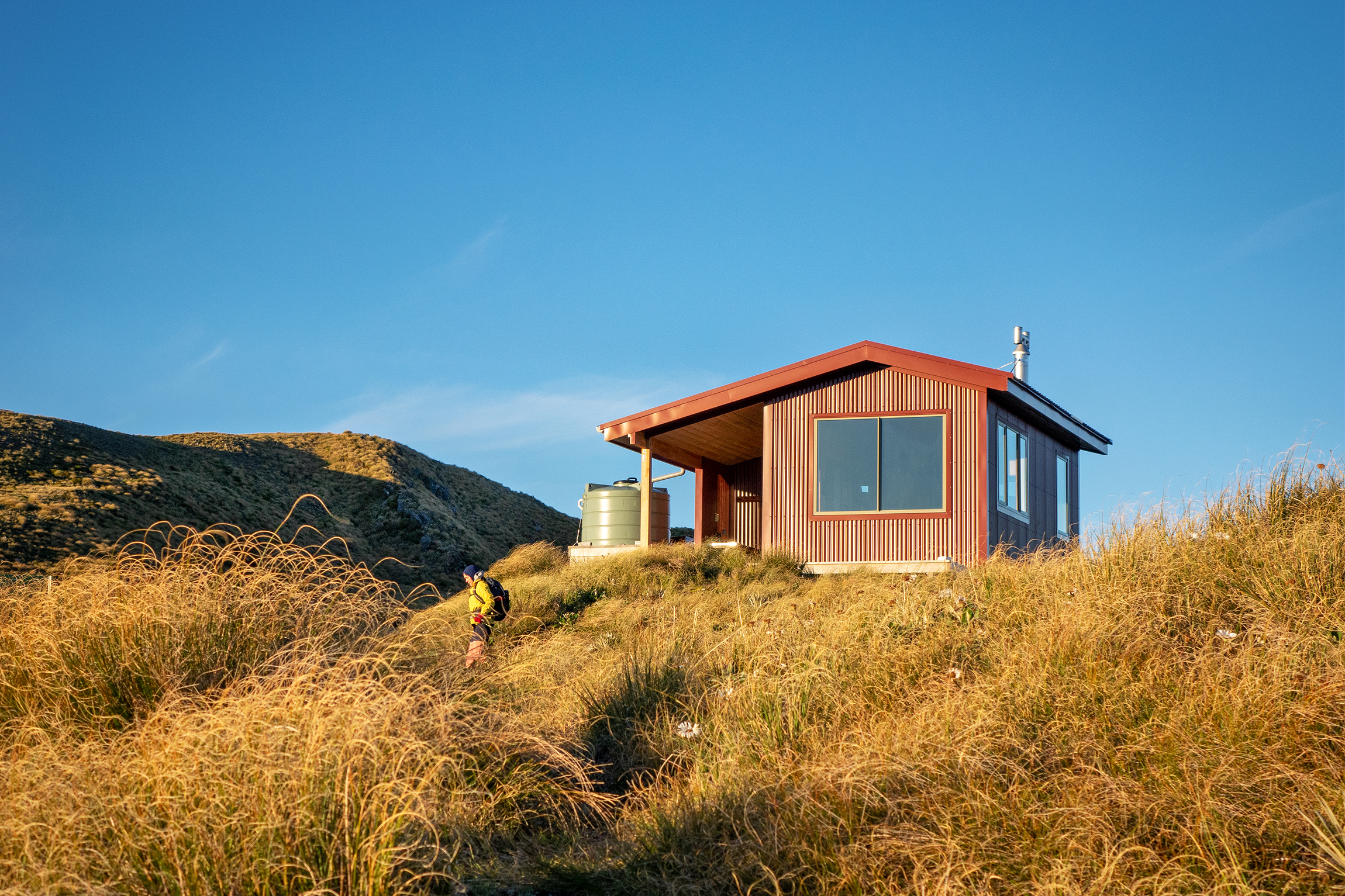
We climbed quickly through the bush on the Māori Saddle Route and onto the tussocky tops, a blustery southerly buffeting us and the sky clear. Emerging from the bush we immediately spotted dark red Mataketake Hut on a prominent ridge. It took another 15 minutes to reach it and we tumbled in out of the wind to find the fire still warm from previous occupants.
Mataketake was built in 2021, funded by a bequest from adventurer and conservationist Andy Dennis, who wanted to open a new accessible tops route so an average tramper could appreciate the glory of his beloved South Westland
The hut is situated to take full advantage of the view – the Haast River delta and the Tasman Sea in one direction, and in the other a panorama of the Southern Alps, including Mts Hooker, Pollux and Dechan and as far north as Aoraki/Mt Cook.
Purpose-built wooden furniture, extra-thick mattresses and a stylish woodstove – this place felt special. Clever engineering was needed to meet standards for maximum wind loadings: securing the hut are 28 anchor piles held in place with 11 tonnes of concrete, all mixed on site. No steel cable tie-downs for this hut.
Our planned rest day was everything we’d dreamed of. As the southerly rocked the hut, the woodstove, well-stocked woodshed and double glazing ensured we were cosy and happy. A shelf of books from Dennis’s own library – a well-curated selection of New Zealand literary fiction and conservation works – provided reading material. There was even tasty food, left by other trampers, to supplement our rations. And we had this cosy gem to ourselves.
Thankfully, the wind had dropped by the time we set off next morning to traverse the tussocky tops on the Mica Mine Route.
Explorer Charlie Douglas had identified mica deposits in the area in 1896, and because mica was used in radio condensers and spark-plug washers in Allied aircraft during World War II, interest in extracting it was rekindled. Mica was mined here from 1942–45.
The way is dotted with appealing alpine tarns, and mountain daisies and speargrasses were in flower. The track is well-poled and easy to follow, so we could devote most of our attention to the magnificent alpine and ocean views.
After four kilometres of fun tops travel it was time to descend the historic mine track, built so that horses could pack supplies to and from the mine – another historic track built to high specifications, making a tramper’s life easy. The zigzags allowed a leisurely descent to rejoin the cattle track on the valley floor. From there it was a couple of hours through to Blowfly Hut and another hour back to the car.
These amazing four days in the mountains were made possible by backcountry infrastructure created for many different purposes. I love tramping in places where history and stories of the area add a cultural dimension to the experience.