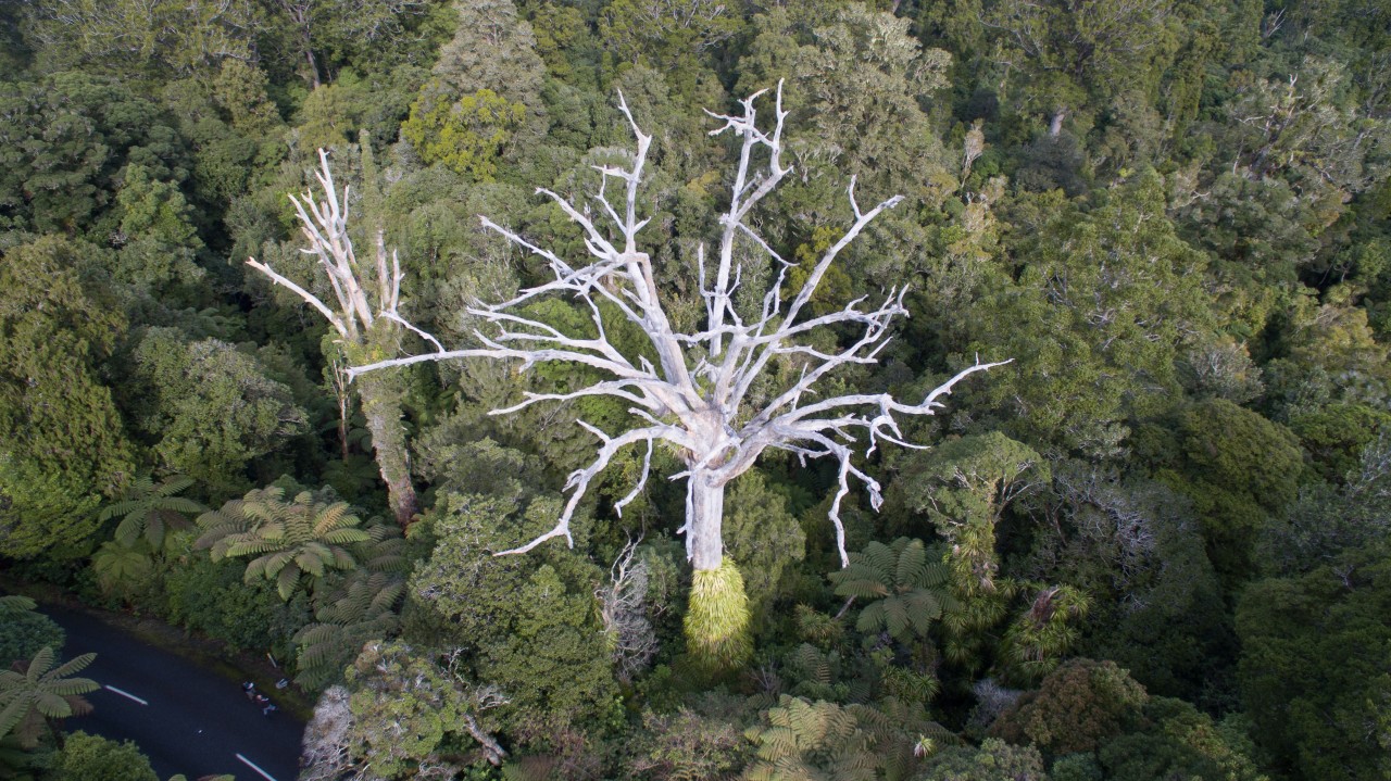
The Ministry of Primary Industries has just released aerial drone images of trees in Waipoua Forest displaying signs of kauri dieback disease.
Jay Harkness, the communications spokesperson from the Kauri Dieback programme, says the aerial drone images are helpful to show the public the real effects of infection.
“There’s all sorts of obstacles to people seeing the trees,” he said. “They might be on private property, or they might be in the middle of nowhere. An infected tree can look okay from the ground but when you get above it, it’s pretty obvious.
“The photos show New Zealanders what the upper North Island’s forests could one day look like, if we don’t all clean our footwear and equipment before entering and before leaving areas with kauri, and stick to the tracks.”
Private lunch shelter proposed for Routeburn’s Lake Howden
Trending Now
Otamatapaio Hut, Oteake Conservation Park
The 2026 Wilderness Outdoor Photographer of the Year competition
Dirt bike trial on Tongariro Northern Circuit gets approval
A majestic coastal walk
Adventurer and author Dunc Wilson
Subscribe!
Each issue of Wilderness celebrates Aotearoa’s great outdoors — written and photographed with care, not algorithms.Subscribe and help keep our wild stories alive.